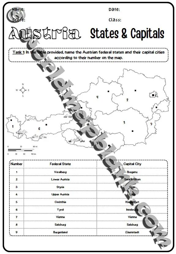
Austria Map Worksheets: States & Capitals
El precio original era: 3,99 €.2,99 €El precio actual es: 2,99 €.
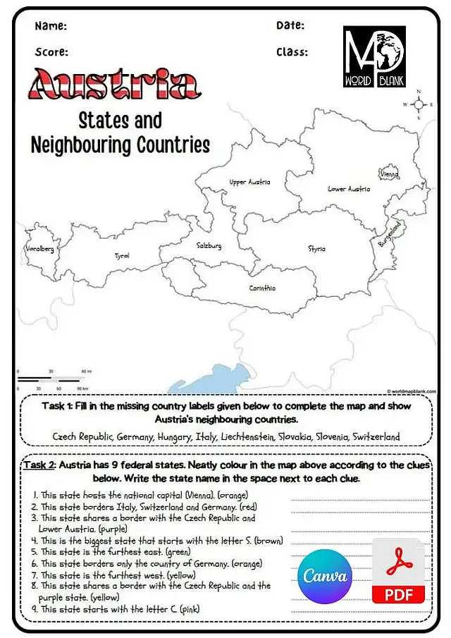
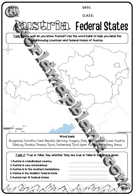
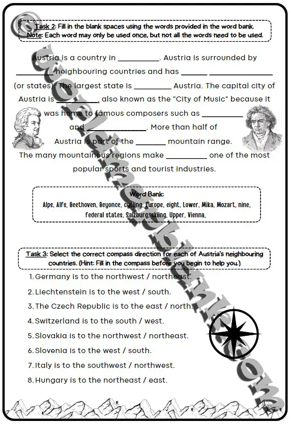
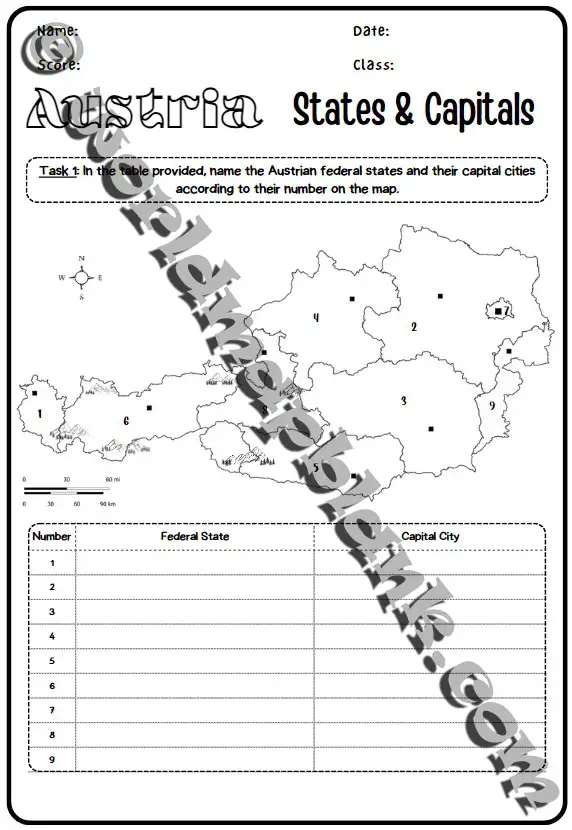
- Pack of 4 Austria map worksheets with answer keys
- Printable PDF and customizable Canva versions
- 5 blank maps of Austria (A4 and A5)
- Political reference map
- Immediate download after purchase
Descripción
Our engaging Austria map worksheets offer interactive learning activities about Austria. They are ideal for teachers and parents to help their students or kids learn about Austria’s states, cities, and neighboring countries.
The pack includes 4 interactive Austria worksheets with exercises, instructions, and answers. Also, they are provided both as printable PDF versions and customizable Canva templates. This means you can edit and adapt them to your specific needs.
With the bonus 10 blank maps of Austria in A4 and A5 sizes, you can create even more exercises for labeling states, cities, rivers, mountain ranges, and more. No more need to download them one by one!
Along with a handy political reference map of Austria detailing states, capitals, cities, borders, and more, this is the ultimate Austrian geography learning bundle!
So, take action and make learning Austria’s geography engaging for all ages – get your Austria worksheets pack now!
Content:
- 4 Austria map worksheets with exercises (1 or 2 pages)
- Answer key pages for all worksheets
- Political map of Austria for reference
- BONUS: 5 blank Austria maps (each in A4 and A5)
Features:
- Immediate download after purchase
- Printable PDF files
- Customizable Canva versions
- No manual download of single Austria blank maps
Additional Information:
- These Austria map worksheets were created by our teaching expert Lana.
- Please read our Licensing Terms for purchased products.
- Also refer to our Terms of Use, Disclaimer, Cookie Policy, and Privacy Policy.
Solo los usuarios registrados que hayan comprado este producto pueden hacer una valoración.
Productos relacionados
-
Oferta
UK Map Worksheets: Countries, Capitals & Cities
El precio original era: 3,99 €.2,99 €El precio actual es: 2,99 €.


Valoraciones
No hay valoraciones aún.