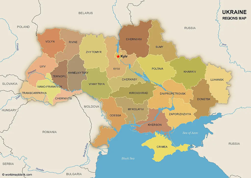
🇺🇦 Printable Map of Ukraine with Oblasts
🇺🇦 Printable Map of Ukraine with Oblasts
No need for single downloads! You can add as many free maps or products to your cart as you like. You'll get them all combined in one checkout process!
Couldn't load pickup availability
Download your free printable map of Ukraine with regions, available as a JPEG image and a PDF file!
We also offer a high-resolution political map of Ukraine with major cities.
Or get your Ukraine labeled maps bundle, including:
🗺 Printable map of Ukraine with regions (oblasts)
🗺 Map of Ukraine and Surrounding Countries (with region capitals)
🗺 Political map of Ukraine with capitals and cities
The bundle includes PDF and JPEG versions of all maps.
The maps with regions and capitals include borders and/or city markers for:
Chernihiv (Chernihiv), Chernivtsi (Chernivtsi), Dnipropetrovsk (Dnipro), Donetsk (Donetsk), Ivano-Frankivsk (Ivano-Frankivsk), Kharkiv (Kharkiv), Kherson (Kherson), Khmelnytskyi (Khmelnytskyi), Kirovohrad (Kropyvnytskyi), Kyiv (Kyiv), Luhansk (Luhansk), Lviv (Lviv), Mykolaiv (Mykolaiv), Odesa (Odesa), Poltava (Poltava), Rivne (Rivne), Sumy (Sumy), Ternopil (Ternopil), Transcarpathian (Uzhhorod), Vinnytsia (Vinnytsia), Volyn (Lutsk), Zaporizhzhia (Zaporizhzhia), Zhytomyr (Zhytomyr), Autonomous Republic of Crimea (Simferopol)
The map with cities includes additional markers for:
Kovel, Korosten, Nizhyn, Shostka, Kupiansk, Lysychansk, Mariupol, Kremenchuk, Voznesensk, Izmail, Nikopol, Melitopol, Yevpatoria, Yalta, Kerch, Sevastopol, Dzhankoy