
🇦🇹 Printable Map of Austria with States
🇦🇹 Printable Map of Austria with States
✅ Descarga gratuita – PDF y JPEG, listos para imprimir.
Descarga aquí un printable Map of Austria with States para imprimir para la enseñanza de la geografía, hojas de ejercicios, actividades para el aula, cuestionarios, planificación de viajes y mucho más.
No se pudo cargar la disponibilidad de retiro
Agrega varios mapas al carrito para descargarlos todos a la vez.
Download your free printable map of Austria with states as a JPEG image and a PDF file!
We also offer a printable, high-resolution political map of Austria.
Or get your labeled Austria maps bundle, including:
🗺 Printable map of Austria with states and capitals
🗺 Political Austria map with neighboring countries
🗺 Labeled Austria map with Bundesländern
The bundle includes PDF and JPEG versions of all maps.
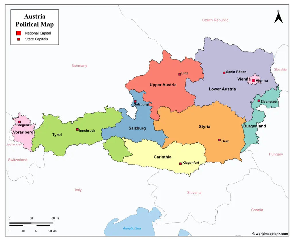
The maps with states and capitals include borders and markers for:
Burgenland (Eisenstadt), Carinthia (Klagenfurt), Lower Austria (Sankt Pölten), Salzburg (Salzburg), Styria (Graz), Tyrol (Innsbruck), Upper Austria (Linz), Vorarlberg (Bregenz), Vienna (Vienna)
The map with cities additionally shows:
Amstetten, Baden, Bischofshofen, Braunau am Inn, Bruck, Dornbirn, Eisenz, Feldkirch, Fohnsdorf, Fürstenfeld, Gleisdorf, Hallen, Horn, Imst, Kappl, Kitzbühel, Krems, Kufstein, Leoben, Liezen, Lienz, Murau, Mürzzuschlag, Neunkirchen, Obervellach, Ried im Innkreis, Saalfelden, Schrem, Schwaz, Spittal an der Drau, Steyr, Telfs, Uttendorf, Villach, Wels, Wiener Neustadt, Wörgl, Zell am See, and Zwettl


Descarga tu mapa gratis
Introduce tu correo electrónico y cuéntanos cómo vas a utilizar el mapa. La descarga comenzará de inmediato.