

🌍 Blank Map of Africa
🌍 Blank Map of Africa
Couldn't load pickup availability
Add multiple maps to the cart to download them all at once.
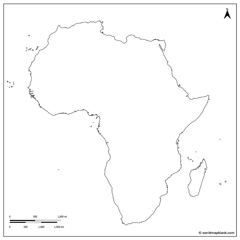
The blank map of Africa is a printable political map that draws the borders of all 54 countries of the continent, in black and white with no names on them, sized for A4 and printing on US Letter. Download it free as a PDF or a JPEG, either as the blank version with country borders or as a plain outline map of Africa with the coastline only.
Because the map is unlabeled, it works as a base for practice: students fill in the countries, their capitals, the Sahara and the Nile themselves, and teachers use the same sheet for map quizzes, homework and coloring at school. It pairs well with our Africa geography worksheets, and with the labeled map of Africa when you need the names for reference.
Both free files carry a north arrow and a scale bar in miles and kilometres, and both keep the island countries rather than cropping them off. For the other continents, browse the blank continent maps.
The image below shows the printable blank map of Africa with country borders and markers for the capital cities of the African countries.

Africa Blank Maps Bundle and More
The blank map and the outline map are free. The bundle adds more versions of the same map:
- Blank map of Africa
- Outline map of Africa
- Blank map of Africa with seas and oceans
- Blank Africa map with capitals
- Labeled Africa map for reference
The bundle includes PDF and JPEG versions of all maps.
The two free downloads are the blank map, which draws the borders between the countries, and the outline map, which has the coastline only. The capital markers are part of the bundle: dots placed on the map without any names, so the sheet still works as an exercise rather than an answer key.
The blank map with seas and oceans includes the Atlantic Ocean, the Mediterranean, the Red Sea and the Indian Ocean.
The 54 Countries of Africa and Their Capitals
Africa has more countries than any other continent. They are usually grouped into five regions, and knowing which region a country sits in is half the work of placing it on a blank map: 6 in Northern Africa, 16 in Western Africa, 9 in Central Africa, 18 in Eastern Africa and 5 in Southern Africa.
Show all 54 African countries with their capitals and regions (click to reveal)
| Country | Capital | Region |
|---|---|---|
| Algeria | Algiers | Northern |
| Egypt | Cairo | Northern |
| Libya | Tripoli | Northern |
| Morocco | Rabat | Northern |
| Sudan | Khartoum | Northern |
| Tunisia | Tunis | Northern |
| Benin | Porto-Novo | Western |
| Burkina Faso | Ouagadougou | Western |
| Cabo Verde | Praia | Western |
| Gambia | Banjul | Western |
| Ghana | Accra | Western |
| Guinea | Conakry | Western |
| Guinea-Bissau | Bissau | Western |
| Ivory Coast (Cote d'Ivoire) | Yamoussoukro | Western |
| Liberia | Monrovia | Western |
| Mali | Bamako | Western |
| Mauritania | Nouakchott | Western |
| Niger | Niamey | Western |
| Nigeria | Abuja | Western |
| Senegal | Dakar | Western |
| Sierra Leone | Freetown | Western |
| Togo | Lome | Western |
| Angola | Luanda | Central |
| Cameroon | Yaounde | Central |
| Central African Republic | Bangui | Central |
| Chad | N'Djamena | Central |
| Democratic Republic of the Congo | Kinshasa | Central |
| Equatorial Guinea | Malabo | Central |
| Gabon | Libreville | Central |
| Republic of the Congo | Brazzaville | Central |
| Sao Tome and Principe | Sao Tome | Central |
| Burundi | Gitega | Eastern |
| Comoros | Moroni | Eastern |
| Djibouti | Djibouti | Eastern |
| Eritrea | Asmara | Eastern |
| Ethiopia | Addis Ababa | Eastern |
| Kenya | Nairobi | Eastern |
| Madagascar | Antananarivo | Eastern |
| Malawi | Lilongwe | Eastern |
| Mauritius | Port Louis | Eastern |
| Mozambique | Maputo | Eastern |
| Rwanda | Kigali | Eastern |
| Seychelles | Victoria | Eastern |
| Somalia | Mogadishu | Eastern |
| South Sudan | Juba | Eastern |
| Tanzania | Dodoma | Eastern |
| Uganda | Kampala | Eastern |
| Zambia | Lusaka | Eastern |
| Zimbabwe | Harare | Eastern |
| Botswana | Gaborone | Southern |
| Eswatini | Mbabane | Southern |
| Lesotho | Maseru | Southern |
| Namibia | Windhoek | Southern |
| South Africa | Pretoria | Southern |
Western Sahara is drawn on the map as well, along its disputed boundary, but it is not counted among the 54 because its status is unresolved. Lesotho is the one country on the continent entirely surrounded by another, which is why it appears as a small closed shape inside South Africa.
About Africa's Countries and Geography
Africa covers about 30.4 million square kilometres, second only to Asia, and holds roughly 1.5 billion people. It is the only continent crossed by the Equator, both tropics and the Prime Meridian at once, which makes it the reference point for locating almost anything else on a world map. The Sahara spreads across some 9.2 million square kilometres of the north, larger than the whole of Australia, and gives way southward to the Sahel and then to savannah and rainforest. The Nile runs about 6,650 kilometres to the Mediterranean and the Congo carries more water than any river except the Amazon, with the Niger and the Zambezi behind them. The Great Rift Valley cuts some 6,000 kilometres from the Red Sea down to Mozambique, holding Lake Tanganyika, the second deepest lake on Earth, while Lake Victoria beside it is the continent's largest. Kilimanjaro rises to 5,895 metres in Tanzania, and the Atlas Mountains, the Ethiopian Highlands and the Drakensberg frame the north, east and south. Those are the features students are usually asked to place, which is why an unlabeled base map is more useful for practice than a finished one.
Blank Map of Africa Features
- Free blank and outline versions in high-resolution PDF and JPEG
- Sized for A4 and prints on US Letter without cropping
- Black and white line work that prints cleanly on a home or school printer
- Country borders on the blank political version, coastline only on the outline version
- Madagascar, Cabo Verde, the Comoros, Mauritius and the Seychelles all included, not cropped off
- North arrow and a scale bar in both miles and kilometres
- Bundle versions with capital markers and with the surrounding seas and oceans
- Suitable for geography lessons, map quizzes, homeschooling, revision and school projects
Frequently Asked Questions
Answers to the questions people ask most about the free blank map of Africa.
How many countries are there in Africa?
54, all of them members of the United Nations, which makes Africa the continent with the most countries. Six of them are island nations, and every one is drawn on this map. Western Sahara appears as well, along its disputed boundary, but is not counted among the 54.
What is the difference between the blank map and the outline map?
The blank map is a political map: it draws every border between the African countries but names none of them. The outline map has no internal borders at all, just the coastline and the islands, which is the version people use for tracing and for drawing in their own features.
Does the free map show the capital cities?
No, and that is deliberate: the free blank map shows borders only, so students can mark the capitals themselves. The bundle adds a version with capital markers, shown as dots without names, so even that one still works as an exercise.
Can I print the map of Africa in A4 size?
Yes, every file is sized for A4 and prints on US Letter without cropping. The PDF keeps its line quality when enlarged, so the same download also works for a poster-size print or a classroom wall chart.
Is the blank map of Africa free to download?
Yes, the blank map and the outline map are free in PDF and JPEG, with no sign-up. The bundle with the capital markers and the seas version is a small one-off price.
How to Get Your Printable Map
- Choose the version you want above.
- Click "Download now" for a free map, or add the bundle to your cart and check out.
- Get your files instantly, then print or annotate them.
Who It's For
Students revising for map tests, teachers building classroom materials and quizzes, homeschooling parents, and travellers marking the countries they have visited.
Download your blank map of Africa now and use it for learning, geography practice, or your own map projects.


Download your free map
Enter your email and tell us how you'll use the map. Your download starts immediately.