
🇮🇪 Printable Map of Ireland with Counties
🇮🇪 Printable Map of Ireland with Counties
✅ Descarga gratuita – PDF y JPEG, listos para imprimir.
Descarga aquí un printable Map of Ireland with Counties para imprimir para la enseñanza de la geografía, hojas de ejercicios, actividades para el aula, cuestionarios, planificación de viajes y mucho más.
No se pudo cargar la disponibilidad de retiro
Agrega varios mapas al carrito para descargarlos todos a la vez.
Download your free printable map of Ireland with counties as a JPEG image and a PDF file!
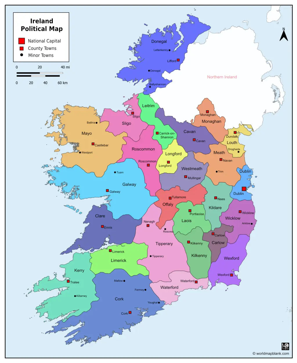
We also offer a printable, high-resolution political map of Ireland with counties, county seats, and towns (7860 x 9607 px).
Or get your Ireland labeled maps bundle, including:
🗺 Printable map of Ireland with counties
🗺 Ireland county map with county seats
🗺 Political Ireland map with counties, county seats, and towns
All versions include PDF and JPEG versions of the maps.
The maps with counties and/or county seats include markers for:
Carlow (Carlow), Cavan (Cavan), Clare (Ennis), Cork (Cork), Donegal (Lifford), Dublin (Dublin), Galway (Galway), Kerry (Tralee), Kildare (Naas), Kilkenny (Kilkenny), Laois (Portlaoise), Leitrim (Carrick-on-Shannon), Limerick (Limerick), Longford (Longford), Louth (Dundalk), Mayo (Castlebar), Meath (Navan), Monaghan (Monaghan), Offaly (Tullamore), Roscommon (Roscommon), Sligo (Sligo), Tipperary (Nenagh), Waterford (Waterford), Westmeath (Mullingar), Wexford (Wexford), and Wicklow (Wicklow)
The map with towns includes additional markers for:
Arklow, Ballina, Ballyshannon, Donegal, Drogheda, Fermoy, Killarney, Letterkenny, Mallow, Roscrea, Tipperary, Trim, Tuam, Westport, Youghal


Descarga tu mapa gratis
Introduce tu correo electrónico y cuéntanos cómo vas a utilizar el mapa. La descarga comenzará de inmediato.