
🇦🇹 Printable Map of Austria with States
🇦🇹 Printable Map of Austria with States
✅ Téléchargement gratuit – PDF et JPEG, prêts à imprimer.
Téléchargez ici une printable Map of Austria with States à imprimer pour l’enseignement de la géographie, les fiches d’exercices, les activités en classe, les quiz, la planification de voyages et bien plus encore.
Impossible de charger la disponibilité du service de retrait
Ajoutez plusieurs cartes à votre panier pour les télécharger toutes en même temps.
Download your free printable map of Austria with states as a JPEG image and a PDF file!
We also offer a printable, high-resolution political map of Austria.
Or get your labeled Austria maps bundle, including:
🗺 Printable map of Austria with states and capitals
🗺 Political Austria map with neighboring countries
🗺 Labeled Austria map with Bundesländern
The bundle includes PDF and JPEG versions of all maps.
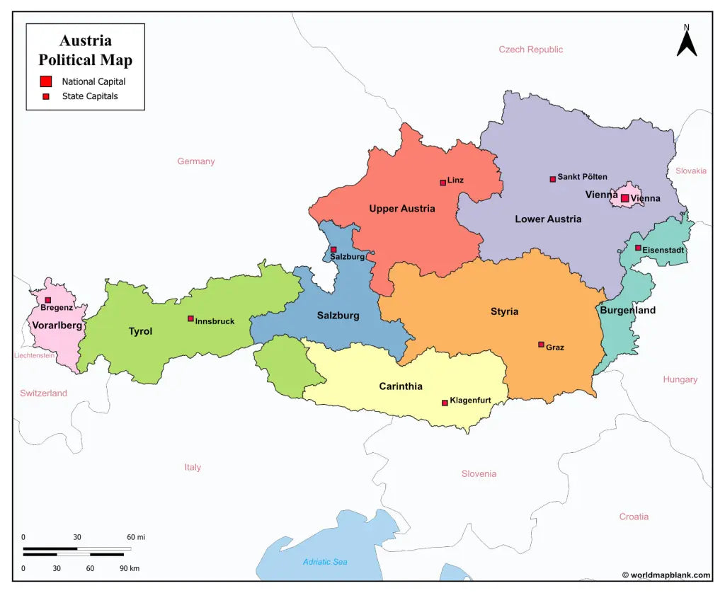
The maps with states and capitals include borders and markers for:
Burgenland (Eisenstadt), Carinthia (Klagenfurt), Lower Austria (Sankt Pölten), Salzburg (Salzburg), Styria (Graz), Tyrol (Innsbruck), Upper Austria (Linz), Vorarlberg (Bregenz), Vienna (Vienna)
The map with cities additionally shows:
Amstetten, Baden, Bischofshofen, Braunau am Inn, Bruck, Dornbirn, Eisenz, Feldkirch, Fohnsdorf, Fürstenfeld, Gleisdorf, Hallen, Horn, Imst, Kappl, Kitzbühel, Krems, Kufstein, Leoben, Liezen, Lienz, Murau, Mürzzuschlag, Neunkirchen, Obervellach, Ried im Innkreis, Saalfelden, Schrem, Schwaz, Spittal an der Drau, Steyr, Telfs, Uttendorf, Villach, Wels, Wiener Neustadt, Wörgl, Zell am See, and Zwettl


Téléchargez votre carte gratuite
Entrez votre adresse e-mail et dites-nous comment vous comptez utiliser la carte. Le téléchargement commence immédiatement.