
🌎 Labeled Political Map of North America
🌎 Labeled Political Map of North America
✅ Gratis download – PDF en JPEG, klaar om af te drukken.
Download hier een labeled Political Map of North America om af te drukken voor aardrijkskunde, werkbladen, klasactiviteiten, quizzen, reisplanning en nog veel meer.
Kan beschikbaarheid voor afhalen niet laden
Voeg meer kaarten toe aan je winkelwagen om ze allemaal in één keer te downloaden.
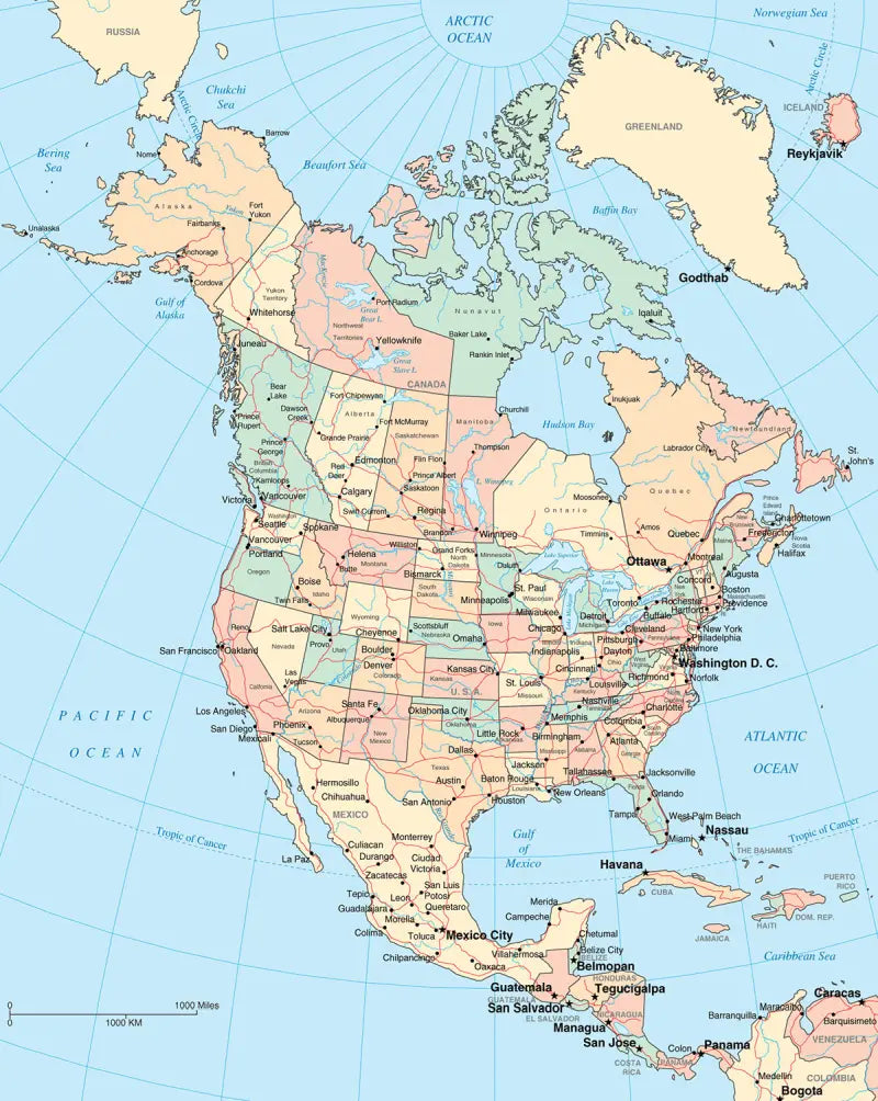
Download your free labeled map of North America, or a printable political map of North America with countries, as a JPG and a PDF!
Choose between the following free maps or download them all:
🗺 Political map of North America with countries
🗺 Labeled map of North America
🗺 North America political map with capitals and cities
The downloads include PDF and JPG versions of the maps.
Our political North America maps include the following countries and capitals:
Antigua and Barbuda (St. John’s), Bahamas (Nassau), Barbados (Bridgetown), Belize (Belmopan), Canada (Ottawa), Costa Rica (San José), Cuba (Havana), Dominica (Roseau), Dominican Republic (Santo Domingo), El Salvador (San Salvador), Guatemala (Guatemala City), Honduras (Tegucigalpa), Jamaica (Kingston), Mexico (Mexico City), Nicaragua (Managua), Panama (Panama City), and the United States (Washington, D.C.).
Complete your maps collection with a blank map of North America or other labeled continent maps.


Download je gratis kaart
Vul je e-mailadres in en vertel ons hoe je de kaart gaat gebruiken. Je download begint direct.