
🇦🇹 Printable Map of Austria with States
🇦🇹 Printable Map of Austria with States
✅ Gratis download – PDF en JPEG, klaar om af te drukken.
Download hier een printable Map of Austria with States om af te drukken voor aardrijkskunde, werkbladen, klasactiviteiten, quizzen, reisplanning en nog veel meer.
Kan beschikbaarheid voor afhalen niet laden
Voeg meer kaarten toe aan je winkelwagen om ze allemaal in één keer te downloaden.
Download your free printable map of Austria with states as a JPEG image and a PDF file!
We also offer a printable, high-resolution political map of Austria.
Or get your labeled Austria maps bundle, including:
🗺 Printable map of Austria with states and capitals
🗺 Political Austria map with neighboring countries
🗺 Labeled Austria map with Bundesländern
The bundle includes PDF and JPEG versions of all maps.
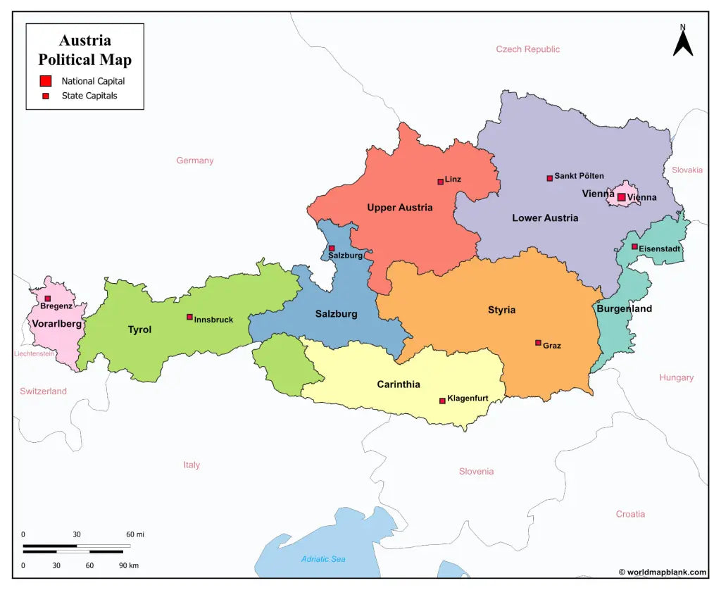
The maps with states and capitals include borders and markers for:
Burgenland (Eisenstadt), Carinthia (Klagenfurt), Lower Austria (Sankt Pölten), Salzburg (Salzburg), Styria (Graz), Tyrol (Innsbruck), Upper Austria (Linz), Vorarlberg (Bregenz), Vienna (Vienna)
The map with cities additionally shows:
Amstetten, Baden, Bischofshofen, Braunau am Inn, Bruck, Dornbirn, Eisenz, Feldkirch, Fohnsdorf, Fürstenfeld, Gleisdorf, Hallen, Horn, Imst, Kappl, Kitzbühel, Krems, Kufstein, Leoben, Liezen, Lienz, Murau, Mürzzuschlag, Neunkirchen, Obervellach, Ried im Innkreis, Saalfelden, Schrem, Schwaz, Spittal an der Drau, Steyr, Telfs, Uttendorf, Villach, Wels, Wiener Neustadt, Wörgl, Zell am See, and Zwettl


Download je gratis kaart
Vul je e-mailadres in en vertel ons hoe je de kaart gaat gebruiken. Je download begint direct.