
🇮🇪 Printable Map of Ireland with Counties
🇮🇪 Printable Map of Ireland with Counties
✅ Gratis download – PDF en JPEG, klaar om af te drukken.
Download hier een printable Map of Ireland with Counties om af te drukken voor aardrijkskunde, werkbladen, klasactiviteiten, quizzen, reisplanning en nog veel meer.
Kan beschikbaarheid voor afhalen niet laden
Voeg meer kaarten toe aan je winkelwagen om ze allemaal in één keer te downloaden.
Download your free printable map of Ireland with counties as a JPEG image and a PDF file!
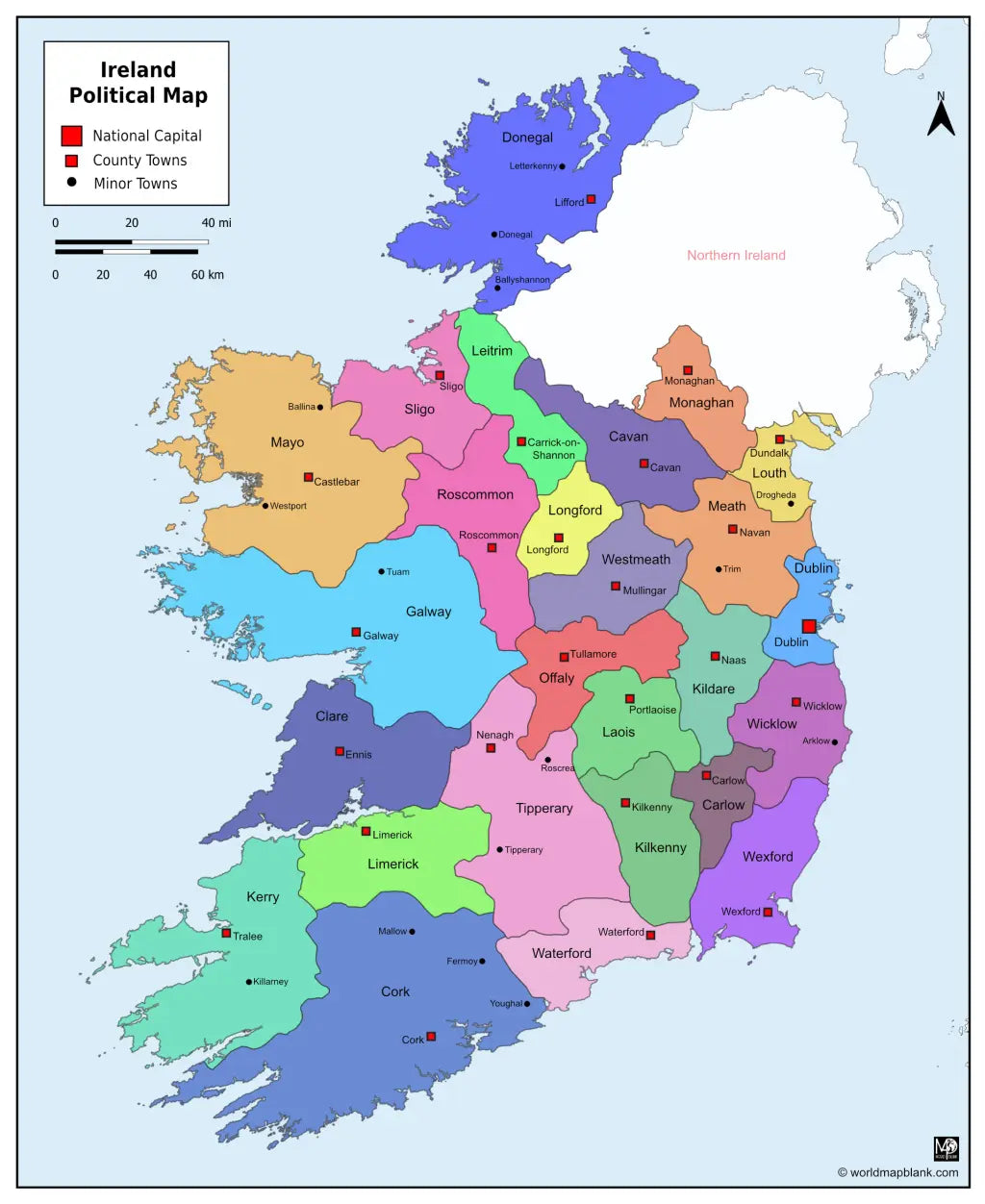
We also offer a printable, high-resolution political map of Ireland with counties, county seats, and towns (7860 x 9607 px).
Or get your Ireland labeled maps bundle, including:
🗺 Printable map of Ireland with counties
🗺 Ireland county map with county seats
🗺 Political Ireland map with counties, county seats, and towns
All versions include PDF and JPEG versions of the maps.
The maps with counties and/or county seats include markers for:
Carlow (Carlow), Cavan (Cavan), Clare (Ennis), Cork (Cork), Donegal (Lifford), Dublin (Dublin), Galway (Galway), Kerry (Tralee), Kildare (Naas), Kilkenny (Kilkenny), Laois (Portlaoise), Leitrim (Carrick-on-Shannon), Limerick (Limerick), Longford (Longford), Louth (Dundalk), Mayo (Castlebar), Meath (Navan), Monaghan (Monaghan), Offaly (Tullamore), Roscommon (Roscommon), Sligo (Sligo), Tipperary (Nenagh), Waterford (Waterford), Westmeath (Mullingar), Wexford (Wexford), and Wicklow (Wicklow)
The map with towns includes additional markers for:
Arklow, Ballina, Ballyshannon, Donegal, Drogheda, Fermoy, Killarney, Letterkenny, Mallow, Roscrea, Tipperary, Trim, Tuam, Westport, Youghal


Download je gratis kaart
Vul je e-mailadres in en vertel ons hoe je de kaart gaat gebruiken. Je download begint direct.