
🌎 Labeled Political Map of North America
🌎 Labeled Political Map of North America
✅ Download gratuito – PDF e JPEG, prontos para imprimir.
Descarregue aqui um labeled Political Map of North America para imprimir, destinado ao ensino de geografia, fichas de exercícios, atividades para a sala de aula, questionários, planeamento de viagens e muito mais.
Não foi possível carregar a disponibilidade de retirada.
Adicione mais cartões ao seu carrinho para baixá-los todos de uma vez.
Download your free labeled map of North America, or a printable political map of North America with countries, as a JPG and a PDF!
Choose between the following free maps or download them all:
🗺 Political map of North America with countries
🗺 Labeled map of North America
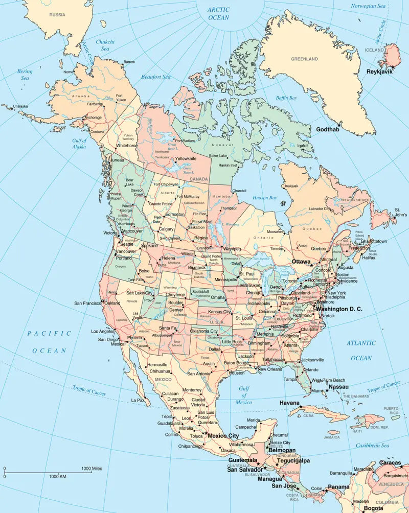
🗺 North America political map with capitals and cities
The downloads include PDF and JPG versions of the maps.
Our political North America maps include the following countries and capitals:
Antigua and Barbuda (St. John’s), Bahamas (Nassau), Barbados (Bridgetown), Belize (Belmopan), Canada (Ottawa), Costa Rica (San José), Cuba (Havana), Dominica (Roseau), Dominican Republic (Santo Domingo), El Salvador (San Salvador), Guatemala (Guatemala City), Honduras (Tegucigalpa), Jamaica (Kingston), Mexico (Mexico City), Nicaragua (Managua), Panama (Panama City), and the United States (Washington, D.C.).
Complete your maps collection with a blank map of North America or other labeled continent maps.


Baixa o teu mapa gratuito
Digita seu e-mail e conta pra gente como você vai usar o mapa. O download começa imediatamente.