
🇦🇹 Printable Map of Austria with States
🇦🇹 Printable Map of Austria with States
✅ Download gratuito – PDF e JPEG, prontos para imprimir.
Descarregue aqui um printable Map of Austria with States para imprimir, destinado ao ensino de geografia, fichas de exercícios, atividades para a sala de aula, questionários, planeamento de viagens e muito mais.
Não foi possível carregar a disponibilidade de retirada.
Adicione mais cartões ao seu carrinho para baixá-los todos de uma vez.
Download your free printable map of Austria with states as a JPEG image and a PDF file!
We also offer a printable, high-resolution political map of Austria.
Or get your labeled Austria maps bundle, including:
🗺 Printable map of Austria with states and capitals
🗺 Political Austria map with neighboring countries
🗺 Labeled Austria map with Bundesländern
The bundle includes PDF and JPEG versions of all maps.
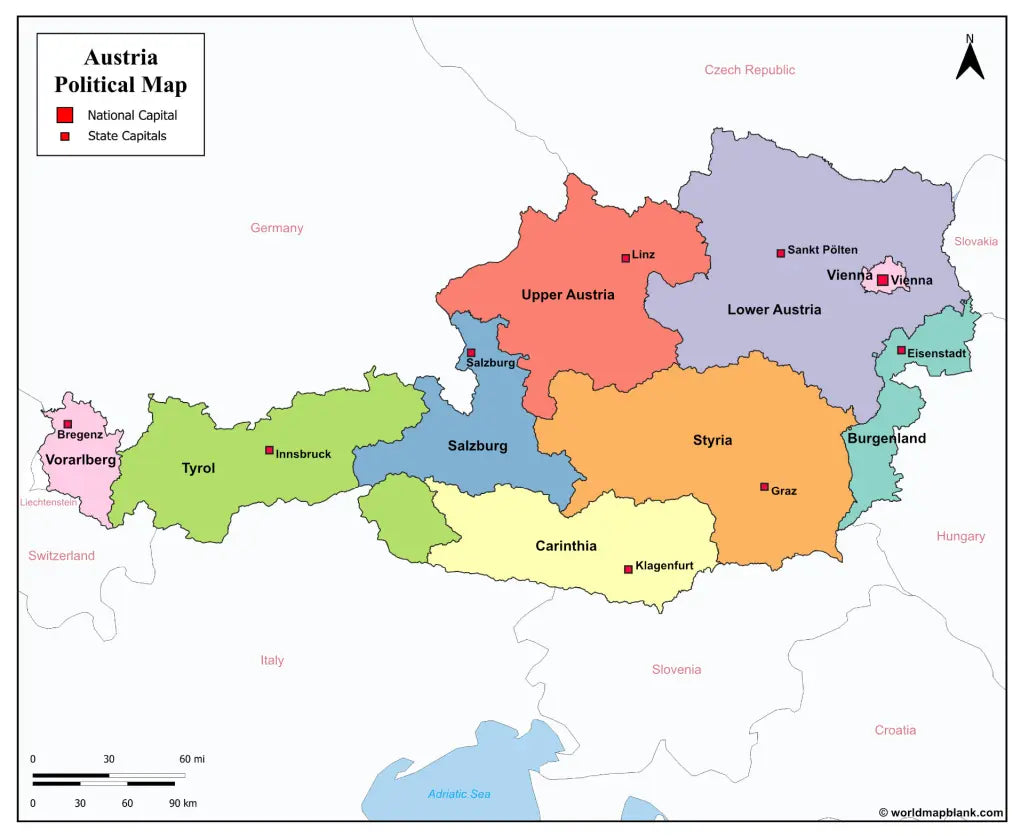
The maps with states and capitals include borders and markers for:
Burgenland (Eisenstadt), Carinthia (Klagenfurt), Lower Austria (Sankt Pölten), Salzburg (Salzburg), Styria (Graz), Tyrol (Innsbruck), Upper Austria (Linz), Vorarlberg (Bregenz), Vienna (Vienna)
The map with cities additionally shows:
Amstetten, Baden, Bischofshofen, Braunau am Inn, Bruck, Dornbirn, Eisenz, Feldkirch, Fohnsdorf, Fürstenfeld, Gleisdorf, Hallen, Horn, Imst, Kappl, Kitzbühel, Krems, Kufstein, Leoben, Liezen, Lienz, Murau, Mürzzuschlag, Neunkirchen, Obervellach, Ried im Innkreis, Saalfelden, Schrem, Schwaz, Spittal an der Drau, Steyr, Telfs, Uttendorf, Villach, Wels, Wiener Neustadt, Wörgl, Zell am See, and Zwettl


Baixa o teu mapa gratuito
Digita seu e-mail e conta pra gente como você vai usar o mapa. O download começa imediatamente.