
🇮🇪 Printable Map of Ireland with Counties
🇮🇪 Printable Map of Ireland with Counties
✅ Download gratuito – PDF e JPEG, prontos para imprimir.
Descarregue aqui um printable Map of Ireland with Counties para imprimir, destinado ao ensino de geografia, fichas de exercícios, atividades para a sala de aula, questionários, planeamento de viagens e muito mais.
Não foi possível carregar a disponibilidade de retirada.
Adicione mais cartões ao seu carrinho para baixá-los todos de uma vez.
Download your free printable map of Ireland with counties as a JPEG image and a PDF file!
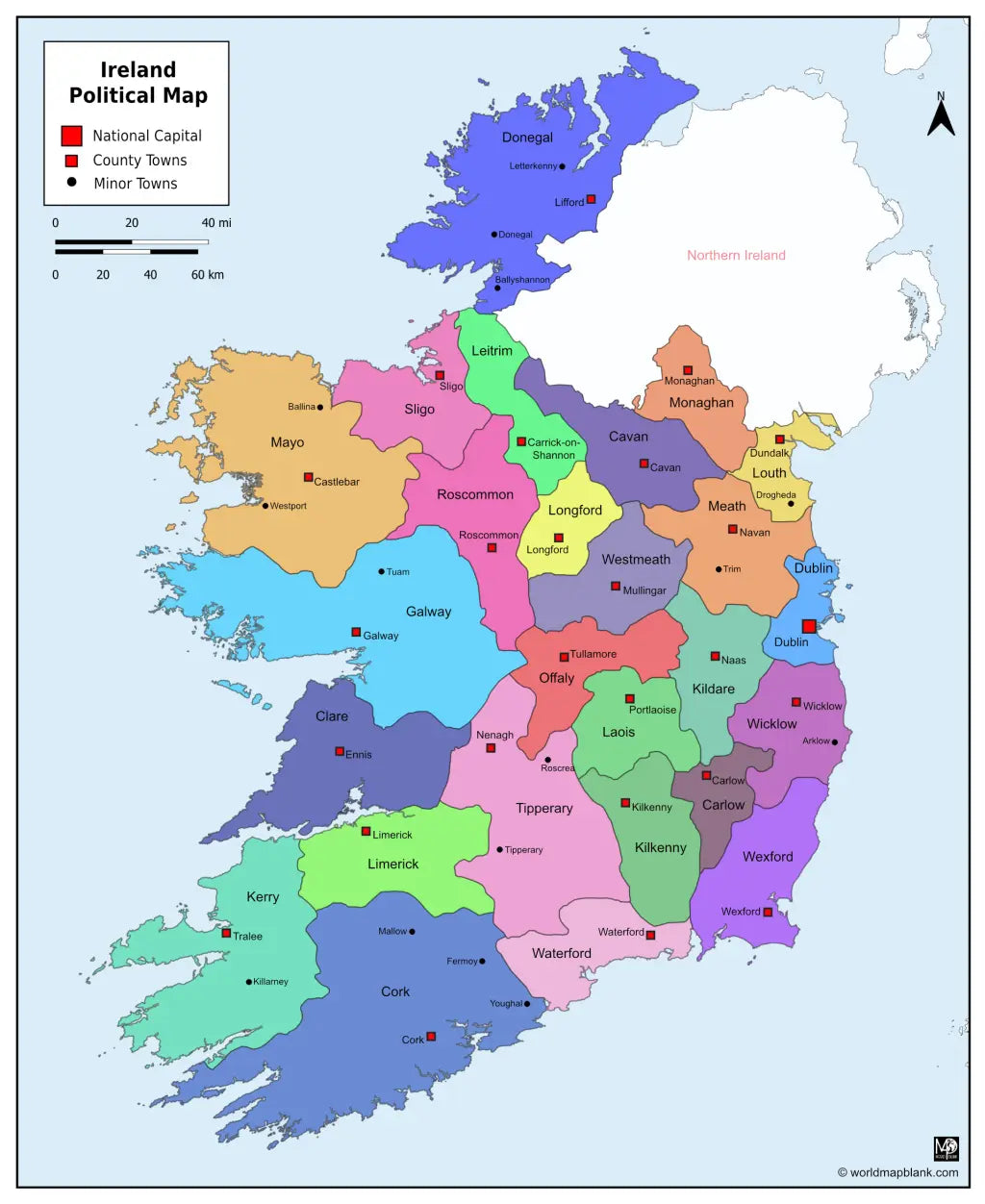
We also offer a printable, high-resolution political map of Ireland with counties, county seats, and towns (7860 x 9607 px).
Or get your Ireland labeled maps bundle, including:
🗺 Printable map of Ireland with counties
🗺 Ireland county map with county seats
🗺 Political Ireland map with counties, county seats, and towns
All versions include PDF and JPEG versions of the maps.
The maps with counties and/or county seats include markers for:
Carlow (Carlow), Cavan (Cavan), Clare (Ennis), Cork (Cork), Donegal (Lifford), Dublin (Dublin), Galway (Galway), Kerry (Tralee), Kildare (Naas), Kilkenny (Kilkenny), Laois (Portlaoise), Leitrim (Carrick-on-Shannon), Limerick (Limerick), Longford (Longford), Louth (Dundalk), Mayo (Castlebar), Meath (Navan), Monaghan (Monaghan), Offaly (Tullamore), Roscommon (Roscommon), Sligo (Sligo), Tipperary (Nenagh), Waterford (Waterford), Westmeath (Mullingar), Wexford (Wexford), and Wicklow (Wicklow)
The map with towns includes additional markers for:
Arklow, Ballina, Ballyshannon, Donegal, Drogheda, Fermoy, Killarney, Letterkenny, Mallow, Roscrea, Tipperary, Trim, Tuam, Westport, Youghal


Baixa o teu mapa gratuito
Digita seu e-mail e conta pra gente como você vai usar o mapa. O download começa imediatamente.