
🌎 Labeled Political Map of North America
🌎 Labeled Political Map of North America
✅ Gratis nedladdning – PDF och JPEG, redo att skriva ut.
Ladda ner en labeled Political Map of North America att skriva ut för geografilektioner, övningsblad, klassrumsaktiviteter, frågeformulär, resplanering och mycket mer.
Det gick inte att ladda hämtningstillgänglighet
Lägg till fler kort i varukorgen för att ladda ner dem alla på en gång.
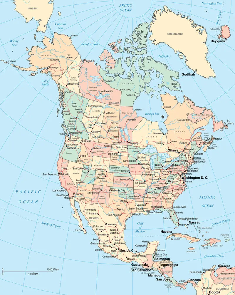
Download your free labeled map of North America, or a printable political map of North America with countries, as a JPG and a PDF!
Choose between the following free maps or download them all:
🗺 Political map of North America with countries
🗺 Labeled map of North America
🗺 North America political map with capitals and cities
The downloads include PDF and JPG versions of the maps.
Our political North America maps include the following countries and capitals:
Antigua and Barbuda (St. John’s), Bahamas (Nassau), Barbados (Bridgetown), Belize (Belmopan), Canada (Ottawa), Costa Rica (San José), Cuba (Havana), Dominica (Roseau), Dominican Republic (Santo Domingo), El Salvador (San Salvador), Guatemala (Guatemala City), Honduras (Tegucigalpa), Jamaica (Kingston), Mexico (Mexico City), Nicaragua (Managua), Panama (Panama City), and the United States (Washington, D.C.).
Complete your maps collection with a blank map of North America or other labeled continent maps.


Ladda ner din gratis karta
Ange din e-postadress och berätta hur du tänker använda kartan. Nedladdningen påbörjas omedelbart.