
🇦🇹 Printable Map of Austria with States
🇦🇹 Printable Map of Austria with States
✅ Gratis nedladdning – PDF och JPEG, redo att skriva ut.
Ladda ner en printable Map of Austria with States att skriva ut för geografilektioner, övningsblad, klassrumsaktiviteter, frågeformulär, resplanering och mycket mer.
Det gick inte att ladda hämtningstillgänglighet
Lägg till fler kort i varukorgen för att ladda ner dem alla på en gång.
Download your free printable map of Austria with states as a JPEG image and a PDF file!
We also offer a printable, high-resolution political map of Austria.
Or get your labeled Austria maps bundle, including:
🗺 Printable map of Austria with states and capitals
🗺 Political Austria map with neighboring countries
🗺 Labeled Austria map with Bundesländern
The bundle includes PDF and JPEG versions of all maps.
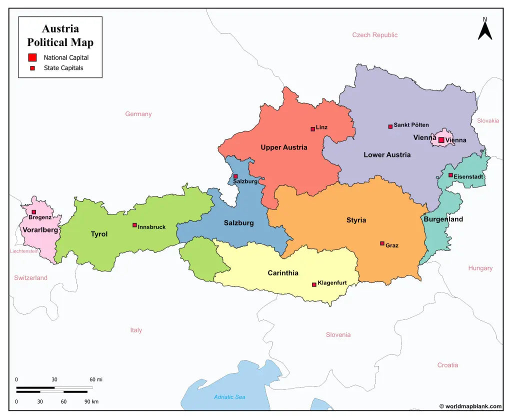
The maps with states and capitals include borders and markers for:
Burgenland (Eisenstadt), Carinthia (Klagenfurt), Lower Austria (Sankt Pölten), Salzburg (Salzburg), Styria (Graz), Tyrol (Innsbruck), Upper Austria (Linz), Vorarlberg (Bregenz), Vienna (Vienna)
The map with cities additionally shows:
Amstetten, Baden, Bischofshofen, Braunau am Inn, Bruck, Dornbirn, Eisenz, Feldkirch, Fohnsdorf, Fürstenfeld, Gleisdorf, Hallen, Horn, Imst, Kappl, Kitzbühel, Krems, Kufstein, Leoben, Liezen, Lienz, Murau, Mürzzuschlag, Neunkirchen, Obervellach, Ried im Innkreis, Saalfelden, Schrem, Schwaz, Spittal an der Drau, Steyr, Telfs, Uttendorf, Villach, Wels, Wiener Neustadt, Wörgl, Zell am See, and Zwettl


Ladda ner din gratis karta
Ange din e-postadress och berätta hur du tänker använda kartan. Nedladdningen påbörjas omedelbart.