
🇨🇳 Labeled Political Map of China
🇨🇳 Labeled Political Map of China
✅ Download gratuito – PDF e JPEG, pronti per la stampa.
Scarica qui una labeled Political Map of China da stampare per l’insegnamento della geografia, fogli di esercizi, attività da svolgere in classe, questionari, programmi di viaggio e molto altro ancora.
Impossibile caricare la disponibilità di ritiro
Aggiungi altre mappe al carrello per scaricarle tutte in una volta.
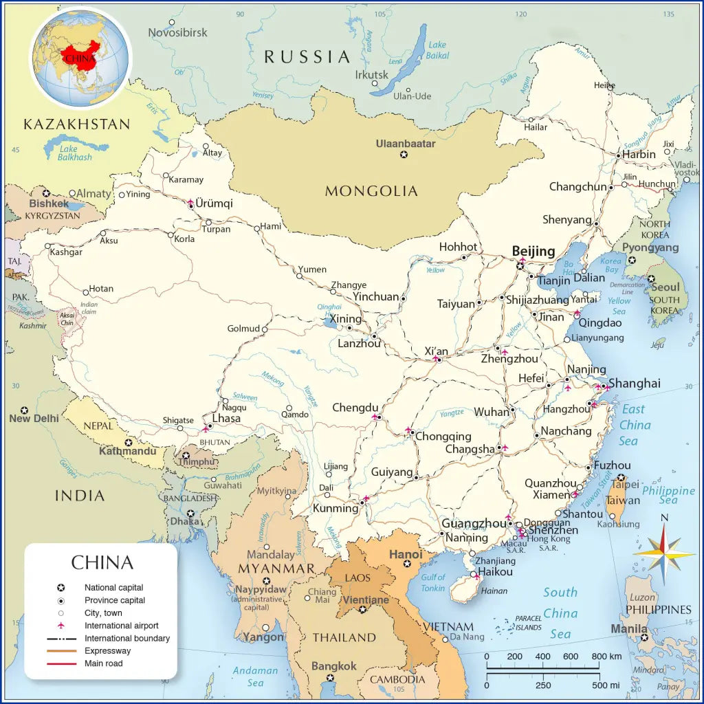
Download your free political map of China with provinces and capitals or a printable labeled map of China as a JPG image and a PDF file!
We also offer a high-resolution map of China and its neighboring countries (3900 x 3300 px).
You can choose from 5 different free maps or get the high-resolution China map:
🗺 Political Map of China
🗺 Labeled Map of China with Cities
🗺 Labeled Map of China with Neighboring Countries
🗺 Printable Map of China with Provinces
🗺 Political Map of China with Provinces and Capitals
All downloads include PDF and JPG versions of the maps.
The maps with provinces and capitals include borders and/or city markers for:
Anhui (Hefei), Fujian (Fuzhou), Gansu (Lanzhou), Guangdong (Guangzhou), Guizhou (Guiyang), Hainan (Haikou), Hebei (Shijiazhuang), Heilongjiang (Harbin), Henan (Zhengzhou), Hubei (Wuhan), Hunan (Changsha), Jiangsu (Nanjing), Jiangxi (Nanchang), Jilin (Changchun), Liaoning (Shenyang), Qinghai (Xining), Shaanxi (Xi’an), Shandong (Jinan), Shanxi (Taiyuan), Sichuan (Chengdu), Taiwan (Taipei), Yunnan (Kunming), and Zhejiang (Hangzhou).
The most detailed India maps also show the following cities:
Altay, Chiang Mai, Dali, Da Nang, Dongguang, Fuzhou, Golmud, Guiyang, Guwahati, Hami, Hangzhou, Jinan, Karamay, Korla, Kunming, Lanzhou, Lhasa, Lijiang, Lianyungang, Linzhi, Mai, Myitkyina, Nagqu, Nanchang, Naypyidaw, Qamdo, Qingdao, Quanzhou, Shantou, Shigatse, Shenzhen, Vientiane, Xiamen, Yangon, Yantai, Yining, Yumen, Yunming, Zhangye, and Zhuhai.


Scarica la mappa gratuita
Inserisci il tuo indirizzo e-mail e dicci come intendi utilizzare la mappa. Il download inizierà immediatamente.