
🌎 Labeled Political Map of North America
🌎 Labeled Political Map of North America
✅ Download gratuito – PDF e JPEG, pronti per la stampa.
Scarica qui una labeled Political Map of North America da stampare per l’insegnamento della geografia, fogli di esercizi, attività da svolgere in classe, questionari, programmi di viaggio e molto altro ancora.
Impossibile caricare la disponibilità di ritiro
Aggiungi altre mappe al carrello per scaricarle tutte in una volta.
Download your free labeled map of North America, or a printable political map of North America with countries, as a JPG and a PDF!
Choose between the following free maps or download them all:
🗺 Political map of North America with countries
🗺 Labeled map of North America
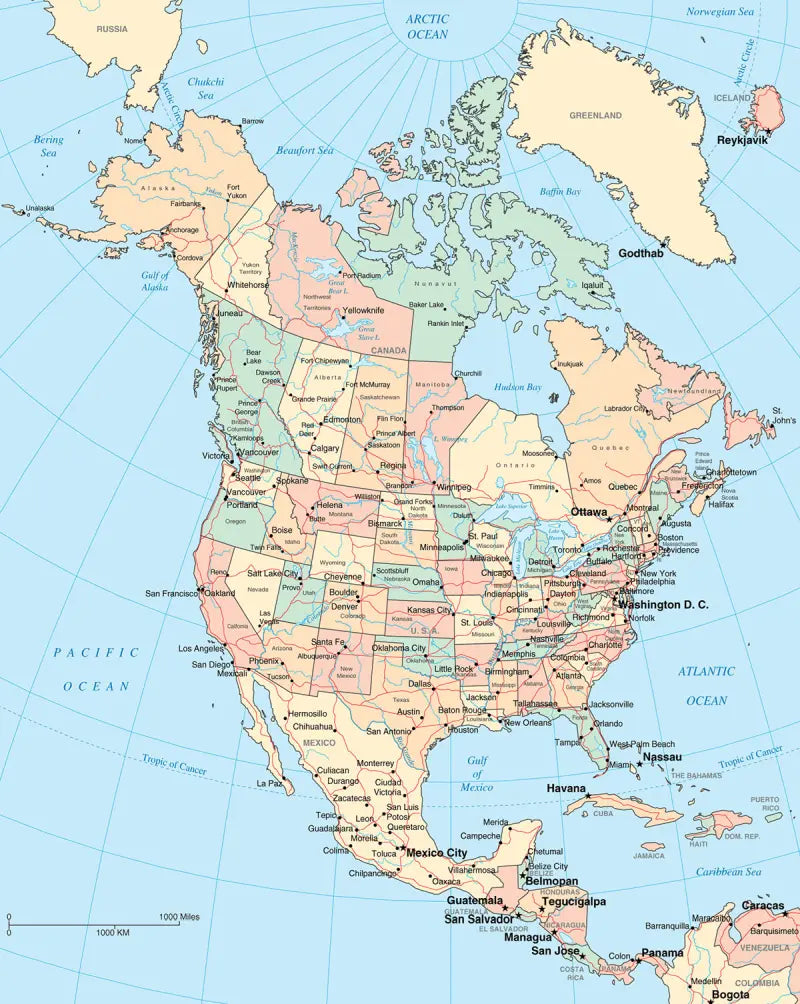
🗺 North America political map with capitals and cities
The downloads include PDF and JPG versions of the maps.
Our political North America maps include the following countries and capitals:
Antigua and Barbuda (St. John’s), Bahamas (Nassau), Barbados (Bridgetown), Belize (Belmopan), Canada (Ottawa), Costa Rica (San José), Cuba (Havana), Dominica (Roseau), Dominican Republic (Santo Domingo), El Salvador (San Salvador), Guatemala (Guatemala City), Honduras (Tegucigalpa), Jamaica (Kingston), Mexico (Mexico City), Nicaragua (Managua), Panama (Panama City), and the United States (Washington, D.C.).
Complete your maps collection with a blank map of North America or other labeled continent maps.


Scarica la mappa gratuita
Inserisci il tuo indirizzo e-mail e dicci come intendi utilizzare la mappa. Il download inizierà immediatamente.