
🇦🇹 Printable Map of Austria with States
🇦🇹 Printable Map of Austria with States
✅ Download gratuito – PDF e JPEG, pronti per la stampa.
Scarica qui una printable Map of Austria with States da stampare per l’insegnamento della geografia, fogli di esercizi, attività da svolgere in classe, questionari, programmi di viaggio e molto altro ancora.
Impossibile caricare la disponibilità di ritiro
Aggiungi altre mappe al carrello per scaricarle tutte in una volta.
Download your free printable map of Austria with states as a JPEG image and a PDF file!
We also offer a printable, high-resolution political map of Austria.
Or get your labeled Austria maps bundle, including:
🗺 Printable map of Austria with states and capitals
🗺 Political Austria map with neighboring countries
🗺 Labeled Austria map with Bundesländern
The bundle includes PDF and JPEG versions of all maps.
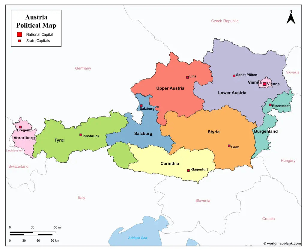
The maps with states and capitals include borders and markers for:
Burgenland (Eisenstadt), Carinthia (Klagenfurt), Lower Austria (Sankt Pölten), Salzburg (Salzburg), Styria (Graz), Tyrol (Innsbruck), Upper Austria (Linz), Vorarlberg (Bregenz), Vienna (Vienna)
The map with cities additionally shows:
Amstetten, Baden, Bischofshofen, Braunau am Inn, Bruck, Dornbirn, Eisenz, Feldkirch, Fohnsdorf, Fürstenfeld, Gleisdorf, Hallen, Horn, Imst, Kappl, Kitzbühel, Krems, Kufstein, Leoben, Liezen, Lienz, Murau, Mürzzuschlag, Neunkirchen, Obervellach, Ried im Innkreis, Saalfelden, Schrem, Schwaz, Spittal an der Drau, Steyr, Telfs, Uttendorf, Villach, Wels, Wiener Neustadt, Wörgl, Zell am See, and Zwettl


Scarica la mappa gratuita
Inserisci il tuo indirizzo e-mail e dicci come intendi utilizzare la mappa. Il download inizierà immediatamente.