
🇺🇦 Printable Map of Ukraine with Oblasts
🇺🇦 Printable Map of Ukraine with Oblasts
✅ Download gratuito – PDF e JPEG, pronti per la stampa.
Scarica qui una printable Map of Ukraine with Oblasts da stampare per l’insegnamento della geografia, fogli di esercizi, attività da svolgere in classe, questionari, programmi di viaggio e molto altro ancora.
Impossibile caricare la disponibilità di ritiro
Aggiungi altre mappe al carrello per scaricarle tutte in una volta.
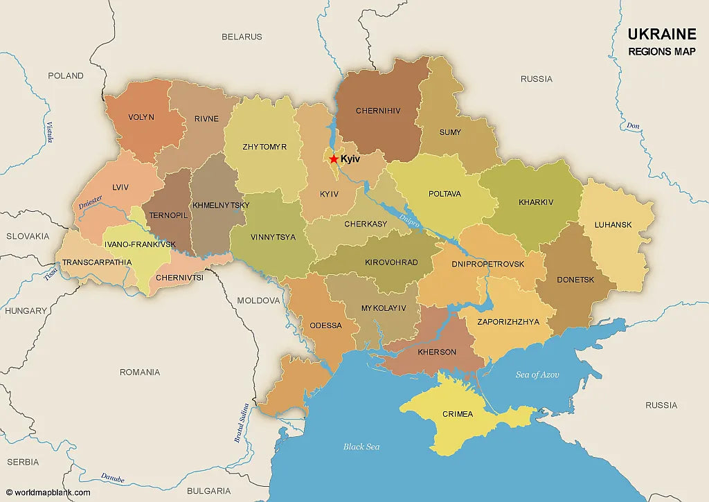
Download your free printable map of Ukraine with regions, available as a JPEG image and a PDF file!
We also offer a high-resolution political map of Ukraine with major cities.
Or get your Ukraine labeled maps bundle, including:
🗺 Printable map of Ukraine with regions (oblasts)
🗺 Map of Ukraine and Surrounding Countries (with region capitals)
🗺 Political map of Ukraine with capitals and cities
The bundle includes PDF and JPEG versions of all maps.
The maps with regions and capitals include borders and/or city markers for:
Chernihiv (Chernihiv), Chernivtsi (Chernivtsi), Dnipropetrovsk (Dnipro), Donetsk (Donetsk), Ivano-Frankivsk (Ivano-Frankivsk), Kharkiv (Kharkiv), Kherson (Kherson), Khmelnytskyi (Khmelnytskyi), Kirovohrad (Kropyvnytskyi), Kyiv (Kyiv), Luhansk (Luhansk), Lviv (Lviv), Mykolaiv (Mykolaiv), Odesa (Odesa), Poltava (Poltava), Rivne (Rivne), Sumy (Sumy), Ternopil (Ternopil), Transcarpathian (Uzhhorod), Vinnytsia (Vinnytsia), Volyn (Lutsk), Zaporizhzhia (Zaporizhzhia), Zhytomyr (Zhytomyr), Autonomous Republic of Crimea (Simferopol)
The map with cities includes additional markers for:
Kovel, Korosten, Nizhyn, Shostka, Kupiansk, Lysychansk, Mariupol, Kremenchuk, Voznesensk, Izmail, Nikopol, Melitopol, Yevpatoria, Yalta, Kerch, Sevastopol, Dzhankoy


Scarica la mappa gratuita
Inserisci il tuo indirizzo e-mail e dicci come intendi utilizzare la mappa. Il download inizierà immediatamente.