
🇦🇹 Printable Map of Austria with States
🇦🇹 Printable Map of Austria with States
✅ Free download – PDF and JPEG, ready to print.
Download a printable map of Austria with states for geography teaching, practice worksheets, classroom exercises, homeschooling, presentations, travel planning, and more.
Couldn't load pickup availability
Add multiple maps to the cart to download them all at once.
Download your free printable map of Austria with states as a JPEG image and a PDF file!
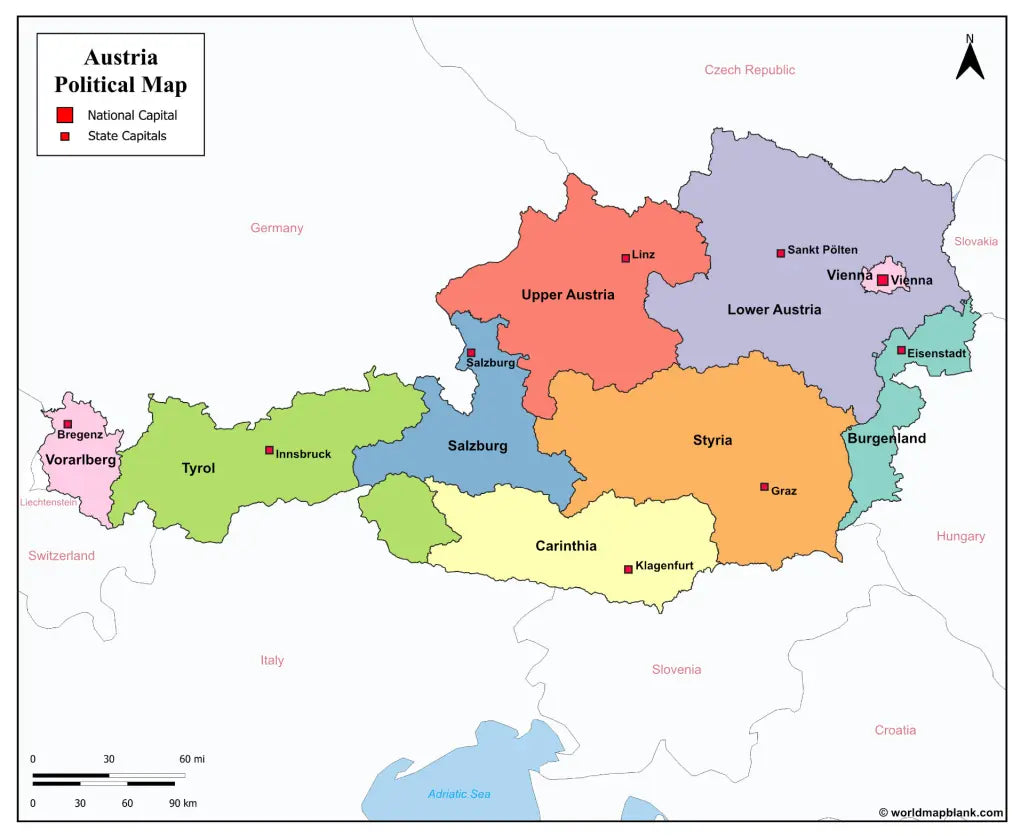
We also offer a printable, high-resolution political map of Austria.
Or get your labeled Austria maps bundle, including:
🗺 Printable map of Austria with states and capitals
🗺 Political Austria map with neighboring countries
🗺 Labeled Austria map with Bundesländern
The bundle includes PDF and JPEG versions of all maps.
The maps with states and capitals include borders and markers for:
Burgenland (Eisenstadt), Carinthia (Klagenfurt), Lower Austria (Sankt Pölten), Salzburg (Salzburg), Styria (Graz), Tyrol (Innsbruck), Upper Austria (Linz), Vorarlberg (Bregenz), Vienna (Vienna)
The map with cities additionally shows:
Amstetten, Baden, Bischofshofen, Braunau am Inn, Bruck, Dornbirn, Eisenz, Feldkirch, Fohnsdorf, Fürstenfeld, Gleisdorf, Hallen, Horn, Imst, Kappl, Kitzbühel, Krems, Kufstein, Leoben, Liezen, Lienz, Murau, Mürzzuschlag, Neunkirchen, Obervellach, Ried im Innkreis, Saalfelden, Schrem, Schwaz, Spittal an der Drau, Steyr, Telfs, Uttendorf, Villach, Wels, Wiener Neustadt, Wörgl, Zell am See, and Zwettl


Download your free map
Enter your email and tell us how you'll use the map. Your download starts immediately.