
🇨🇳 Labeled Political Map of China
🇨🇳 Labeled Political Map of China
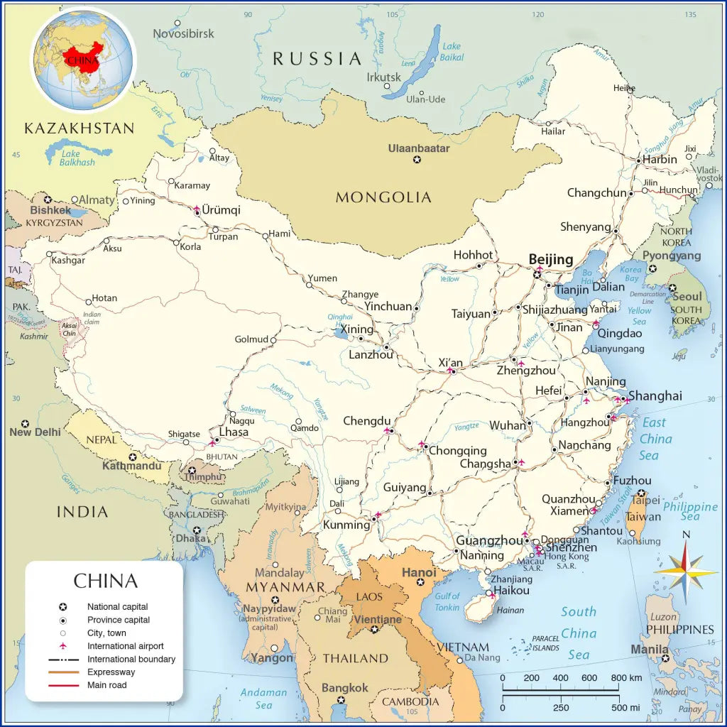
Download a printable labeled political map of China for geography teaching, practice worksheets, classroom exercises, homeschooling, presentations, travel planning, and more.
Couldn't load pickup availability
Add multiple maps to the cart to download them all at once.
Download your free political map of China with provinces and capitals or a printable labeled map of China as a JPG image and a PDF file!
We also offer a high-resolution map of China and its neighboring countries (3900 x 3300 px).
You can choose from 5 different free maps or get the high-resolution China map:
🗺 Political Map of China
🗺 Labeled Map of China with Cities
🗺 Labeled Map of China with Neighboring Countries
🗺 Printable Map of China with Provinces
🗺 Political Map of China with Provinces and Capitals
All downloads include PDF and JPG versions of the maps.
The maps with provinces and capitals include borders and/or city markers for:
Anhui (Hefei), Fujian (Fuzhou), Gansu (Lanzhou), Guangdong (Guangzhou), Guizhou (Guiyang), Hainan (Haikou), Hebei (Shijiazhuang), Heilongjiang (Harbin), Henan (Zhengzhou), Hubei (Wuhan), Hunan (Changsha), Jiangsu (Nanjing), Jiangxi (Nanchang), Jilin (Changchun), Liaoning (Shenyang), Qinghai (Xining), Shaanxi (Xi’an), Shandong (Jinan), Shanxi (Taiyuan), Sichuan (Chengdu), Taiwan (Taipei), Yunnan (Kunming), and Zhejiang (Hangzhou).
The most detailed India maps also show the following cities:
Altay, Chiang Mai, Dali, Da Nang, Dongguang, Fuzhou, Golmud, Guiyang, Guwahati, Hami, Hangzhou, Jinan, Karamay, Korla, Kunming, Lanzhou, Lhasa, Lijiang, Lianyungang, Linzhi, Mai, Myitkyina, Nagqu, Nanchang, Naypyidaw, Qamdo, Qingdao, Quanzhou, Shantou, Shigatse, Shenzhen, Vientiane, Xiamen, Yangon, Yantai, Yining, Yumen, Yunming, Zhangye, and Zhuhai.


Download your free map
Enter your email and tell us how you'll use the map. Your download starts immediately.