Labeled Map of Ohio with Capital & Cities
The Labeled Map of Ohio, shows the user the exact location of Ohio state, in the US. This state is situated in the northeastern region of the US with a shoreline at Lake Erie. To the north, the state has borders with Ontario Canada and across Lake Erie. It has borders with other US states, like Michigan in the northwest. In the east, it has borders with Pennsylvania. With Kentucky in the south, and West Virginia in the southeast, the River Ohio forms the border with the state.
Labeled Map of Ohio
Ohio was admitted as the seventeenth state to the Union on first March, in 1803. In general, based on the labeled map of Ohio state in the US, it is possible to get details of the boundaries that are surrounding the state, the location of the state capital, Columbus, details of populated states, including major cities, lakes and rivers, principal and interstate highways and railroads. The nickname of this state is the Buckeye state that occupies a land area of 44,825 square miles or 116,096 square kilometers. When compared, the area of Ohio state is somewhat larger than that of Bulgaria.
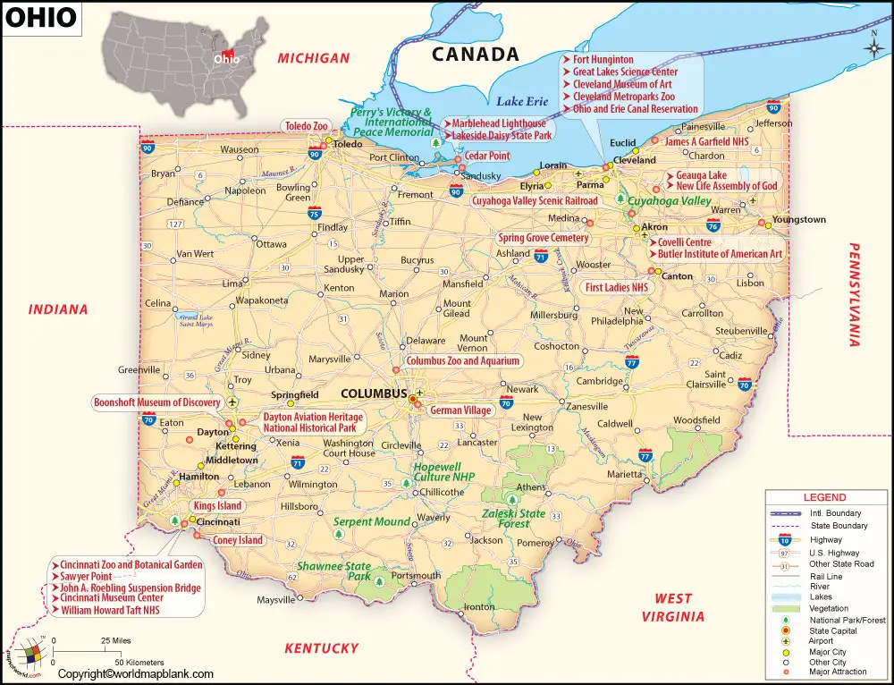
The area of Ohio state is considered to be slightly smaller than that of Nicaragua. The rivers that flow through Ohio state, include the Cuyahoga River, the Great Miami River, the Maumee River, the Muskingum River, the Scioto River and the Ohio River. The population count of Ohio state is 11.6 million people. It has the largest airport known as, Cleveland-Hopkins International Airport. The major religious people here are, Christians, Protestants, the Evangelical Lutheran, and the Southern Baptists.
Printable Map of Ohio Labeled
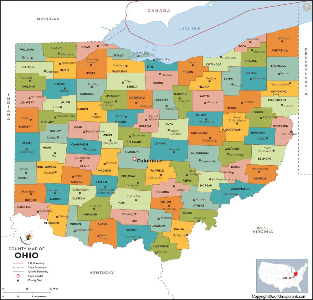
As a part of the labeled map of Ohio with states, the state has eighty-eight counties. Out of this, Adams County is ranked as the poorest county in the state. The richest county in Ohio is known as, Delaware County. Other names of counties include Franklin County that has a population of 1,316,756, Cuyahoga County that has a population of 1,235,072, Hamilton County with a population of 817,473, and Summit County that has 541,013.
Labeled Map of Ohio with Cities
The labeled map of Ohio with cities shows the names of large cities that have a population count greater than 100,000. They are Dayton with a population of 140,000, Akron with a population of 198,000, Cincinnati with a population of 302,000, Toledo with a population of 275,000, Cleveland with a population of 384,000, and Columbus with a population of 873,000. The largest Metropolitan area of Ohio is Greater Ohio, which is located in Ohio State.
Labeled Ohio Map with Capital

As a part of labeled Ohio with capital, the capital city of this state is Columbus. The Scioto Mile region of the city has a number of parks established on both sides of the River Scioto. These parks are provided with attractively designed huge interactive fountains and trails. The COSI science center located on the west bank provides hands-on exhibits and a planetarium.
Related Posts


