🇺🇸 Printable U.S. Interstate Highways Map
🇺🇸 Printable U.S. Interstate Highways Map
Download a printable U.S. interstate highways map for geography teaching, practice worksheets, classroom exercises, homeschooling, presentations, travel planning, and more.
Couldn't load pickup availability
Add multiple maps to the cart to download them all at once.
🗺️ U.S. Interstate Highways Map for Practice, Learning, or Projects
Download your free printable U.S. Interstates map showing all the Interstate highways of the USA as a JPEG image and a PDF file. You can also complete your collection with a labeled United States map, a blank USA map, or additional blank maps of U.S. states and printable U.S. state maps for more regional practice.
Highway maps are ideal for trip planning, geography lessons, and study projects.
Whether you're looking for a U.S. Interstate map, a U.S. highway map, or a printable Interstate map of the United States, this download offers multiple variations for flexible use.
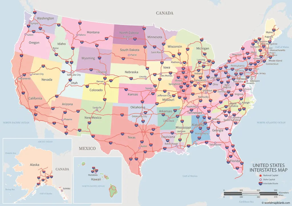
The below image shows a printable U.S. interstate highways map with states and state capitals labeled. It is included in our maps bundle.

We offer several versions of printable U.S. Interstate maps for free download and as part of our maps bundle. Additionally, our most detailed U.S. Interstates map is available as a jigsaw puzzle.
📁 U.S. Highway Map Bundle and More
Each file is available in high-resolution PDF and JPEG formats, ready for download and immediate use.
Available styles:
Or get your U.S. Highway maps bundle, including:
- U.S. Highway Map
- U.S. Interstate Map
- Interstate Map of the USA
- Highway Map of the United States
- Interstate Map of the United States
The bundle includes PDF and JPEG versions of all the included maps.
🛣️ About the U.S. Interstate Highway System
The U.S. Interstate Highway System is the backbone of national road travel, connecting major cities, regions, and coasts through a network of controlled-access freeways. Established with the Federal Aid Highway Act of 1956, the Interstate System spans over 48,000 miles and provides the fastest, most efficient routes for cross-country travel.
Route numbering follows a clear pattern: odd-numbered interstates run north–south, even-numbered routes run east–west, and three-digit interstates connect cities through loops, bypasses, and spurs.
Our printable U.S. Interstate maps highlight every primary and auxiliary route—including I-5, I-10, I-40, I-70, I-80, I-90, and I-95—making them ideal for trip planning, geography lessons, and understanding how America's national highway network is structured.
✅ U.S. Interstate Map Features
- Printable U.S. Interstate maps in PDF and JPEG formats
- Multiple highway and Interstate map variations
- Suitable for trip planning, education, and reference
- High-resolution versions available
🛒 How to Get Your Printable Map
- Add all your preferred map(s) to the cart
- Proceed to checkout
- Download your maps instantly
🎓 Who It's For
This U.S. Interstate map is ideal for travelers, students, teachers, and anyone interested in the structure of the national highway network. It works well for road trip planning, classroom materials, and general reference.
Download your printable U.S. Interstates map now and start using it for trip planning, teaching, or reference.