
🌎 Labeled Political Map of South America
🌎 Labeled Political Map of South America
✅ Free download – PDF and JPEG, ready to print.
Download a printable labeled political map of South America for geography teaching, practice worksheets, classroom exercises, homeschooling, presentations, travel planning, and more.
Couldn't load pickup availability
Add multiple maps to the cart to download them all at once.
Download your free labeled map of South America or a printable political map of South America as a JPEG image and a PDF file!
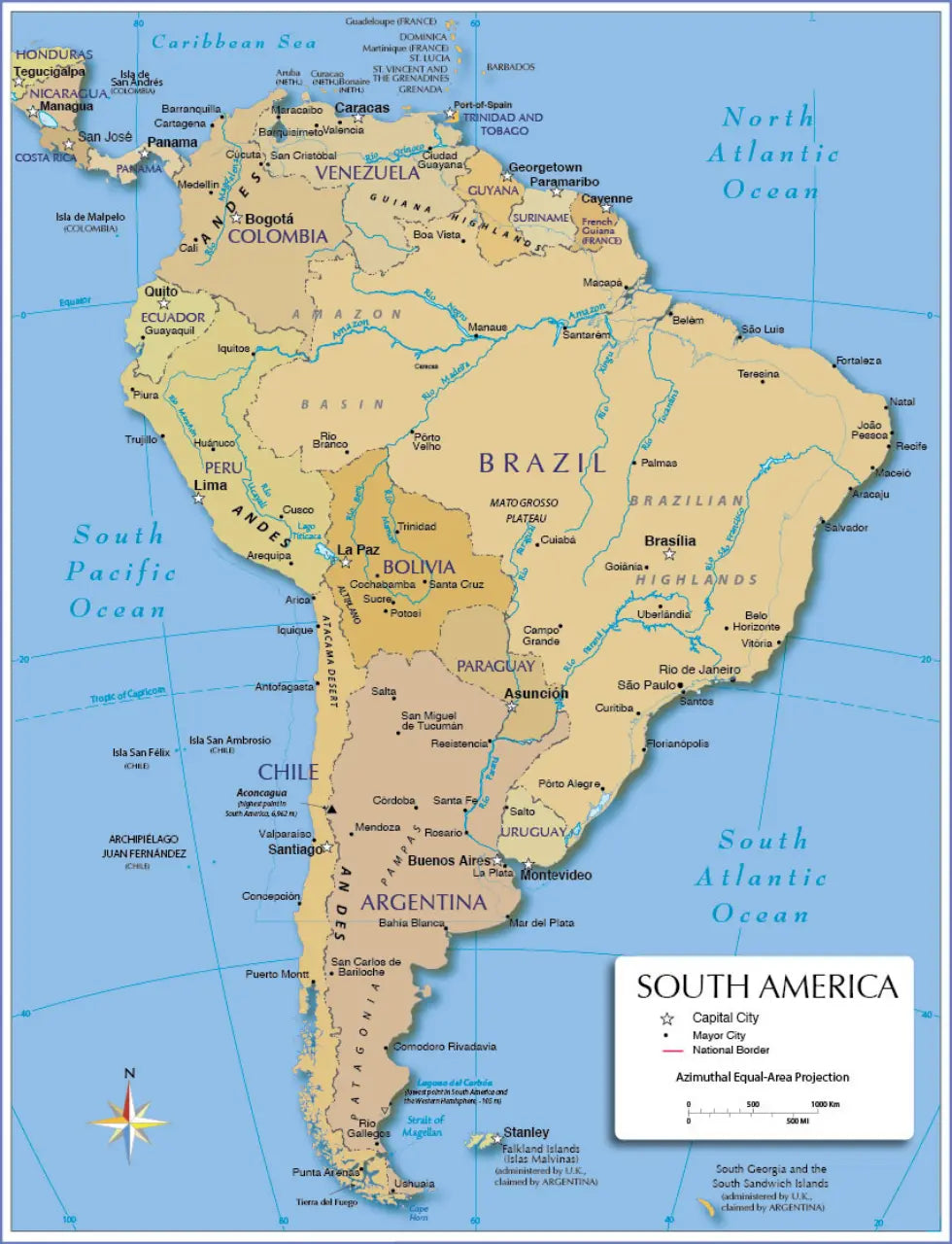
🗺 Political South America Map with Countries and Capitals
🗺 Labeled South America Map with Cities
The bundle includes PDF and JPEG versions of all maps.
The political South America map includes the following countries and capitals:
Argentina (Buenos Aires), Bolivia (La Paz, Sucre), Brazil (Brasília), Chile (Santiago), Colombia (Bogotá), Ecuador (Quito), French Guiana (Cayenne), Guyana (Georgetown), Paraguay (Asunción), Peru (Lima), Suriname (Paramaribo), Uruguay (Montevideo), and Venezuela (Caracas).
The labeled map of South America additionally includes the following cities:
Antofagasta, Aracaju, Arequipa, Arica, Bahia Blanca, Barquisimeto, Barranquilla, Belém, Belo Horizonte, Boa Vista, Cali, Campo Grande, Cartagena, Cochabamba, Comodoro Rivadavia, Concepción, Córdoba, Cúcuta, Cuiabá, Curitiba, Cusco, Florianópolis, Fortaleza, Goiânia, Guayaquil, Huánuco, Iquique, Iquitos, João Pessoa, La Plata, Maceió, Manaus, Mar del Plata, Maracaibo, Medellín, Mendoza, Natal, Palmas, Piura, Pôrto Alegre, Porto Velho, Potosí, Puerto Montt, Punta Arenas, Recife, Resistencia, Rio Branco, Rio de Janeiro, Rio Gallegos, Rosario, Salta, Salvador, San Carlos de Bariloche, San Cristóbal, San Miguel de Tucumán, Santa Cruz, Santa Fe, Santarém, Santos, São Luís, São Paulo, Salto, Stanley, Teresina, Trinidad, Trujillo, Uberlândia, Ushuaia, Valencia, Valparaíso, and Vitória.
Complete your maps collection with a blank map of South America or other labeled continent maps.

Download your free map
Enter your email and tell us how you'll use the map. Your download starts immediately.