Labeled Map of Arizona with Capital & Cities
Labeled Map of Arizona indicates that this is a landlocked state located in the southwestern region of the US. Out of the Western and Mountain states, Arizona is considered as a portion of it. Out of the fifty states of the US, Arizona is recognized as the sixth largest and the fourteenth populous state. Phoenix is the largest capital city of Arizona.
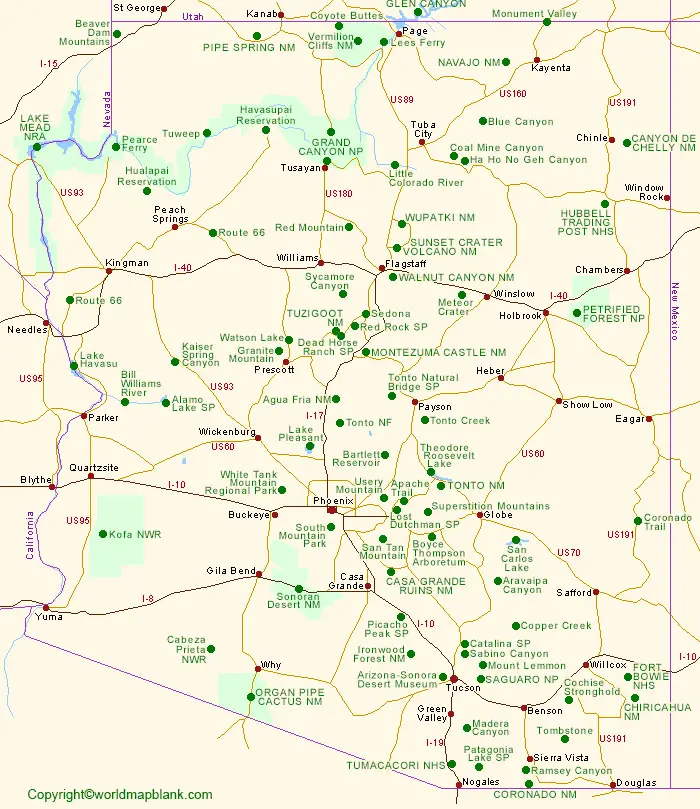
Labeled Map of Arizona
This state shares the Four Corners of the region with New Mexico, Colorado, and Utah. Arizona’s neighboring states are California and Nevada in the west. This includes the Mexican states of Sonora and Baja California towards the southwest and south. Arizona is famous for its hot low-elevation desert that is covered with creosote and cacti bushes. More than fifty percent of the state is at an elevation of 4,000 feet or 1,200 meters, above the mean sea level.
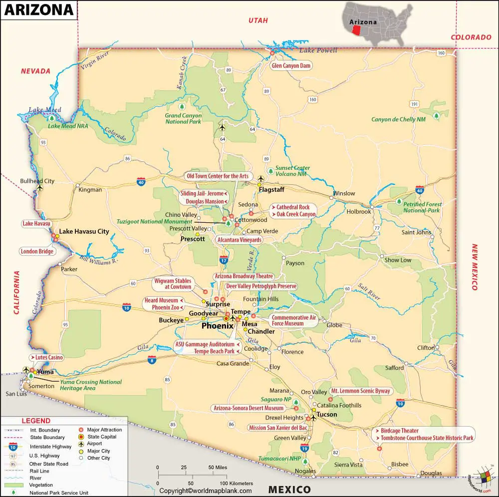
The state owns the largest evergreen ponderosa pine trees on the globe. The nickname of this state is known as, The Grand Canyon State. The estimated population of Arizona is equivalent to 7.4 million, in 2020. The land area of the state is 113,990 square miles or 295,234 square kilometers. The names of the Arizona Rivers shown on the map, include Aqua Fria River, Williams River, Black River, Colorado River, Gila River, Hassayampa River, San Pedro River, Santa Cruz, Santa Maria, Virgin and White River. Major religions followed, including Christianity, Islam, Hinduism, and others.
Labeled Map of Arizona Printable
As a part of the labeled map of Arizona, the state is divided into fifteen counties and comprise ninety-one incorporated cities and towns. Three major land areas constitute the Arizona state. They are Ridge and Basin Region, the Transition Zone, and the Colorado Plateau. About the northern 2/5 of the state of Arizona is covered by the Colorado Plateau. Some of the names of the counties of Arizona, include Yuma, Yavapai, Santa Cruz, Santa Cruz, Pinal, Pima, Navajo, Mohave and Maricopa.
Labeled Map of Arizona with Cities
As a part of the labeled map of Arizona with cities, the names of ten major cities of Arizona state are Surprise, Peoria, Tempe, Glendale, Gilbert, Scottsdale, Chandler, Mesa, Tucson, and Phoenix.
Labeled Arizona Map with Capital
Through labeled Arizona with capital, it can be observed that Phoenix is the capital city of Arizona state. It is recognized as the fifth-largest city in the US with a population of 1,615,017 people. The city is situated along the Salt River in the south-central region of the state. It is also located midway between Texas, El Paso, and California, and Los Angles.
Serving as a transportation, communications, and financial hub, Phoenix plays a major role in the development of the economy in the Mountain West Region of Arizona state. Approximately, seventy-five percent of Arizona states manufacturing facilities are located in Phoenix city. Manufacture of light industrial products, like equipment for transportation, electronics, aerospace technology, food processing industries, and cosmetics are found to be prominent in this city.
Related Posts


