Labeled Map of Iowa with Capital & Cities
The Labeled Map of Iowa indicates where in the US, this Iowa state is situated. Accordingly, the user can identify that Iowa is a landlocked Midwestern state, in the US. It is bordered by South Dakota in the northwest, Missouri in the south, and Minnesota in the north. It is also the only state whose western and eastern borders are created by rivers.
Labeled Map of Iowa
The Big Sioux River marks most of the border with South Dakota, in the west. This river then joins the Missouri, which creates the entire section of Iowa’s border with Nebraska. The eastern border of Iowa with Illinois and Wisconsin is defined by the River Mississippi. The land covered by Iowa is 56,272.81 square miles or 145,746 square kilometers.
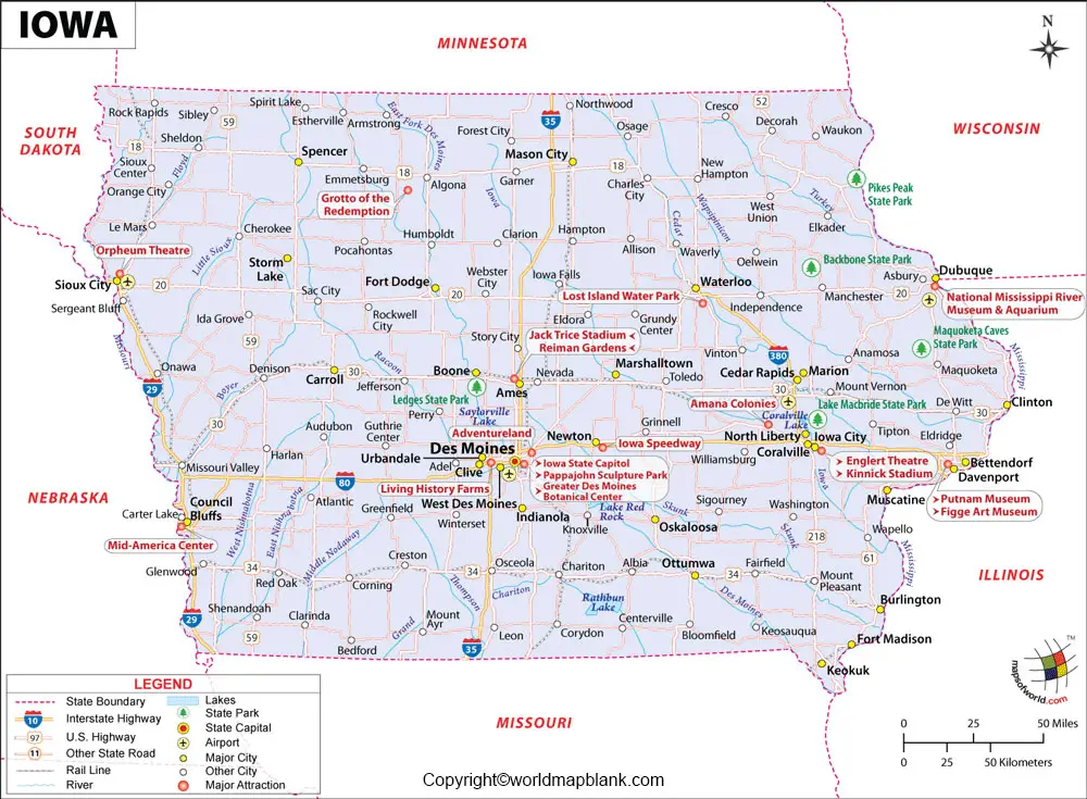
The area of Iowa is slightly larger than that of Greece. When compared with other US states by area, the area of Iowa is 6.5 times larger than that of New Jersey. The names of major rivers, include Missouri River, River Mississippi, Des Moines River, Cedar River, Iowa River, and Wapsipinicon River. Iowa has a population of 3.18 million people. The names of religions, include Christianity, Islam, and Hinduism.
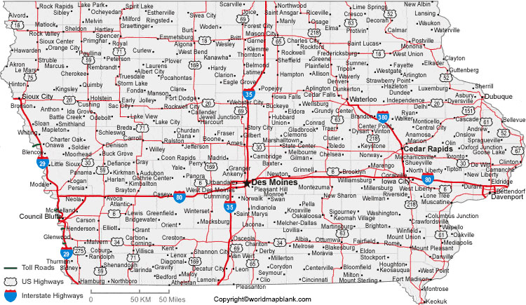
Labeled Map of Iowa Printable
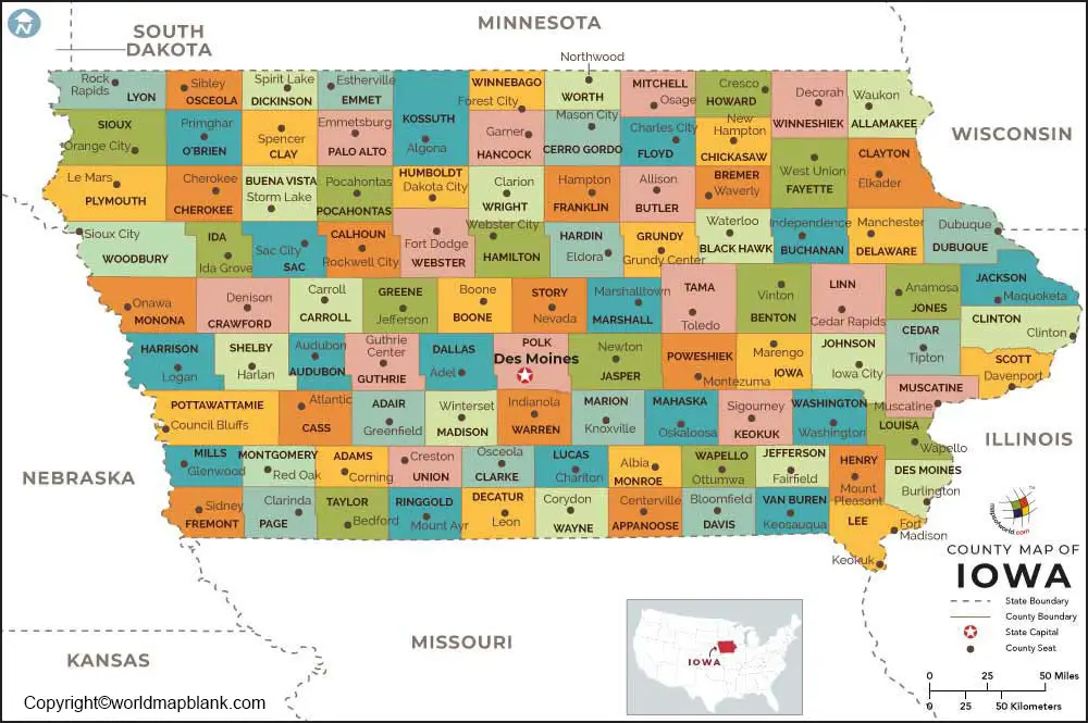
The labeled map of Iowa with states, reveals that this state is divided into ninety-nine counties. Out of this, the first two counties such as Dubuque County and Des Moines were created in 1834 when Iowa was still part of the territory of Michigan.
Labeled Map of Iowa with Cities
The labeled map of Iowa with cities shows the location of cities and towns in Iowa. Des Moines is the largest city in Iowa with a population of 215,500 people. Other names of large cities, include the city of Cedar Rapids, Davenport, Sioux City, Iowa City, Waterloo City, Ames City, West Des Moines, Council Bluffs, and Dubuque.
Labeled Iowa Map with Capital
The satellite view of labeled Iowa with capital shows that the capital city of Iowa is recognized as Des Moines. This is the most populous city in the state of Iowa. In the central region of Iowa state, this important city is located. It has an established educational institution named, Drake University. It is a midsized and co-educational university. The city is famous for a variety of economic activities, like logistics, data processing, insurance, and financial services.
The names of the largest employers available in the city, include Principal Financial Group, UnityPoint Health, Mercy Medical Center, and Wells Fargo & Company. Some of the places of attraction in the city are, John and Mary Pappajohn Sculpture Park, and John and Mary Pappajohn Art Park.
Other places of historical importance in this Des Moines city, include the Iowa State Capitol building, the Renaissance style building that houses the Iowa Senate, Secretary of State, Treasurer, Auditor, the Offices of the Attorney General, the Office of the Governor, and the Iowa House of Representatives. The official residence of the Governor of Iowa State, Iowa Governor’s Mansion is also located in this city.
Related Posts


