Labeled Map of Kentucky with Capital & Cities
From the Labeled Map of Kentucky, it can be seen that any user can find the location of Kentucky state, in the US. Officially, Kentucky is known as, the Commonwealth of Kentucky. It is considered as one of the fifty US states situated in the east south-central region along the western side of the Appalachian Mountains.
Labeled Map of Kentucky
This area is also known as, the Upland South. In the southeast, Kentucky borders Virginia. In the south, it borders with Tennessee. A natural border is formed by the Ohio River with Kentucky and other states like Ohio, Indiana, and Illinois. There are other rivers like, the Tug Fork and The Big Sandy that define Kentucky state line with West Virginia, in the east. While looking at the labeled map of Kentucky, the user can visualize details of Kentucky state with well-defined boundaries.
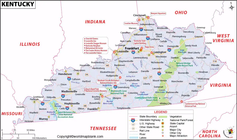
This also shows other details, like the location of the state capital city, Frankfort, other major cities and populated places, lakes and rivers, principal and interstate highways, and railroads. The land area occupied by The Commonwealth of Kentucky is equivalent to 104,659 square kilometers or 40,409 square miles. Kentucky’s area when compared to that of Iceland is found to be slightly larger, but smaller than that of Guatemala. The major rivers that flow in the state of Kentucky are the Green River, the Licking River, the Kentucky River, the Cumberland River, and the Tennessee River. Kentucky state has a population of 4.46 million people.
Printable Map of Kentucky Labeled
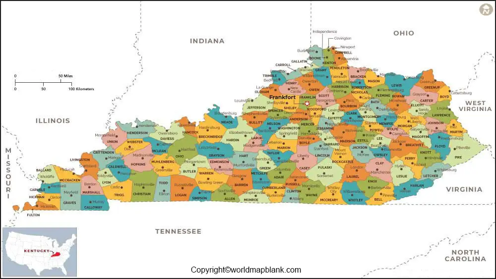
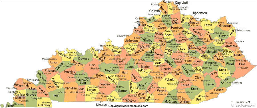
As a part of the labeled map of Kentucky with states, there are 120 counties. The names that start with the letter ‘E’ are Edmonson County, Elliott County and Estill County. Another county named, McCreary County is located in the Daniel Boone National Forest, in southern Kentucky along the Tennessee state border. This is the poorest county in Kentucky and in the US, wherein the earnings of most of the households are found to be less than $20,000 a year. Some of the other names of counties in Kentucky, include Jefferson County, Fayette County, Kenton County and the Boone County.
Labeled Kentucky Map with Cities
As a part of the labeled map of Kentucky with cities, the map shows the location of all the cities and towns in the state. The names of the major cities, include Paducah, Hopkinsville, Covington, Bowling Green, Lexington and Louisville. Kentucky[E]’s capital city is known as Frankfort.
Labeled Kentucky Map with Capital

Through labeled Kentucky[E] with capital, the user can find that Frankfort is the capital city of Kentucky. Since 1792, Frankfort has been the state capital and the seat of Franklin county. This city is situated at a distance of about fifty miles or eighty kilometers east of the city, Louisville. It is also situated at a distance of twenty-six miles or forty-two kilometers northwest of the city, Lexington. It is a popular trading center for products, like automotive parts, bourbon whiskey, candy, furniture and other electronic goods.
Related Posts


