Labeled Map of Missouri with Capital & Cities
Labeled Map of Missouri shows the location of Missouri state, in the US. In the Midwestern region in the US, this landlocked state is situated. It is located on the borders of the Bible Belt. The state has its name from the Missouri River. This river in turn got its name from Missouria, which is a Native American tribe. The official nickname of this state is, ‘The Show-Me State,’ and has its border from a total of eight different states in the US.
Labeled Map of Missouri
In the north, the bordering state is Iowa. In the east and across the Mississippi River, Missouri has border with Illinois. Similarly, in the southeast, Missouri has a border with Kentucky, in the south, with Arkansas and Tennessee. In the west, it has borders with Kansas and Oklahoma, and in the northwest, this state has borders with Nebraska and across the Missouri River. From the general map of Missouri, it is possible to understand the details of boundaries, the location of the state capital city known as, Jefferson City, populated places and major cities, lakes and rivers, principal highways and interstate highways, and important railroads. A small portion of Missouri Territory was admitted to the Union as Missouri.
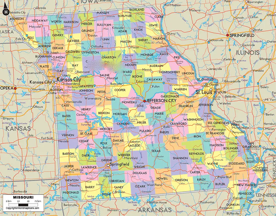
It was declared as the twenty-fourth state in the US on 2ndMarch 1821. The land area covered by this state is 180,540 square kilometers. When compared, this area of Missouri is equivalent to about fifty percent of the area of Germany or about twenty-five percent of the area of Texas state. The population of Missouri is 6.1 million people.
Labeled Map of Missouri Printable
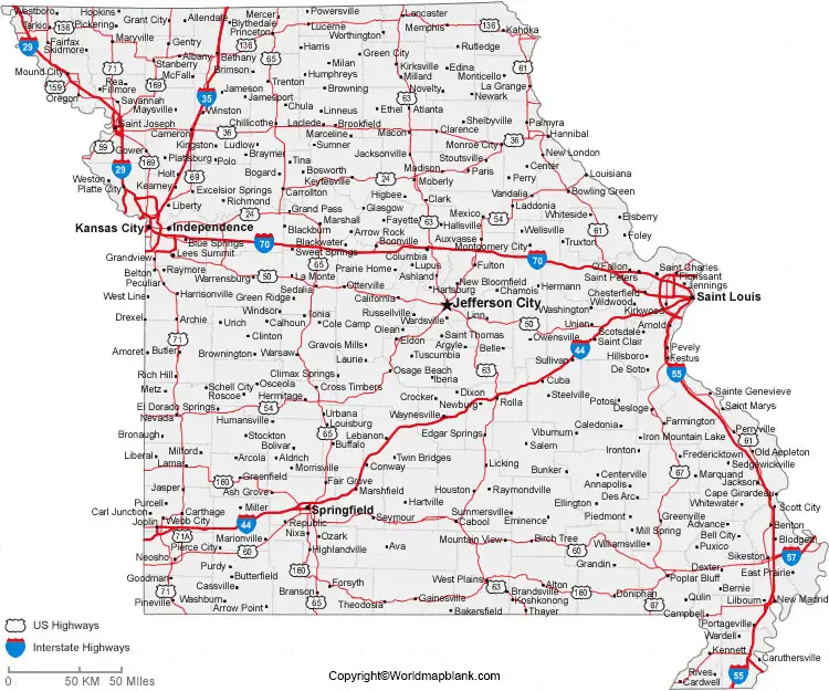
The ten long rivers in Missouri, include Missouri River, Mississippi River, White River, Des Moines River, St. Francis River, Black River, Gasconade River, Osage River, Meramec River, and Chariton River. The largest airports of Missouri state are Kansas City International Airport and Lambert-St. Louis International Airport. Different religions followed in this state are Protestants, Baptists, Methodists, Presbyterians, Catholics, Jewish, and Muslim.
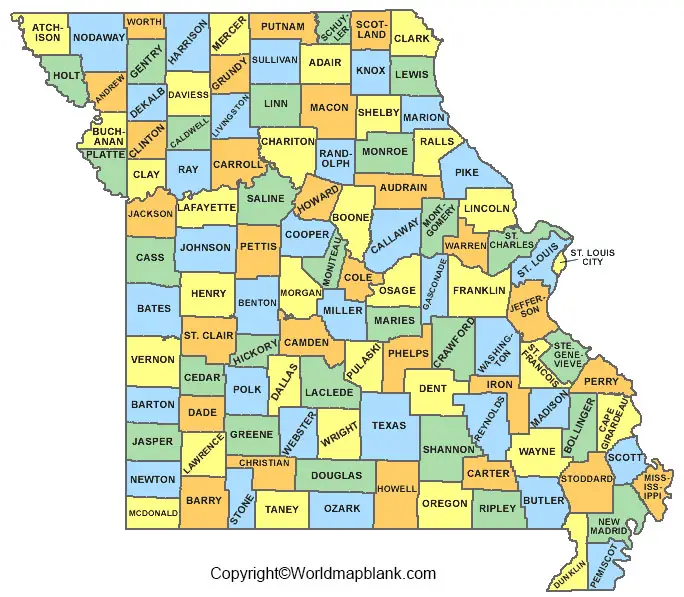
As a part of the labeled map of Missouri with states, the state is divided into 114 counties and one independent city. Worth County is the smallest county in the state and is situated in the northwestern region of Missouri. It occupies the smallest total area. Shannon County is considered as one of the poorest counties in Missouri. The richest county of Missouri state is known as, Charles County.
Labeled Map of Missouri with Cities
As a part of the labeled map of Missouri with cities, the large cities of the state, include the Kansas City that has a population of 467,000 inhabitants. Other cities, include St. Louis with a population of 318,000, Springfield with a population of 164,000, Independence with a population of 117,000, and Columbia with a total population of 115,000.
Labeled Missouri Map with Capital
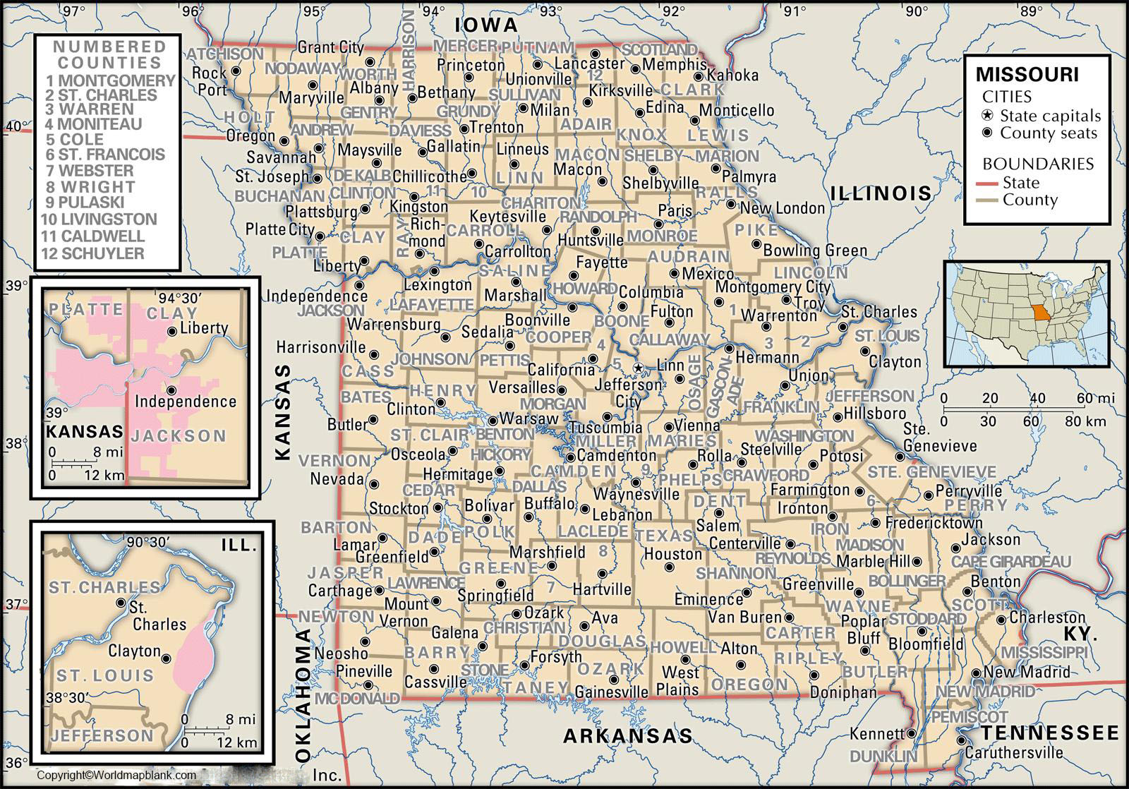
From the labeled Missouri with capital, the state’s capital city is known as, Jefferson City. This city houses the buildings of the legislative and executive branches of the government of Missouri, and also a history museum of importance.
Related Posts


