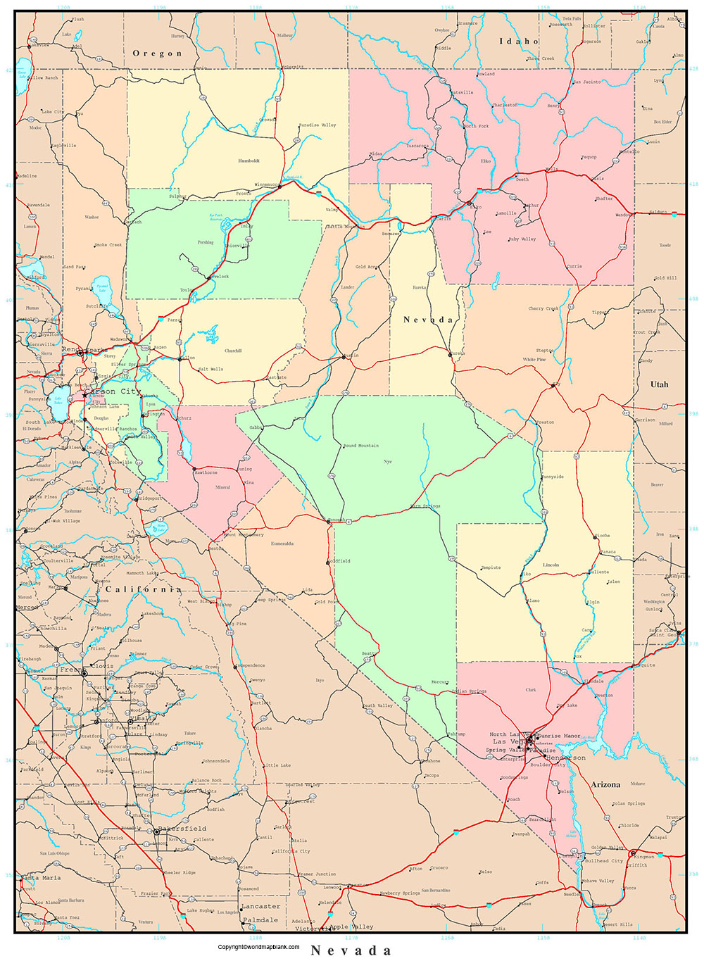
Labeled Map of Nevada with Capital & Cities
Labeled Map of Nevada is a unique document that depicts all the essential details of Nevada state, based in the US. Accordingly, Nevada is recognized as landlocked state situated in the western region in the US. It has borders with Idaho and Oregon, in the north. On the eastern side, Nevada has borders with Utah, and on the southeastern side, with Arizona. Similarly, in the west and southwest, this state has borders with California.
Labeled Map of Nevada
Nevada was first explored by the Spanish Europeans. It is because of the snow-covered mountains, the Spanish people named it Nevada, meaning snowy. Nevada was admitted to the Union as the 36th US state, on the 31st of October in 1864. While referring to the general Nevada Labeled Map, it is possible to gain access to the boundaries of Nevada state surrounding it. Other details, such as location of the state capital, Carson City, populated places and major cities, lakes and rivers, principal and interstate highways and railroads, can be visualized and obtained from the map.
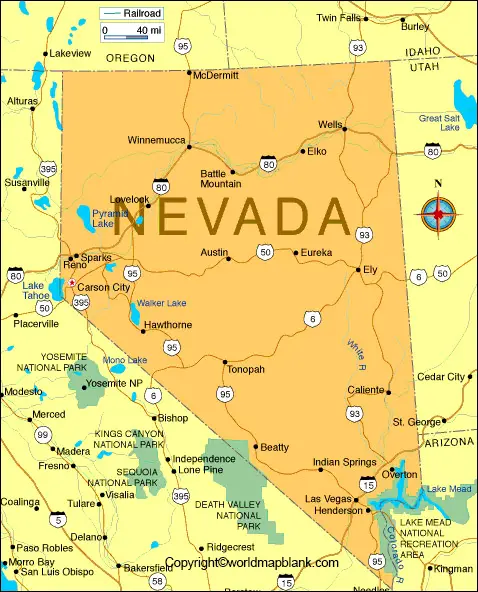
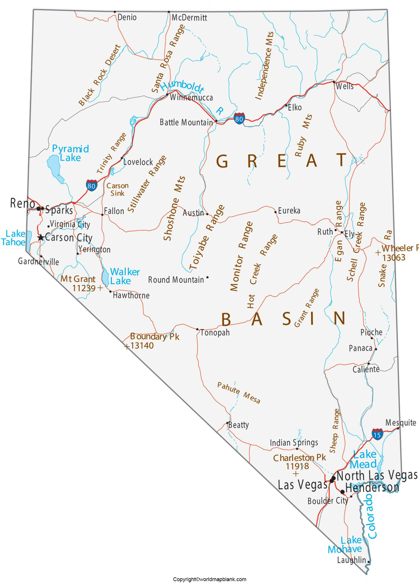
The land area covered by the Nevada state is 286,380 square kilometers. When compared with the other US states, Nevada’s area is equivalent to approximately two times the size of the New York state. The estimated population of Nevada in 2019 was recorded as 3 million people. In Nevada, the largest airport is McCarran International Airport located in Paradise, Las Vegas. Other airports, include Reno or Tahoe International Airport and a Municipal Airport in the Boulder City of Nevada. Important rivers that flow in Nevada, include the Humboldt River, Colorado River, and Truckee River. Religions followed include Christianity, Buddhism, and Hinduism.
Printable Map of Nevada Labeled
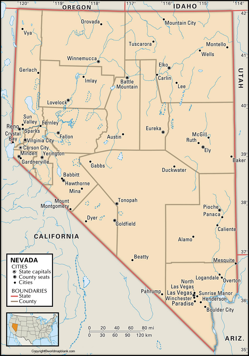
As a part of the labeled map of Nevada with states, there are sixteen counties and one independent city. Nye County is the largest county in Nevada state. The independent city in the state is Carson City, and is considered as the official consolidated municipality. Esmeralda County is another most populous county in Nevada. This county does not have any incorporated communities.
Labeled Map of Nevada with Cities
With reference to the labeled map of Nevada with cities, some of the large cities with a population more than 90,000 inhabitants, are Sparks with a population of 91,000 people, North Las Vegas with a population of 219,000, Reno with a population of 249,000, Henderson with a population of 310,000 and Las Vegas with a population of 644,000 people.
Labeled Nevada Map with Capital
As a part of the labeled Nevada with capital, Carson City is an independent city and the capital of Nevada state, in the US. It is officially recognized as the Consolidated Municipality. Its name was derived from the mountain man known as Kit Carson. This city has the State Government Office complex building of Nevada. It has other important buildings, like the Supreme Court of Nevada and Nevada Legislature. Nevada State Museum and State Railroad Museum are some of the major attractions of the city. The museum displays the railroad heritage of Nevada.
Related Posts


