Labeled Map of Oregon with Capital & Cities
The Labeled Map of Oregon helps the user to gather information about Oregon state, situated in the US. From the labeled map of Oregon, the user can find out the details of well-defined boundaries surrounding it, the state capital city, Salem and its location, populated places and major cities, lakes and rivers, principal and interstate highways, and important railroads. Out of all the fifty recognized US states, Oregon is situated in the north-western United States. With a coastline at the Pacific Ocean, it is one among the three adjoining states, in the US.
Labeled Map of Oregon
The state’s border is largely defined by the River Columbia with Washington in the north. In the east, the Snake River forms a portion of its state line with Idaho. In the south, the forty-second north defines the state’s borders with Nevada and California. The nickname of this state is, ‘The Beaver State,’ and has a land area of 98,379 square miles or 254,800 square kilometers. When compared, the area of Oregon is found to be slightly larger than that of the United Kingdom.
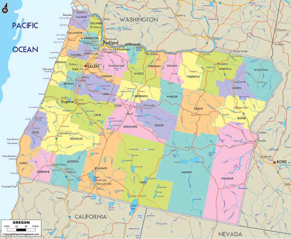
When compared with the area of other states in the US, the area of New Jersey might fit into the area of Oregon eleven times. The estimated population of Oregon was found to be 4.2 million people in 2019. In the Willamette Valley, which is one of the most fertile landscapes of agriculture on the globe, almost seventy percent of population find their living. The rivers that flow in the state, include Columbia River, Grande Ronde river, Wenaha River, Snake River, and Klamath River. The major religious people identified in the state of Oregon are Christians, Protestants, Buddhists and Mormons.
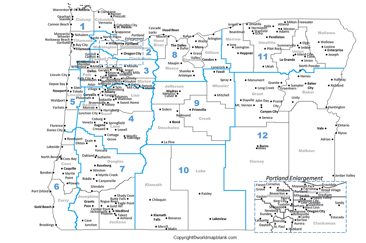
Printable Map of Oregon Labeled
As a part of the labeled map of Oregon with states, there are thirty-six recognized counties in the state.
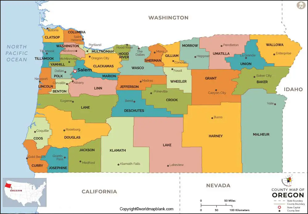
Labeled Map of Oregon with Cities
According to the labeled map of Oregon with cities, the map shows ten large cities in the state. According to the census data of 2018, the names of the cities, include Portland with a population of 653,000, Salem with a population of 173,000, Eugene with a population of 171,000, Gresham with a population of 110,000, Hillsboro with a population of 108,000, Beaverton with a population of 99,000, Bend with a population of 97,600, Medford with a population of 82,000, Springfield with a population of 63,000 and Corvallis with a population of 58,600.
Labeled Oregon Map with Capital
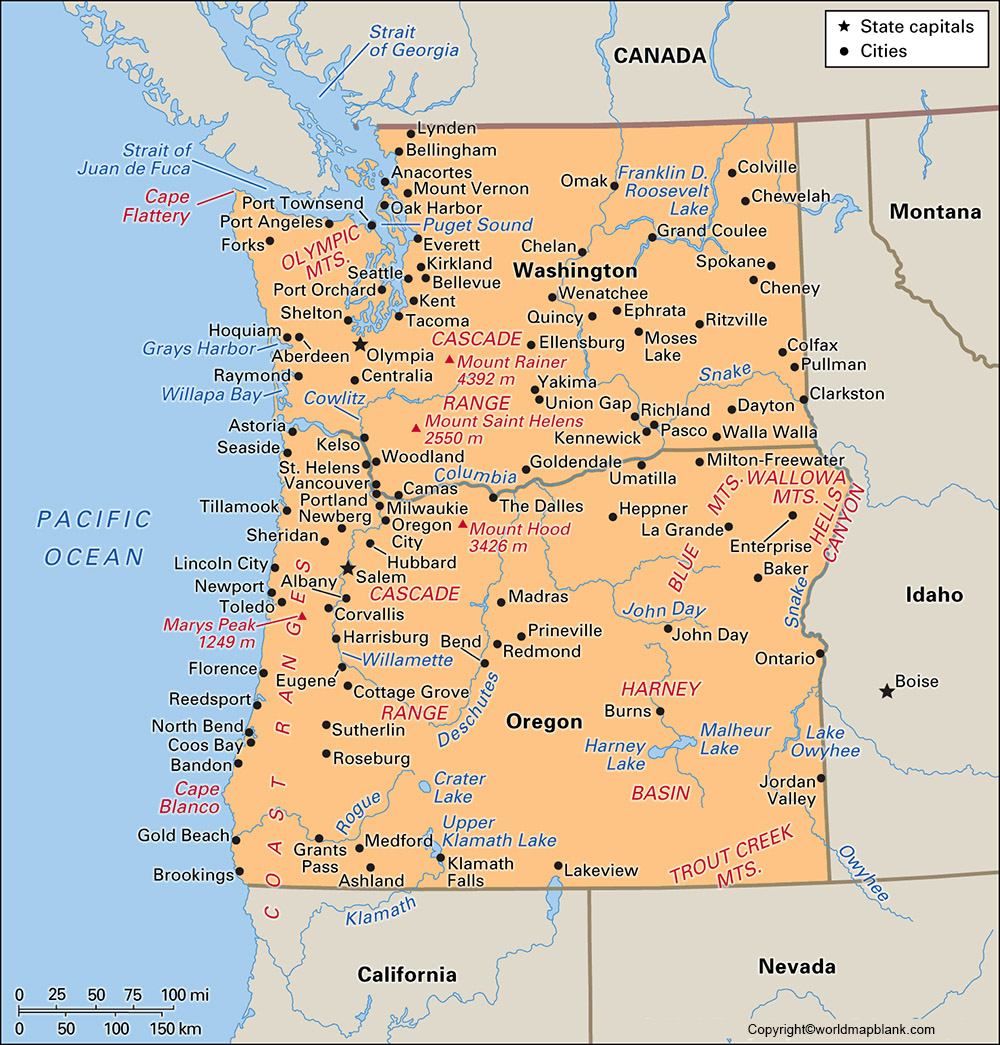
As a part of the labeled Oregon with capital, Salem City is recognized as the state capital of Oregon. The city has the Art Deco building, which houses the state legislature and the offices of the governor of Oregon. This capital city is identified as the seat of Marion county. The city is situated along the Willamette River at a distance of forty-three miles or sixty-nine kilometers southwest of Portland City. The city is famous for food processing industries, like dairy products, and fruits. It has other light manufacturing industries for producing light and wood products.
Related Posts


