Labeled Map of Michigan with Capital & Cities
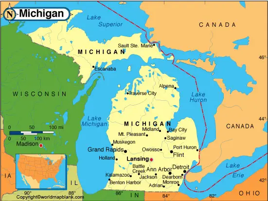
While viewing the Michigan Labeled Map, it is easy to find out the location of Michigan state, in the US. It is one out of the East North Central states, in the US. This state has a French name as well. The French name of Michigan is, Ojibwa, also known as, mishigamaa. This represents the meaning of “large lake” or “large water.” This state has borders with the Canadian province of Ontario and with other US states, like Wisconsin, Indiana, and Ohio. It shares a water boundary with Minnesota and Illinois. The Michigan state has shorelines at four places out of five Great Lakes. These shorelines are at Lake Erie, Lake Huron, Lake Michigan, and Lake Superior.
Labeled Map of Michigan
A detailed labeled map of Michigan shows the boundaries, the location of the state capital, Lansing, populated places and major cities, lakes and rivers, principal highways and interstate highways, and railroads. The area covered by the state is 96,713 square miles or 250,485 square kilometers. This area makes the state slightly larger than that of the UK. However, out of the East North Central states, this state is considered as the largest in area, but in Alaska, it would fit almost seven times.
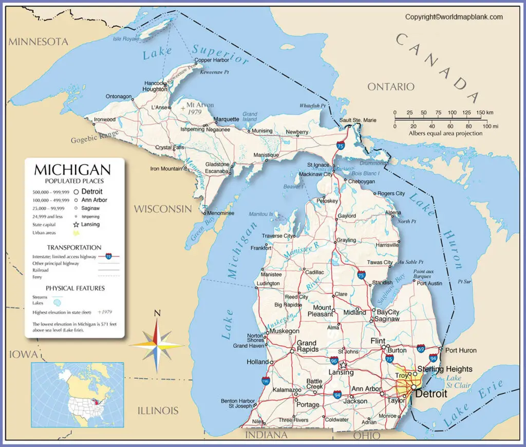
The shape of Michigan can be found to be unusual as it is located on two peninsulas. The nickname of this state is known as, The Wolverine State. It is divided into the Lower and Upper Peninsulas. It is recognized as the tenth most populous state in the US, with a population of 9.98 million people.
Labeled Map of Michigan Printable
Some of the rivers are the Tittabawassee River, St. Joseph River, Shiawassee River, Raisin River, Grand River, and Au Sable River. The majority of residents are Christians with the largest denomination belonging to the Roman Catholic Church. Other religions include Muslims, Conservative and Orthodox Jews, Hindus, and Buddhists.
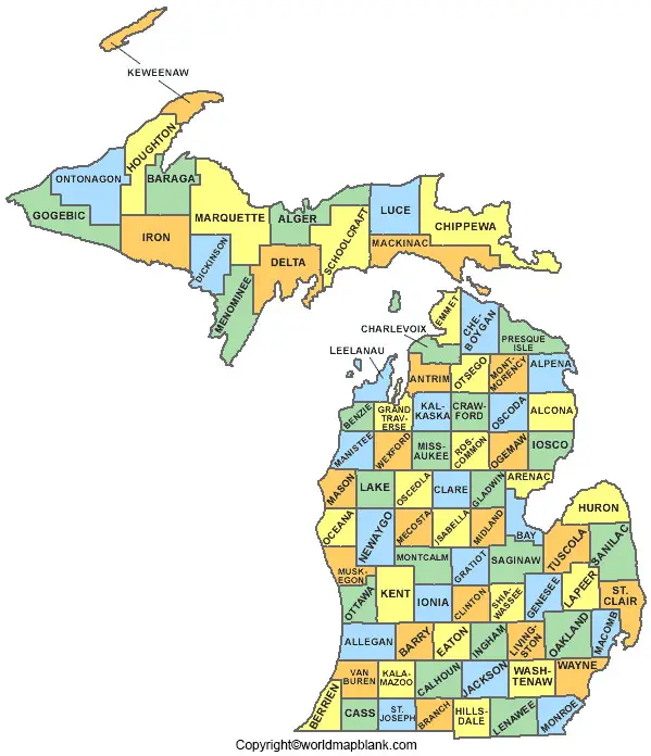
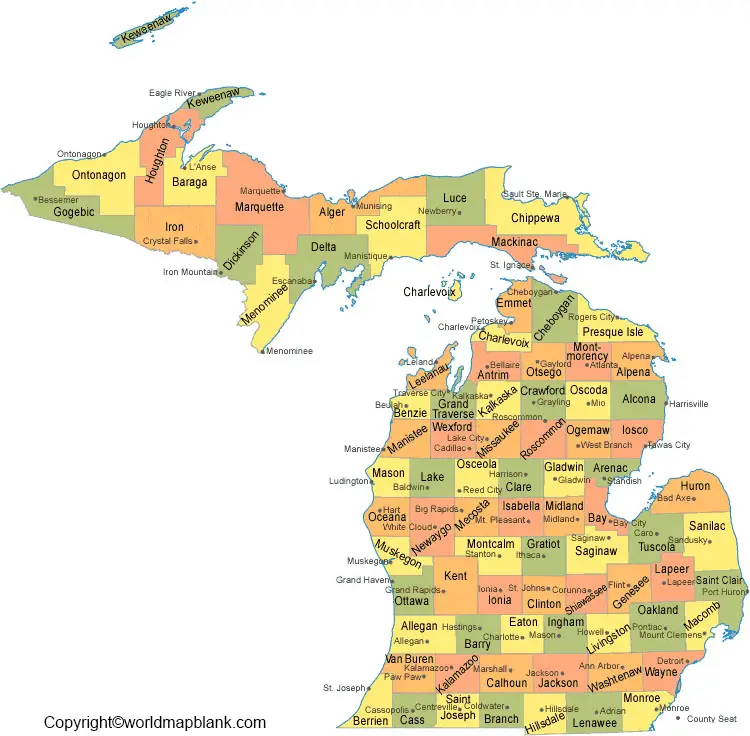
The labeled map of Michigan state comprises 83 counties. The largest county is Marquette County. It is also considered as the most populous county located in the Upper Peninsula of Michigan. The smallest county out of all the 83 counties is Benzie County. However, the poorest county in the state is known as, Lake County. Here, unemployed people are more.
Labeled Michigan Map with Cities
The labeled map of Michigan with cities shows the location of cities in Michigan. Major cities, include Livonia, Dearborn, Flint, Ann Arbor, Lansing, Sterling Heights, Warren, Grand Rapids, and Detroit. Detroit is the largest city in Michigan. Grand Rapids city is the second-largest city in the state of Michigan.
Labeled Michigan Map with Capital
The labeled Michigan map with capital shows that Lansing is the capital city of Michigan state. It is situated in the county of Ingham. This state capital has a ten-acre or four-hectare park, built in the center of the city. The city has a major automobile production center for producing auto parts, metal parts, and textile machinery. There is an established community college known as Lansing Community College.
Related Posts


