Labeled Map of Idaho Capital & Cities
The Idaho Labeled Map shows the location of Idaho state in the US. It is a landlocked state having a mountainous type of land profile in the Northwest Pacific. This state shares a long border extending to a distance of seventy-two kilometers or 44.7 miles with the Canadian province of British Columbia. Its border is well defined with Montana, having ridges along the Bitterroot Range. Further, it may be said that Idaho borders with other US states, like Washington and Oregon in the west, Wyoming in the southeast, Utah, and Nevada in the south.
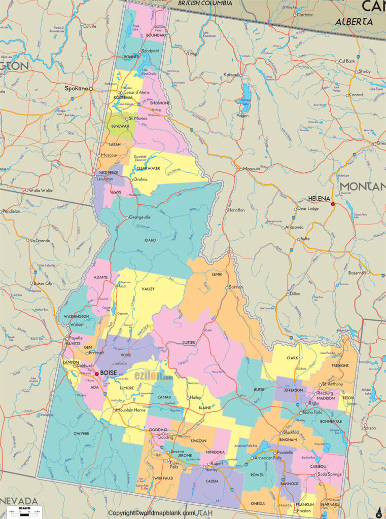
Labeled Map of Idaho
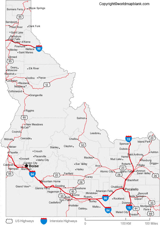
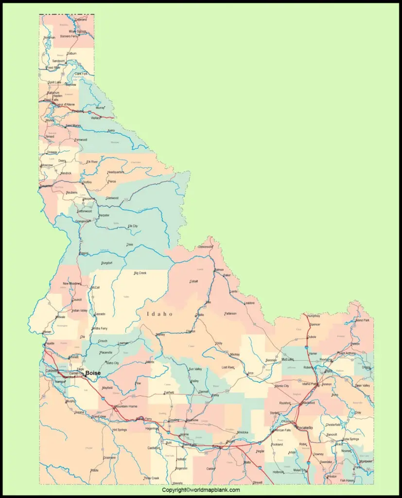
This map of Idaho provides all the details of Idaho with boundaries surrounding it. It also indicates the details of the location of the state capital city, Boise, other major cities and places of population, lakes and rivers, highways, and railroads that connect principal and interstates in the US. The estimated and projected current population of Idaho state in the US is anticipated to reach 1.75 million people for 2020. The names of some of the rivers that flow in the state of Idaho, include Snake River, Bear River, Kootenai River, Salmon River, Owyhee River, Clark Fork, Palouse River, Bruneau River, Big Wood River, and Blackfoot River.
Labeled Map of Idaho Printable
The state of Idaho has a land area of 216,632 square kilometers or 83,570 square miles. The nickname of Idaho state is known as, the ‘Gem State,’ which is somewhat smaller than the island of Great Britain or it is about half the size of Iraq. However, Idaho is about the size of Utah but can accommodate into Texas more than three times. The majority of religion observed in the state of Idaho is Christianity.
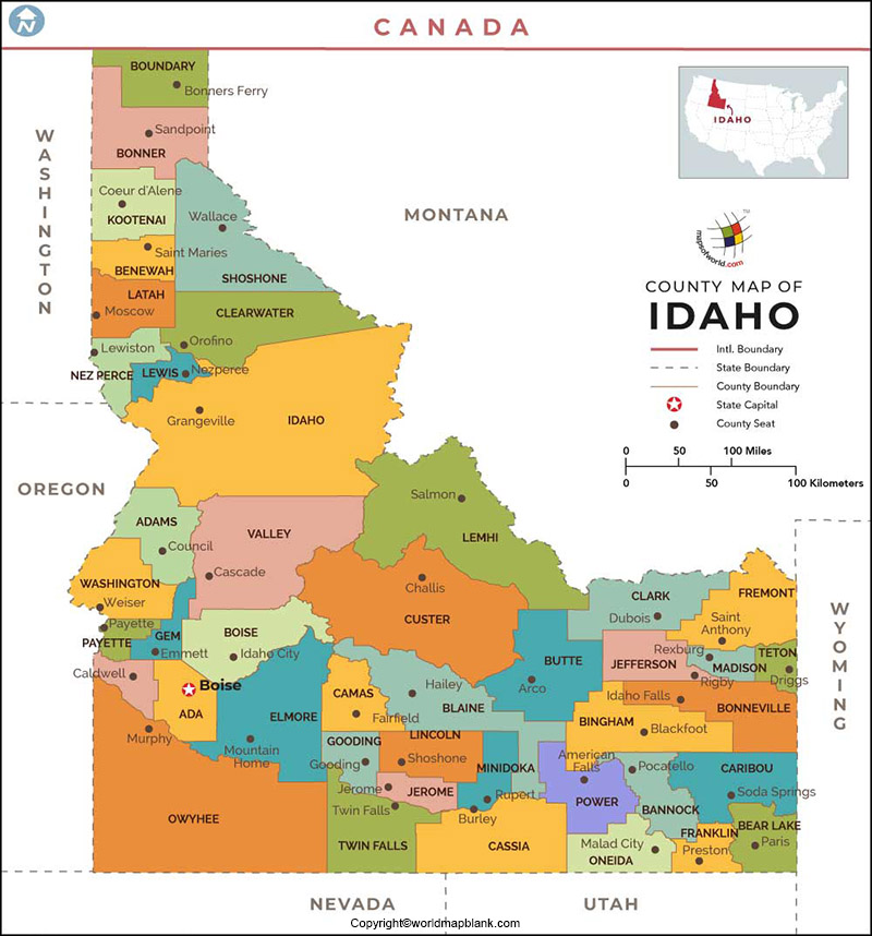
The labeled map of Idaho with states is divided into forty-four counties and comprises 201 incorporated municipalities, which are legally described as cities.
Labeled Map of Idaho with Cities
The labeled map of Idaho with cities shows the location of all the cities and towns in Idaho. The largest city is Boise, with a population of 223,000 people. The names of other cities in Idaho with more than a population of 50,000 people, include Napa, Meridian, Idaho Falls, and Pocatello.
Labeled Idaho Map with Capital
Through labeled Idaho with capital, Boise is the capital as well as the largest city of Idaho, US. The busiest airport in the state is known as, Boise Airport. The city has an art decorative building with Boise Art museum that exhibits contemporary works, and a garden consisting of outdoor sculpture. The State Capital Building of Idaho in the City is constructed out of sandstone. Boise City is the seat of Ada county. The city lies along the River of Boise, which is in the southwestern region of the state.
The weather in the city has mild winter, but the summers are dry. The expansion of agricultural activities has contributed greatly to the growth of this capital city. The city has a lumber industry, including the largest construction companies, which are progressing well
Related Posts


