Labeled Map of Indiana with Capital & Cities
With the help of Labeled Map of Indiana, the user can learn about where Indiana state is located in the US. According to the labeled map of Indiana, the user can find that this state is located in the Great Lakes and Midwestern regions of North America. Indiana is considered as the thirty-eighth largest state by area, in the US. Besides, it is recognized as the seventeenth most populous state out of the fifty states. However, on December 11, 1816, Indiana got admitted to the US as the nineteenth state to the Union. In the east, Indiana borders Ohio.
Labeled Map of Indiana
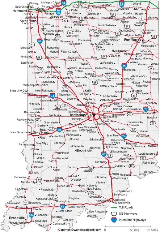
The Wabash River formed the southern section of Indiana’s border with Illinois in the west. In the south, a natural border is created by the Ohio River with Kentucky and Indiana. In the north direction, Indiana shares a state line with the state of Michigan. This state has a short coastline at Lake Michigan, in the northwest. With the assistance of a general map of Indiana, it is possible to ascertain the details of the state with its boundaries surrounding it. The details also include the location of the state capital city, Indianapolis, major cities and populated locations, lakes and rivers, principal as well as instate highways, and railroads.
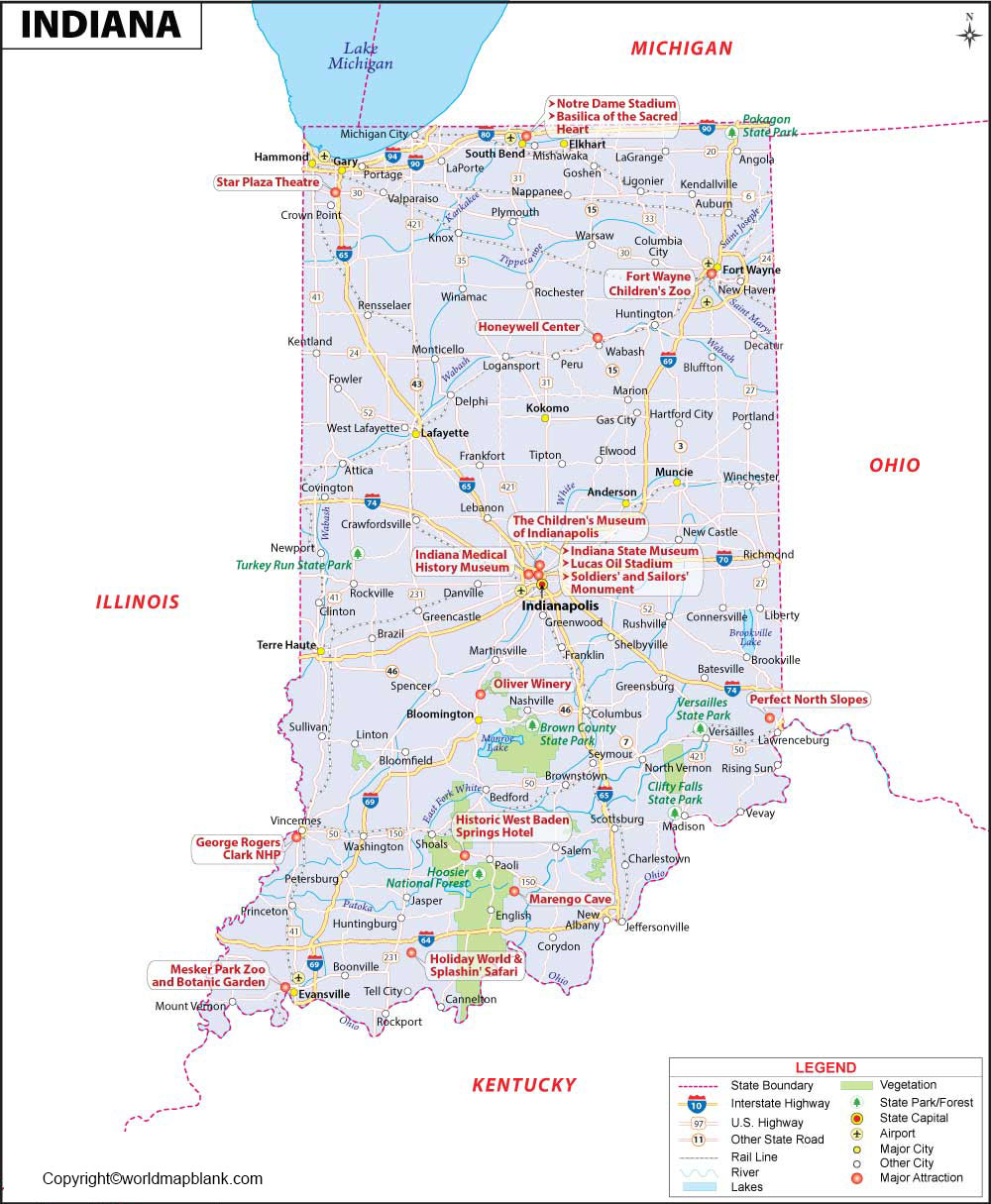
The longest river that flows in the state is known as, the Wabash River. Other names of rivers, include Embarrass River, Vermilion River, White River, Tippecanoe River, Eel River, Mississinewa River, and Salamonie River. All these rivers drain in the central region of Indiana. This state occupies an area of 94,321 square kilometers or 36,418 square miles. Indiana State has a massive population of 6.73 million people for its size. In Indiana, the names of the top five religious groups, include Historically Black Protestants, Mainline Protestants, Roman Catholics, The Unaffiliated, and the Evangelical Protestants.
Labeled Map of Indiana Printable
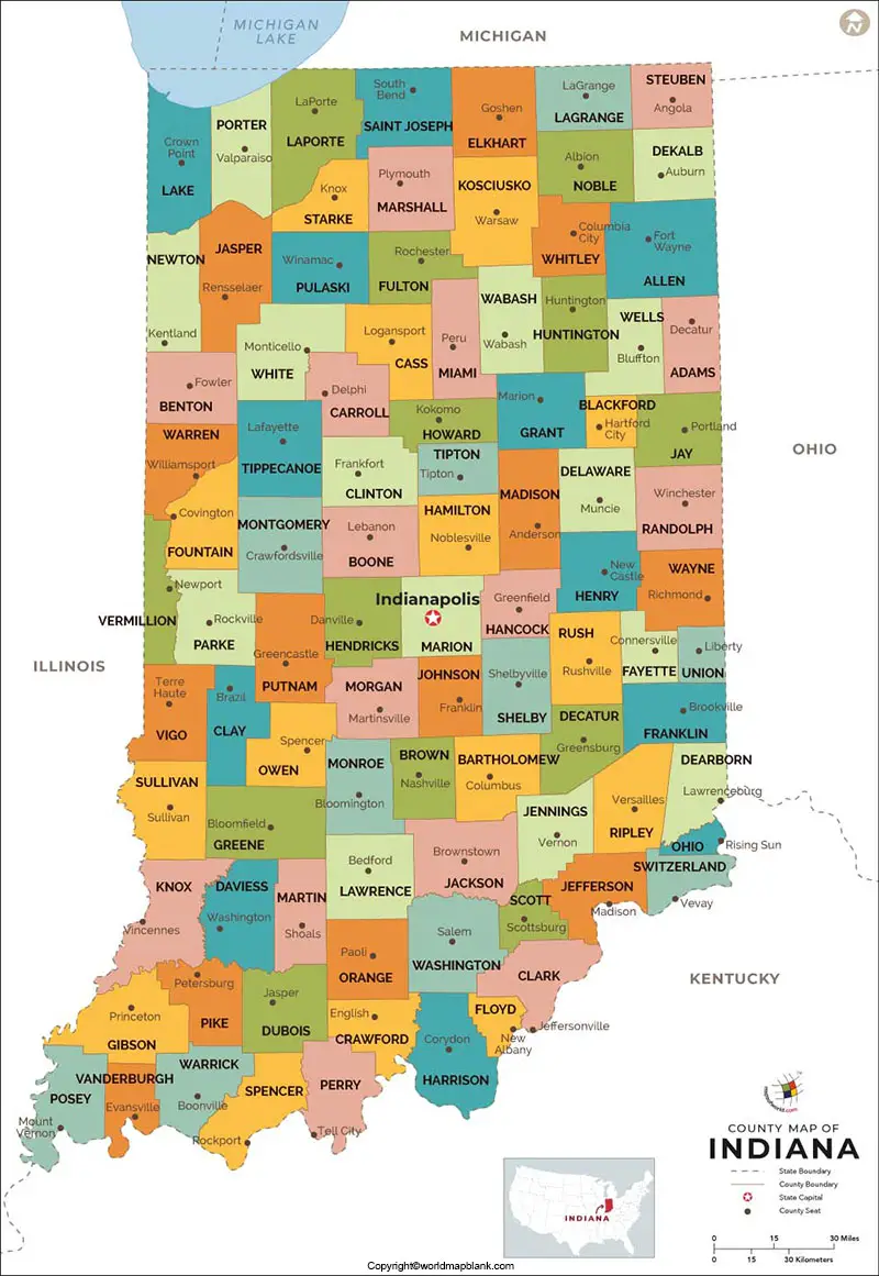
Based on the labeled map of Indiana with states, the state is divided into ninety-two counties. The local government in Indiana comprises 569 city governments, 1006 town governments, and 92 county governments. Besides, there are 737 special districts and 291 independent school districts. All the 569 cities in the state of Indiana are categorized as law cities.
Labeled Indiana Map with Cities
The labeled map of Indiana with cities shows that there are ten large cities in the state. These cities, include Indianapolis, Fort Wayne, Evansville, South Bend, Carmel, Fishers, Bloomington, Hammond, Gary, and Lafayette.
Labeled Indiana Map with Capital

As a part of labeled Indiana with capital, Indianapolis, also known as Indy, is recognized as the state capital city of Indiana. In the state, this city is most populous. Indianapolis is located in Marion County. The city is a hub of air, rail, and road transportation activities. It has Corn Belt, large coalfields, and consumer markets, which make it an important, industrial, financial as well as commercial center. Major products distributed through this city, include chemicals and pharmaceuticals, paper and wood products, electrical equipment including televisions and audio equipment.
Related Posts


