Labeled Map of Nebraska with Capital & Cities
The user of Labeled Map of Nebraska will be able to find all the details about the boundaries surrounding this state, in the US. Besides, the user can find the location of the state capital, Lincoln, populated places and major cities, lakes and rivers, principal highways, major cities, and important railroads. Nebraska is a landlocked state, situated in the central US mainland and to the west of River Mississippi. In the region of Great Plains, Nebraska is one of the states having a broad territory mostly comprising flat land. This land extends from the north to the south in the middle of the US. In the north, Nebraska borders South Dakota. In the south, it borders with Kansas.
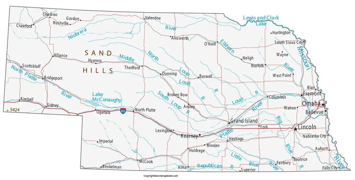
Labeled Map of Nebraska
In the southwest, it borders with Colorado. In the west, with Wyoming. Being a midwestern US state, Nebraska encompasses the prairies of the Great Plains, the dramatic rock formations of the panhandle, and the soaring dunes of Sandhills. The land area occupied by the state is 200,330 square kilometers. This area is about sixty-percent of the size of Italy.
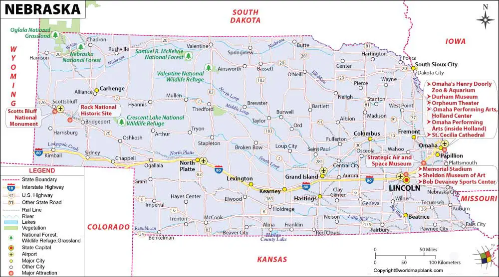
When compared with the other US states, the area of Nebraska would fit into Texas 3.5 times. The major rivers that flow in this state are the Republican River, Platte River, Niobrara River, and Missouri River. The population of Nebraska is just 1.9 million people. Major religions followed, including Roman Catholics, Protestants, Lutherans, Methodists, and Baptists.
Printable Map of Nebraska Labeled
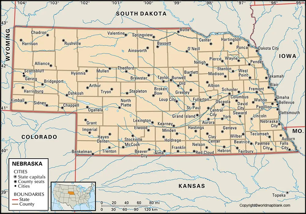
With reference to the labeled map of Nebraska with states, it is divided into ninety-three counties. Out of this, Cherry County is recognized as the largest county in the state, and the land area of this county is 6,000 square miles. This county is situated in the Sandhills of Nebraska. This State is larger than Connecticut state. Arthur County is recognized as the smallest county in the state and has four hundred inhabitants. It is considered as the fifth smallest county in the US, in terms of population.
Labeled Map of Nebraska with Cities
As a part of the labeled map of Nebraska with cities, the names of large cities in the state that have a population of more than 50,000 people, include Grand Island, Bellevue, Lincoln, and Omaha.
Labeled Nebraska Map with Capital
While referring to labeled Nebraska with capital, Lincoln is recognized as the capital as well as the second-largest city of Nebraska. It is the seat of Lancaster County and located in the southeastern region of the state. Lincoln is located about sixty miles or ninety-five kilometers southwest of Omaha city. This state capital has a domed tower with decks for observation. The city’s attraction includes Sunken Gardens, featuring a variety of themes in the garden, lily ponds, and sculptures. Other important places of tourist attractions include the Lincoln Children’s Zoo and Sheldon Museum of Art. This museum is located in the campus of the University of Nebraska. The museum has a notable collection of American art and a garden of sculptures. This University was established in the year 1869.
Related Posts


