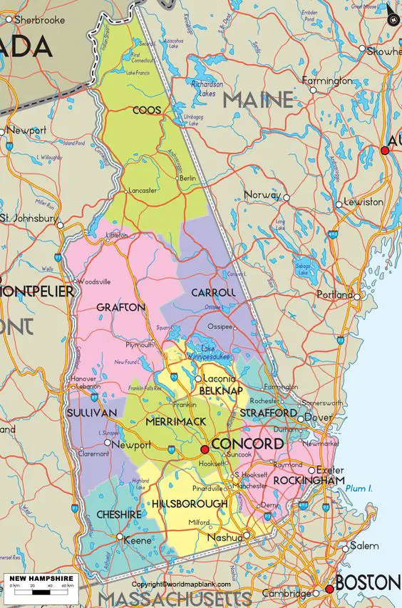
Labeled Map of New Hampshire with Capital & Cities
The advantage of viewing the Labeled Map of New Hampshire is that any user can find out the location of New Hampshire state, in the US. Accordingly, it can be seen that New Hampshire is one of the six states of New England. In the northeastern part of the US, New England is a region.
The New Hampshire state has borders with the Canadian province of Québec in the northwest and north. Similarly, New Hampshire state has borders with the US states of Massachusetts in the south, and Maine in the east. In the west, the state has borders with Vermont through the Connecticut River. New Hampshire has a nickname known as, ‘The Granite State.’
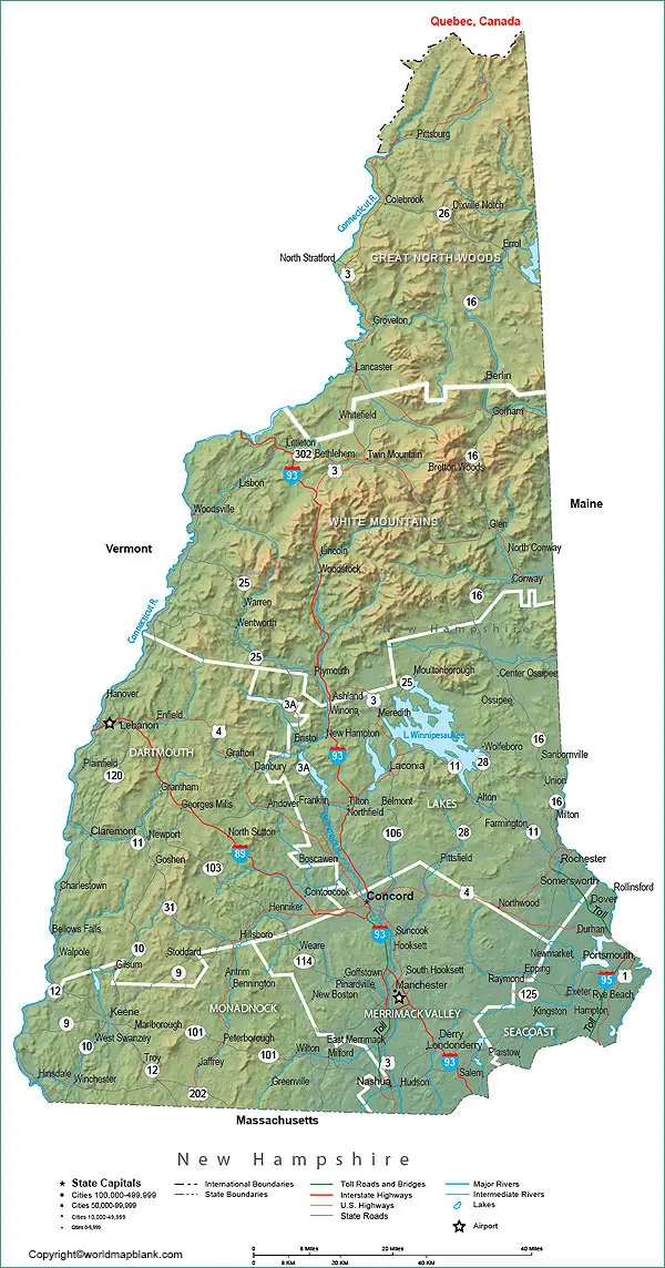
Labeled Map of New Hampshire
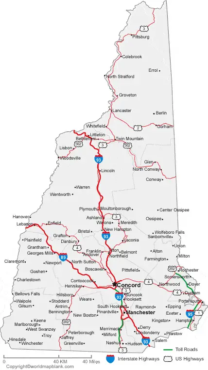
It has a short coastline of twenty-four kilometers or fifteen miles at the Gulf of Maine, which is also known as, the gulf of the Atlantic Ocean. It can be said that from a general labeled map of New Hampshire, it is possible to derive the boundaries of the state surrounding it. The user of the map can locate the state’s capital, Concord, populated places and major cities, lakes and streams, principal and interstate highways and railroads.
The New Hampshire state roughly appears like a right-angled triangle in the map with a land area of 24,214 square kilometers. This area of the state makes it somewhat smaller than that of Belgium. By area, New Hampshire in the US is considered as the fifth smallest state. The estimated population of New Hampshire is 1.35 million people. The state’s main river includes Piscataqua, Ashuolot, Pemigewasset, Souhegan, Androscoggin, Connecticut, Saco, Merrimack, and Salmon Falls. Religions in New Hampshire, include Baptists, Episcopalians, Catholics, Lutherans, Methodists, Pentecostal, Presbyterian, and Judaism.
Printable Map of New Hampshire Labeled
As part of the labeled map of New Hampshire with states, there are ten counties in this state. In 1769, five of the counties were created and later on, all the remaining five counties. It can be seen that there are 234 municipalities in New Hampshire all governed by local government agencies. Some of these municipalities are called as cities, and others are known as towns. Besides, there are 132 special districts and 166 independent school districts.
Labeled Map of New Hampshire with Cities
As a part of the labeled map of New Hampshire with cities, there are six large cities in this state. The names of such cities, include Manchester, Nashua, Concord, Derry, Dover, and Rochester.
Labeled New Hampshire Map with Capital
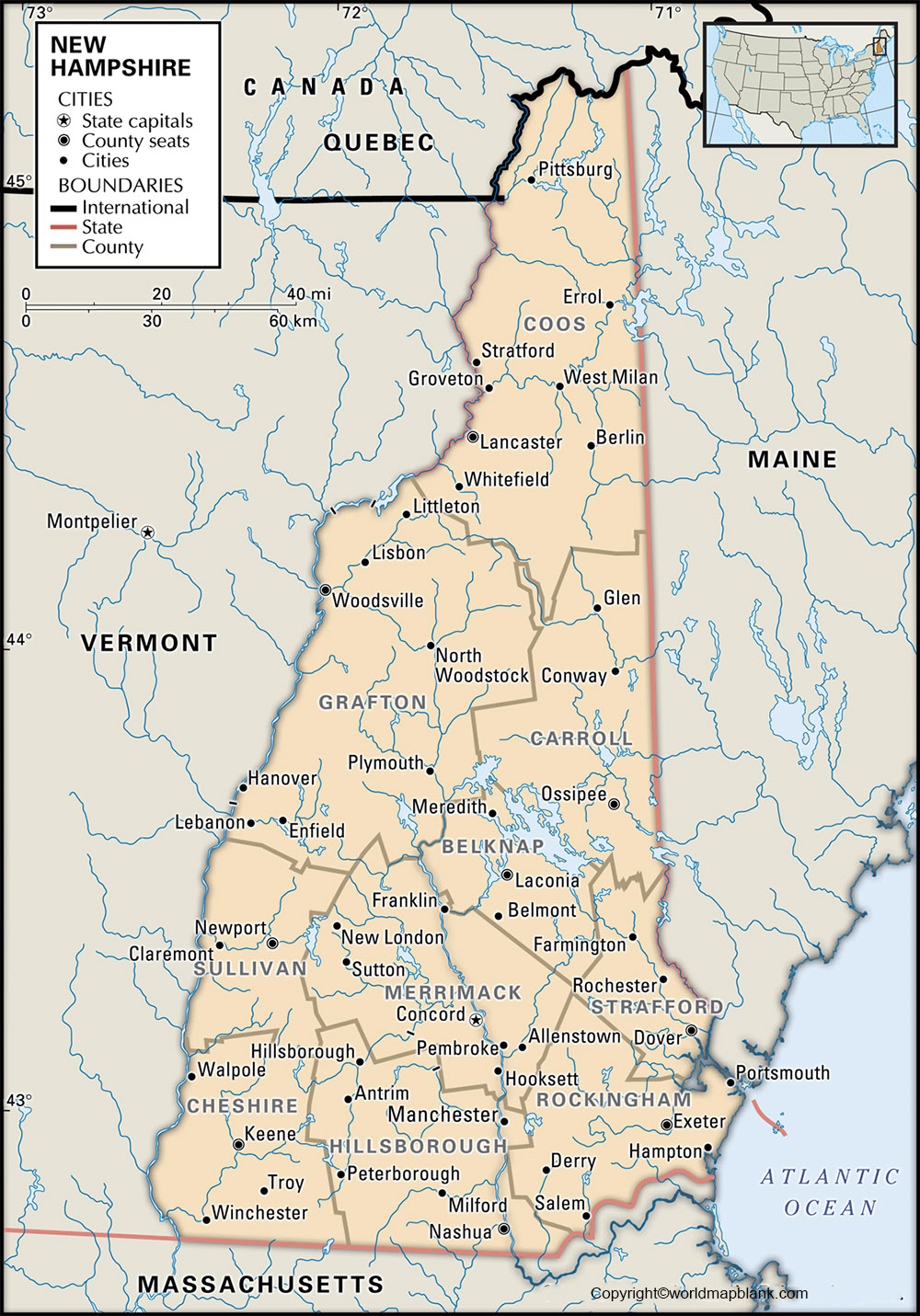
With reference to the labeled New Hampshire with capital, Concord city is recognized as the capital city of New Hampshire. This is the seat of Merrimack county, since the year 1823. The printing industry has contributed greatly to the development of this city including the quarrying of granite. The city is famous for the production of semiconductors and industrial equipment. Other business activities include agriculture and insurance, dairy and food products. The state House and the Library of Congress in Washington D.C., buildings here were constructed out of granite stone supplied from New Hampshire.
Related Posts


