Labeled Map of South Carolina with Capital & Cities
While looking into Labeled Map of South Carolina, any user can find out where South Carolina state is situated, in the US. This state is situated in the southeastern region of the US. In the southeast, South Carolina has borders with the Atlantic Ocean. In the north and northeast, it has borders with North Carolina.
Labeled Map of South Carolina
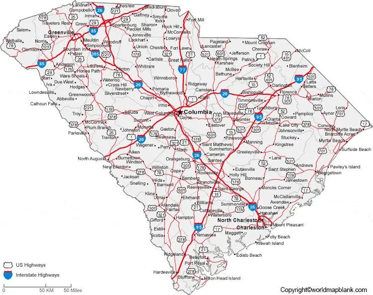
A natural border is formed by the River Savannah, and with Georgia in the west. The nickname of this state is, “The Palmetto State.” From a detailed labeled map of South Carolina, it is possible to understand the location of South Carolina state with the boundaries surrounding it, location of the state capital, populated places, and major cities, lakes, streams and rivers, principal highways, interstate highways, and railroads.
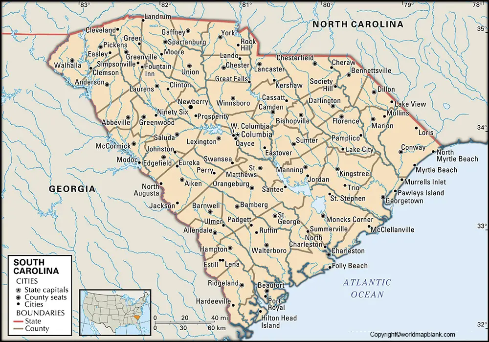
The land area occupied by this state is 32,020 square miles or 82,931 square kilometers. When compared with other US states, the area of South Carolina is almost four times as big as that of New Jersey. The names of major rivers that flow in the state, include the Savannah River, the Tugaloo River, the Chattooga River, Catawba River, Wateree River, the Santee River, the Congaree River and the Black River. In 2018, the estimated population of South Carolina was recorded as five million people. The majority of South Carolinians follow the Christian religion.
Labeled Map of South Carolina Printable
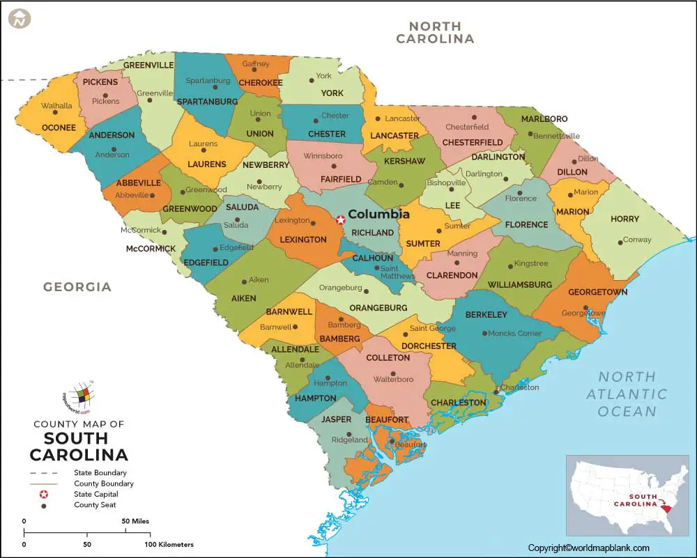
While looking into the map of South Carolina with states, it is subdivided into forty-six counties wherein the population count ranges from 9,958 to 379,616. McCormick County has a population count of 9,958 people whereas the population count of Greenville County is 379,616 people. Counties operate under four types of governments. Six counties operate under the council, four counties under council-supervisor, thirty-four counties operate under council-administrator and two counties under council-manager.
Labeled Map of South Carolina with Cities
As a part of the labeled map of South Carolina with cities, the large cities in South Carolina with a population of more than 40,000 count, include Hilton Head Island, Sumter, Summerville, Greenville, Rock Hill, Mount Pleasant, North Charleston, Charleston and Columbia.
Labeled South Carolina Map with Capital
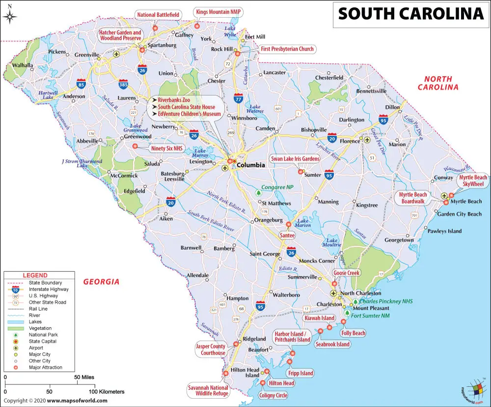
As a part of the labeled South Carolina with capital, Columbia is recognized as the capital city of South Carolina state. The city is considered as the second largest city of South Carolina with a population count of 131,674 people as estimated in 2019. The capital city is the home for the state house of South Carolina known as, Greek Revival Building.
This building is built in the middle of gardens with monuments. There is a huge park known as, Riverbanks Zoo & Garden, which is famous for botanical and animal enclosures. The city has a wholesale distribution center for products, like cotton and tobacco. Peaches are an important crop found in the surrounding area of the city. Other important industries include the manufacture of synthetic fibers, textiles and electrical equipment. There is a museum known as, Robert Mills House, which is a mansion surrounded by a beautiful garden that is located in the city.
Related Posts


