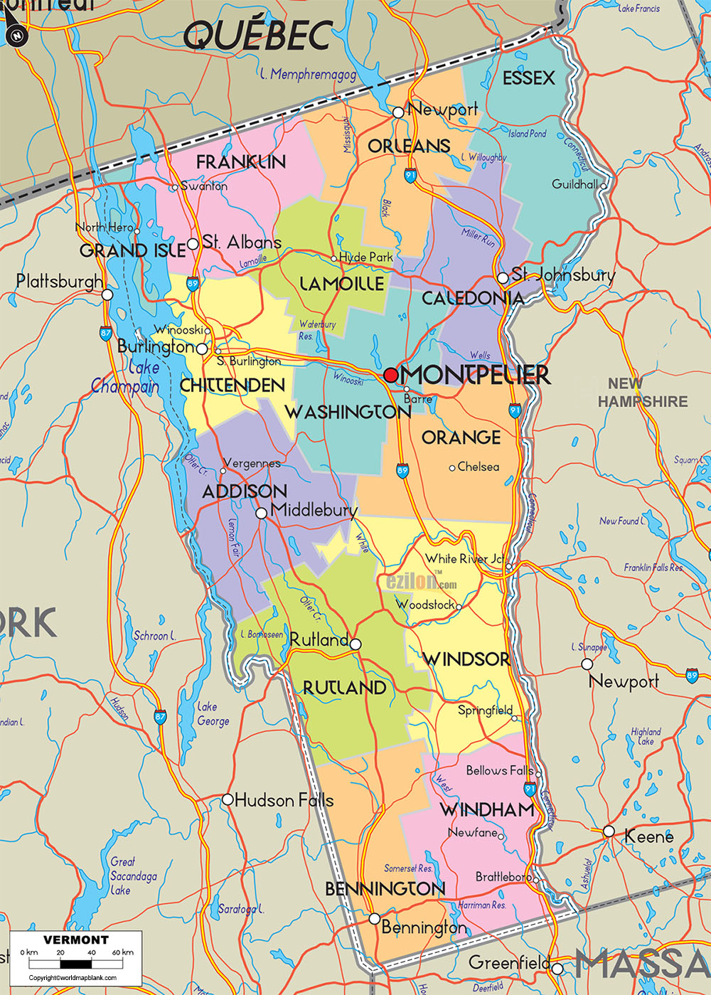
Labeled Map of Vermont with Capital & Cities
By viewing the Labeled Map of Vermont, it is possible to have knowledge about where, in the US, is Vermont located. Vermont is considered as one of the six states situated in the region known as, New England. It has borders with Canada or Québec province, in the north. With New Hampshire in the east, Vermont’s border is defined through the Connecticut River. In the northwest, Vermont is separated by Lake Champlain. Vermont from Massachusetts in the south is separated by a straight line. It was declared as an independent republic on 18th January in 1777.
Labeled Map of Vermont
This state got admitted to the Union as the fourteenth state on 18th February in the year 1791. The detailed labeled map of Vermont reveals the user about the boundaries that surround it, the location of the state capital city, Montpelier, populated places and major cities, lakes and rivers, principal highways, interstate highways, and railroads. The land area occupied in Vermont state is 9,616 square miles or 24,905 square kilometers. This area makes Vermont as the forty-fifth largest state in the US.
When compared, Vermont’s area is considered to be about one-quarter of Iceland or South Korea. Compared with other US states, the area is about the size of New Jersey. The few rivers that flow in the state, include the Connecticut River and the Winooski River. The population count of Vermont is 624,000 people, and is the second least populated state, in the US. Major religion observed is Catholicism.
Labeled Map of Vermont Printable
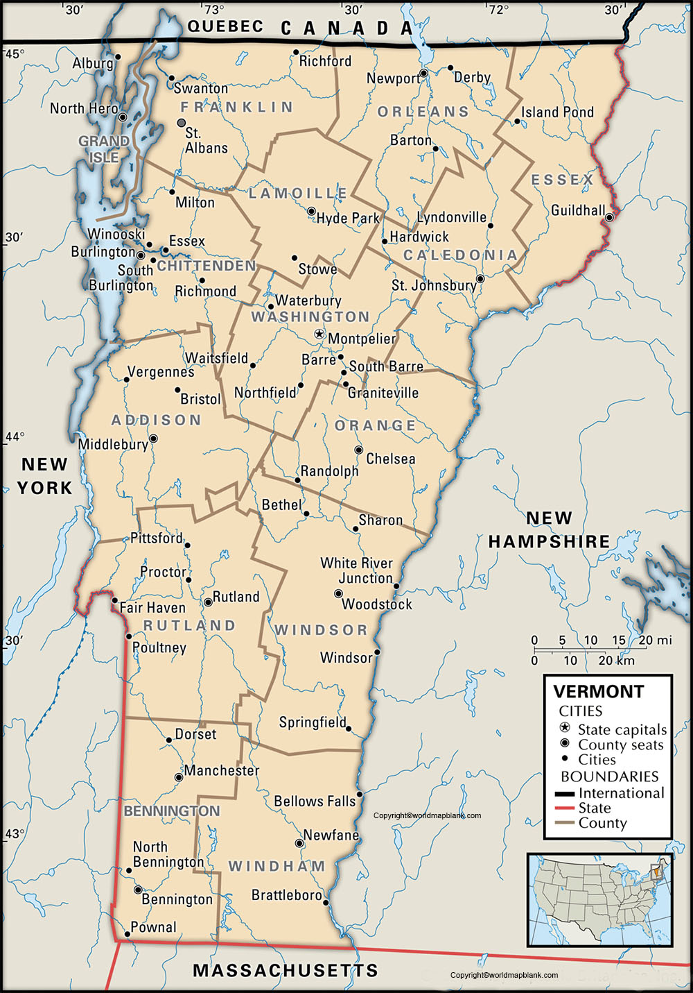
The labeled map of Vermont with states, indicates that Vermont has fourteen counties, nine cities, 237 towns and thirty-six villages.
Labeled Map of Vermont with Cities
As a part of the labeled map of Vermont with cities, the map indicates the location of cities with a population of more than 10,000 inhabitants. They are Hartford with a population of 9,700, Brattleboro with a population of 11,700, Bennington with a population of 15,700, Rutland with a population of 16,000, Colchester with a population of 17,300, Essex with a population of 26,000 and Burlington with a population of 42,500. Population figures are based on the census data of the year 2016.
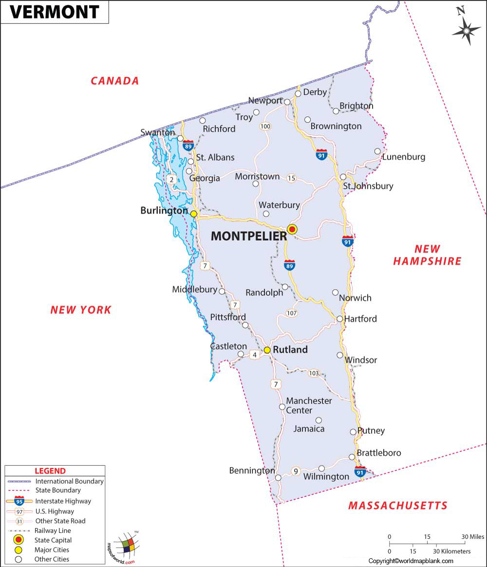
Labeled Vermont Map with Capital
As a part of labeled Vermont with capital, the capital city of Vermont is Montpelier. The Vermont State House is situated in this city, and it has a gold-domed Greek Revival building with fine art and decorative collections. The city has a multimedia and mural exhibit that depicts the history of the state situated in the nearby Vermont History Museum. Other attractions of the city, include a sprawling and wooded Hubbard Park that has meadows, a stone observation tower and a birch grove. There is a theater known as, the lost Notion Theater in which modern type of musicals, classic plays are staged as a part of entertainment to the people of the capital city. Montpelier is situated in Washington County and is considered as one of the best places to live in Vermont.
Related Posts


