Rio Grande River Map | US Map of Rio Grand River
The Rio Grande River Map shows where it originates and where it ends. Moreover, it shows its physical features and significance for various purposes. It is one of the major rivers in the United States. You can also find it on the US river map. It is about 1896 miles long and originates in south-central Colorado in the US. Then it reaches the Gulf of Mexico. It drains about 182,200 square miles. It serves as the water source for seven US states and the Mexican states. It passes through arid as well as semi-arid lands. Here we are presenting a Rio Grande River map.
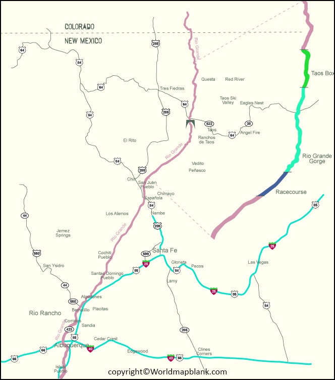
Rio Grande River Map
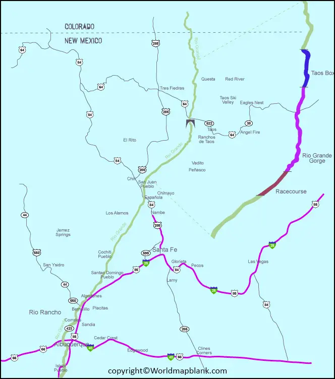
It becomes the Mexico-US border after travelling through New Mexico. Furthermore, it is a partial state boundary between New Mexico and Texas. Due to its enormous consumption of water for irrigating fields, the Gulf of Mexico receives only 20% of its water. This river rises from the Rio Grande National Forest in the western part of the United States in the state of Colorado. Moreover, it joins several streams at the base of Canby Mountain. It passes through the San Luis Valley and New Mexico.
Rio Grande River on US map
It flows through the Rio Grande Gorge near Taos, and then it goes towards Espanola. It plays a significant role in irrigating farmlands in the Middle Rio Grande Valley. The Rio Grande river-border is between 889 miles and 1248 miles long. It shares its water with both the United States and Mexico. The users are more than the water present in the river.
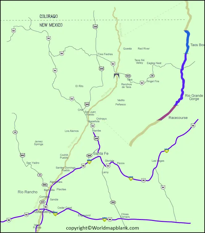
Rio Grande River Texas Map
Rio Conchos is the most extended tributary by discharge and contributes double in comparison to others. It plays a significant role in agriculture and hydropower uses. The San Juan River is about 12,949 square miles long and is the longest river basin in North America. It starts in Coahuila and passes through Nuevo León and into Tamaulipas. Then it finally joins the Rio Grande near Camargo, Tamaulipas. The Rio Alamo is also a tributary of the Rio Grande River and enters at 422 kilometers. Rio Salado, a tributary of the Rio Grande, extends across the northern portions of Coahuila, Nuevo Leon, and Tamaulipas states. Here we are providing the Rio Grande River map.
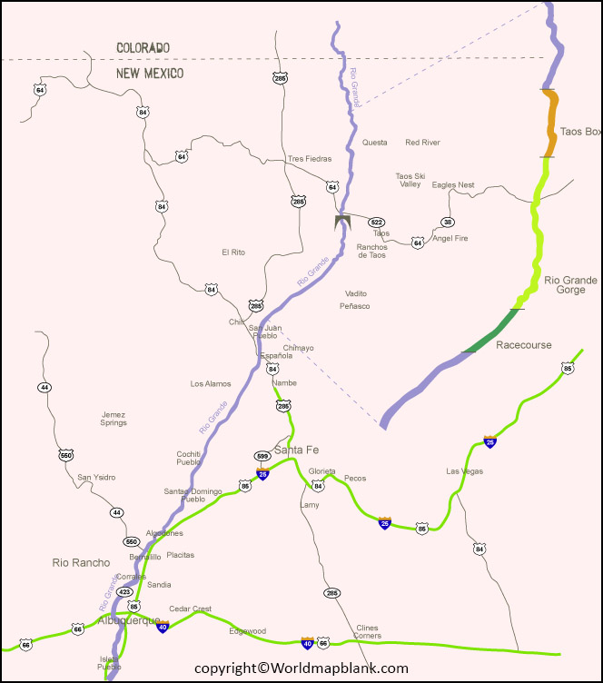
Rio Grande River Map Printable
The Rio San Rodrigo and the Devils River are also their tributaries. The Pecos River flows about 926 miles. Moreover, it has the most extended drainage basin, encompassing about 44,300 square miles. It starts in north-central New Mexico, passes through Texas, and enters the Rio Grande. The Rio Puerco is a tributary of the Rio Grande and is about 230 miles long.
It usually flows to the south to join the Rio Grande River. The Jemez River and the Santa Fe River are also tributaries of the Rio Grande River. Rio Chama is also one of the major tributaries of it. The Conejos River is about 92.5 miles long and is also known as one of the tributaries. The Rio Grande River map is essential for students and researchers. It shows its watershed, tributaries, and other features.
Related Posts