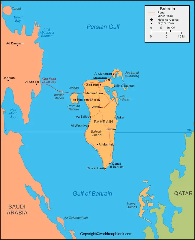
Labeled Map of Bahrain with States, Capital & Cities
From the Labeled Map of Bahrain, it can be seen that Bahrain state consists of two groups of islands. They are separated at a distance of fifty kilometers from north to south and sixteen kilometers, east to west. Officially designated as the Kingdom of Bahrain, it is situated in the Persian Gulf. It is located east of Saudi Arabia and north of Qatar. The main island of Bahrain is, Al Bahrayn, and there are a few smaller islands and islets nearby Bahrain.
Labeled Map of Bahrain
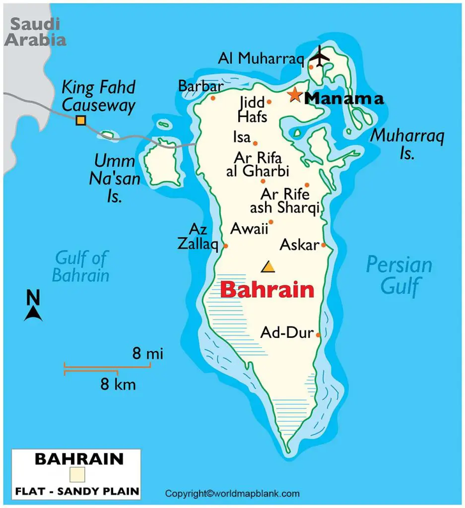
The King Fahd Causeway in Bahrain is famous for bridges and causeways that connect Bahrain with the Arabian Peninsula. The kingdom of Bahrain shares maritime borders with Saudi Arabia, Qatar, and Iran. This island nation covers a land area of 780 square kilometers making it slightly larger than that of Singapore or three and a half times the size of Washington DC, in the US. The population of Bahrain is 1.58 million people in 2021, which includes more than 800,000 non-nationals.
Most of the population of Bahrain live in the northern part of the mainland of Bahrain. The main language spoken is Arabic with mostly Muslim population consisting of about thirty-percent Sunni Muslims and about seventy-percent of Shia’s.
Labeled Map of Bahrain with States
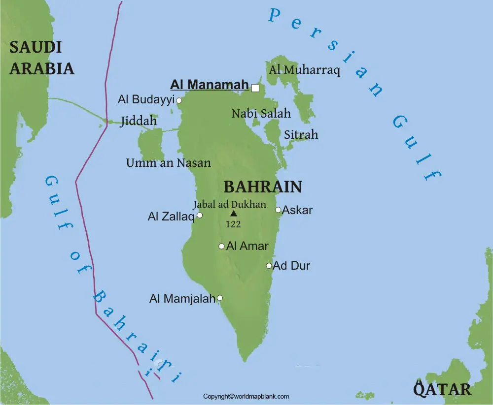
The labeled map of Bahrain with states reveals that it has states and provinces known as, Governorates and has five Governorates. The first Governorate is known as, Capital Governorate, the second is Central Governorate, the third is Muharraq Governorate, the fourth is Northern Governorate and the fifth one is named as Southern Governorate.
Labeled Map of Bahrain with Cities
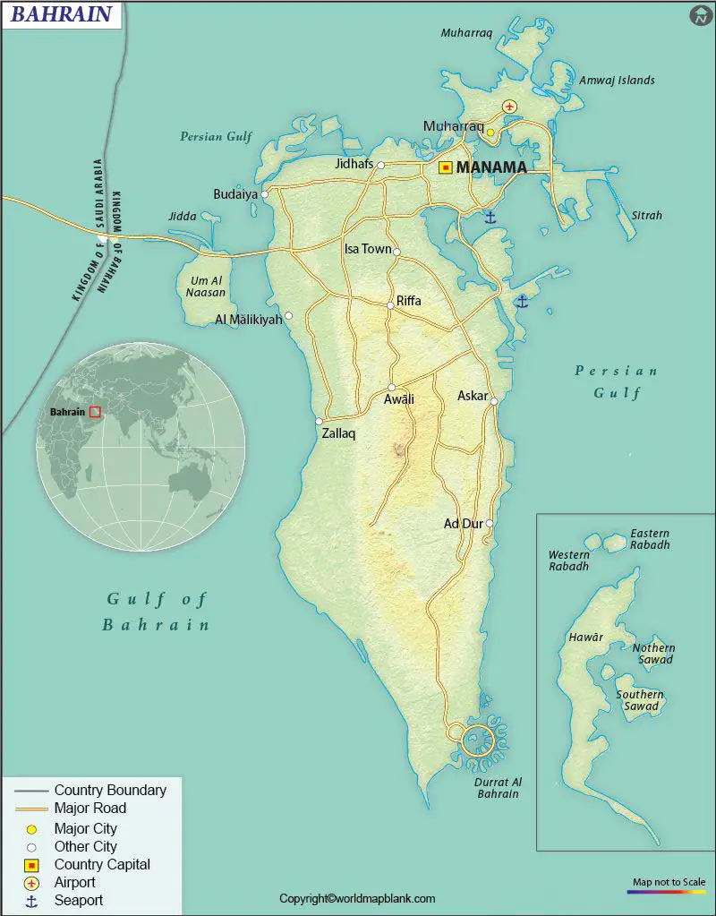
The labeled map of Bahrain with cities includes ten large cities. They are Al-Malikiyah with a population of 14,800, Jidhafs with a population of 32,600, Budaiya with a population 33,230, Sitra with a population of 60,100, Isa Town with a population of 39,800, A’ali with a population of 51,400, Hamad Town with a population of 57,000, Muharraq with a population of 176,583, Riffa with a population of 195,606 and Manama with a population of 200,000.
Labeled Bahrain Map with Capital
The labeled map of Bahrain indicates that Manama is recognized as the capital and the largest city of Bahrain. It is situated at the northeastern tip of the island of Bahrain and in the Persian Gulf. Being an important commercial hub of the northern Persian Gulf, Manama is maintaining a traditional economy-based activities, like the import trade, building of boats, fishing and pearling. As a trade developed center, Manama is the seat of numerous banks.
The Bahrain Petroleum Company is the head quarters of this company and is located in the center of Bahrain Island. This city has storage and refrigeration facilities and equipment for executing operations, like docking and repair of large oceangoing vessels. It is now recognized as one of the most important port of the Persian Gulf. With the discovery of petroleum in Bahrain, there is great revolution in the economic growth of the city, including appearance and construction of many modern buildings.
Related Posts


