
World Map with Oceans and Seas
World Map with Oceans and Seas
✅ Free download – PDF and JPEG, ready to print.
Download a printable world map with oceans and seas for geography teaching, practice worksheets, classroom exercises, homeschooling, presentations, travel planning, and more.
Couldn't load pickup availability
Add multiple maps to the cart to download them all at once.
World Map with Oceans and Seas for Practice, Learning, or Projects
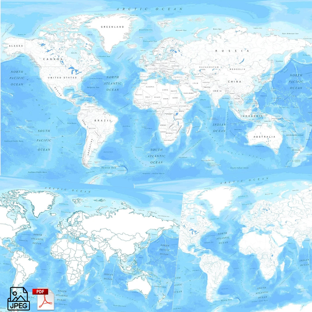
Download your free, printable world map with oceans and seas, or a world map with rivers, as a JPG and a PDF file. You can also explore our digital world maps for download or use a printable blank world map for additional map practice.
World maps are great for classroom activities, geography lessons, worksheets, reports, travel planning, and creative projects.
Whether you're looking for a world map with oceans and seas, a map of all the oceans of the world, a world map with rivers, or a printable world map for labeling and study, this download offers versatile options in clear, high-quality formats.
The below image shows a printable oceans and seas world map that also includes the largest rivers.

We offer several versions of world maps with oceans, seas, and rivers for free download and in high-resolution formats. Additionally, we have other rivers maps like a map of Australia with rivers.
Available Variants
Each file is available in PDF and JPEG formats, with premium options in PNG and high-resolution formats.
- Free Blank World Map with Oceans – A simple outline map showing all major oceans, ideal for geography lessons, labeling exercises, or classroom worksheets
- Free World Map with Oceans, Seas, and Countries – Includes country borders plus major oceans and seas for political and geographic reference
- Free World Map with Oceans, Seas, and Rivers – Features major world rivers alongside oceans and seas for comprehensive study
- High-Resolution Premium Versions (PNG and JPG)
- High-Resolution Value Bundle with all 3 Maps (PNG and JPG)
We also offer single high-resolution maps of the world with oceans, as well as a bundle with all three maps in high resolution (4K) for the best printing quality.
World Map Features
- Instant download after purchase
- Clear labeling of major oceans and seas
- High-quality artwork suitable for print or digital use
- Educational and versatile for schools, reports, travel planning, and design projects
- Multiple styles available to match your lesson, presentation, or creative needs
About Oceans, Seas, and Rivers
Earth's oceans cover more than 70% of the planet's surface and are traditionally divided into five major basins: the Pacific, Atlantic, Indian, Southern, and Arctic Oceans. These vast bodies of water shape global climate, support marine ecosystems, and serve as essential trade and migration routes.
Seas, such as the Mediterranean Sea, Caribbean Sea, Bering Sea, South China Sea, and Red Sea, are minor subdivisions of the oceans and are often partially enclosed by land. They influence regional weather patterns, biodiversity, and human settlement.
Major rivers like the Amazon, Nile, Yangtze, and Mississippi connect land to sea, carrying nutrients, shaping landscapes, and supporting civilizations throughout history.
How to Get Your Printable Map
- Add all your preferred map(s) to the cart
- Proceed to checkout
- Download your maps instantly
Who It's For
This world map with oceans and seas is ideal for students, teachers, homeschoolers, and travelers. It works well for geography lessons, classroom worksheets, study projects, and global map practice.
This is a digital product for instant download and cannot be returned.
Download your world map with oceans and seas now and start learning global geography, planning trips, or creating your own projects.


Download your free map
Enter your email and tell us how you'll use the map. Your download starts immediately.