Labeled Map of Bangladesh with States, Capital & Cities
Labeled Map of Bangladesh reveals to the user that it is a South Asian country and known as one of the significant populated countries on the globe. This is owing to the reason of its population density. This country is dominated by the rivers Brahmaputra and Ganges. Besides, plateaus Barind and Madhupur form important geography of Bangladesh.
Major portion of the land area of Bangladesh is very fertile and plain, which makes this country an agricultural domain nation. Bangladesh has borders with the Bay of Bengal in the south, Myammar or Burma in the east, and India in the east, north and west.
Labeled Map of Bangladesh
The land area occupied by Bangladesh is 143,998 square kilometers; when compared, this area appears to be lightly larger than that of Greece or slightly smaller than that of the US state of Iowa. Considering economy and other aspects, Dhaka is recognized as the capital and the largest city of the country. As of Monday, September 13, 2021, the current population of Bangladesh is 166,652,162.
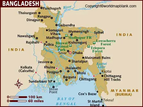
Major portion of the population is dominated by Muslim community and the spoken language is Bangla or Bengali. The labeled map of Bangladesh shows that this country is surrounded by countries with international borders. It has labels showing the national capital, Dhaka, province capitals, major cities, main roads, railroads and major airports.
Labeled Map of Bangladesh with States
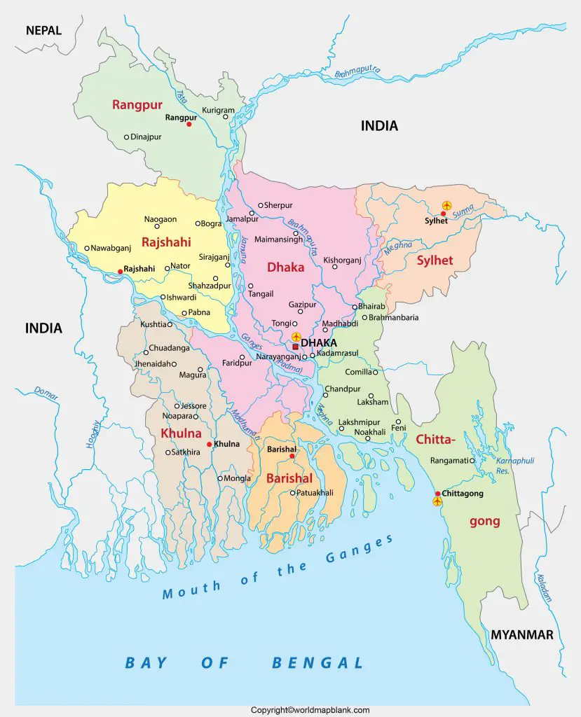
As a part of the labeled map of Bangladesh with states, officially known as, The People’s Republic of Bangladesh, is further categorized into eight administrative divisions. They are Sylhet, Chittagong, Dhaka, Khulna, Barisal, Mymensingh, Rajshahi, and Rangpur. The administrative divisions are further divided into sixty-four districts and a number of smaller subdivisions.
Labeled Map of Bangladesh with Cities
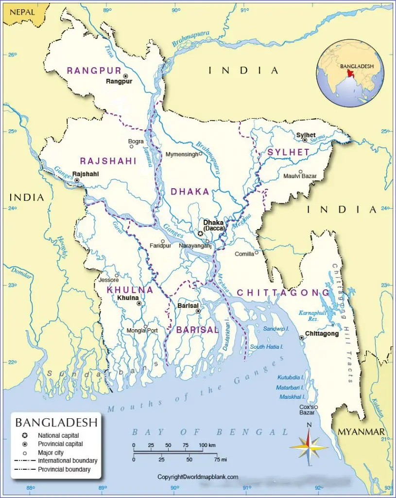
The labeled map of Bangladesh with cities shows that there are eleven major cities governed by twelve city corporations. They include North and South Dhaka, Chittagong, Gazipur, Khulna, Rajshahi, Mymensingh, Sylhet, Comilla, Barisal, Rangpur, and Narayanganj. Among this, Dhaka is considered as the Megacity governed by two city corporations.
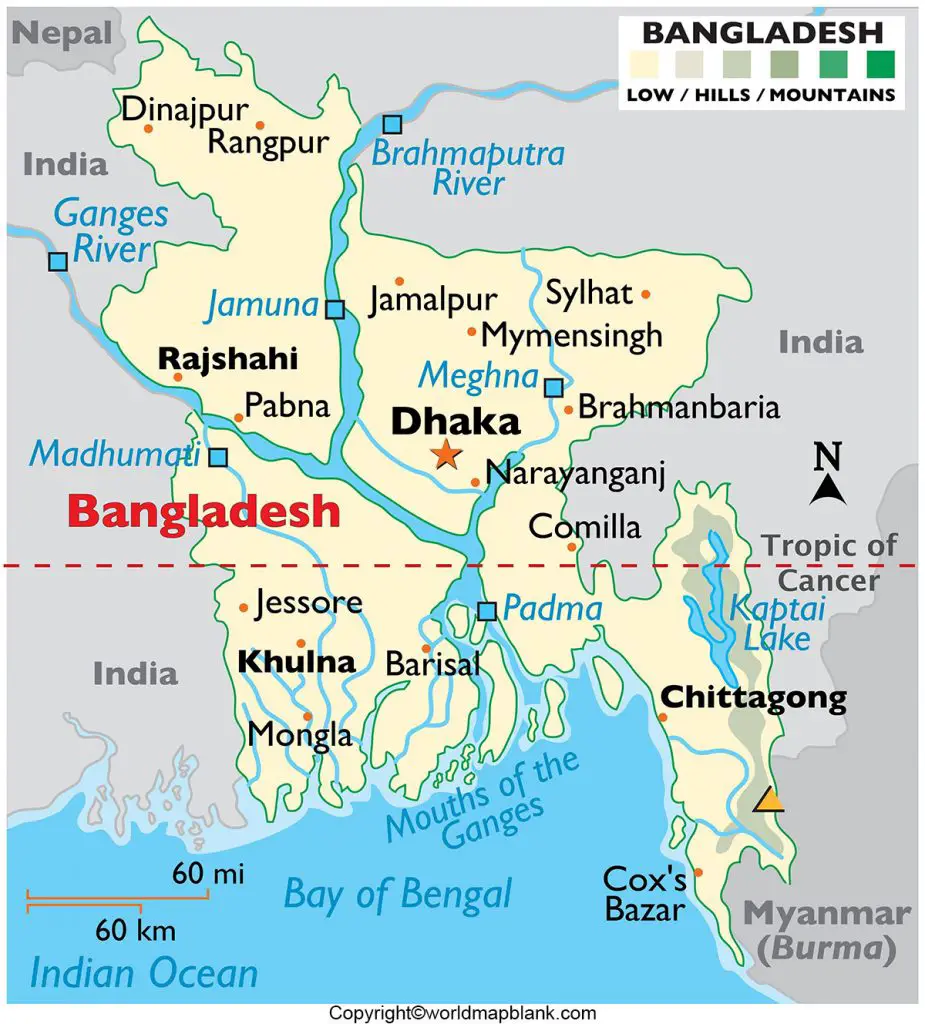
Labeled Bangladesh Map with Capital
According to the labeled Bangladesh Map with capital, it can be seen that Dhaka is recognized as the capital and the largest city in Bangladesh in the central region of the country. The population, area, social and economic diversity of Dhaka have grown tremendously since its establishment as the capital city of the country. Besides, Dhaka is one of the most densely industrialized regions of the country.
It has a river port at Narayanganj, ten miles or sixteen kilometers to the south of Dhaka. Traditional products produced in Dhaka, includes fine quality-muslin, jewelry, silk and embroidery. Major industries of the city include processing of jute and manufacture of chemicals, electronic products, ceramics, leather goods, textiles, and pharmaceuticals. In the late twentieth century, a strong export-oriented garment industry emerged.
Important agriculture crops include rice, oilseeds, sugarcane, and jute. Some cattle farming is also found in the city. The city has several universities, like the University of Dhaka and the Bangladesh University of Engineering and Technology.
Related Posts


