Labeled Map of Benin with States, Capital & Cities
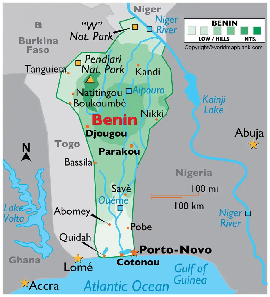
From the Labeled Map of Benin, it can be observed that Benin is a country located in West Africa. In the northern as well as Eastern Hemispheres of the Earth, this country can be seen from the map. It has four bordering nations; Niger and Burkina Faso in the northeast, Togo and Nigeria in the west and east, respectively.
In South Benin, a small stretch of coastline can be identified, which is a portion of the Gulf of Guinea in the Atlantic Ocean. Officially, this country is named as, the Republic of Benin, and formerly it was known under the name, Dahomey. The land area of Benin is 112,622 square kilometers and is slightly larger than that of Bulgaria or slightly smaller than that of the US state of Pennsylvania.
Labeled Map of Benin
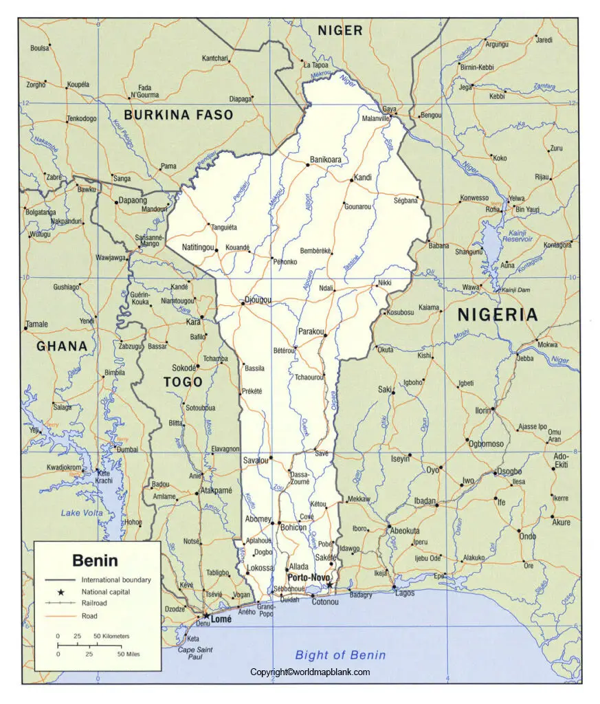
As on Friday of September 17, 2021, the population of Benin is 12,505,413 people. The population of Benin is equivalent to 0.16 percent out of the total global population. Some of the major rivers that flow through Benin, include River Niger, Oueme River, River Mono, and River Volta. In Benin, Christianity is the most widely followed religion with almost half of the population being members of several denominations of Christians. In shaping the country’s cultural and social life, Christian religion has played a vital role.
Labeled Map of Benin with States
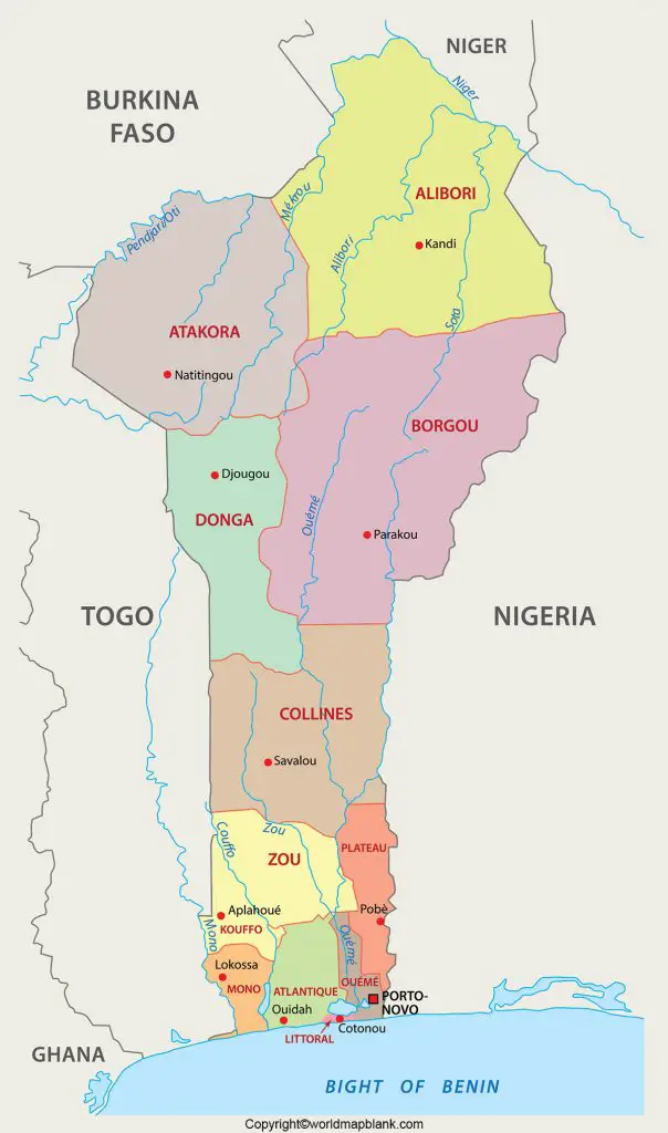
As a part of the labeled map of Benin with states, it can be seen that Benin has twelve departments, which are further classified into about seventy-seven communes. They are further subdivided into areas like arrondissements. The twelve departments include Zou, Plateau, Ouema, Mono, Littoral, Donga, Couffo, Collines, Borgou, Atlantique, Atacora and Alibori. Alibori is recognized as the largest department with an area of 26,242 square kilometers, and the most populous department in the country is Atlantique.
Labeled Map of Benin with Cities
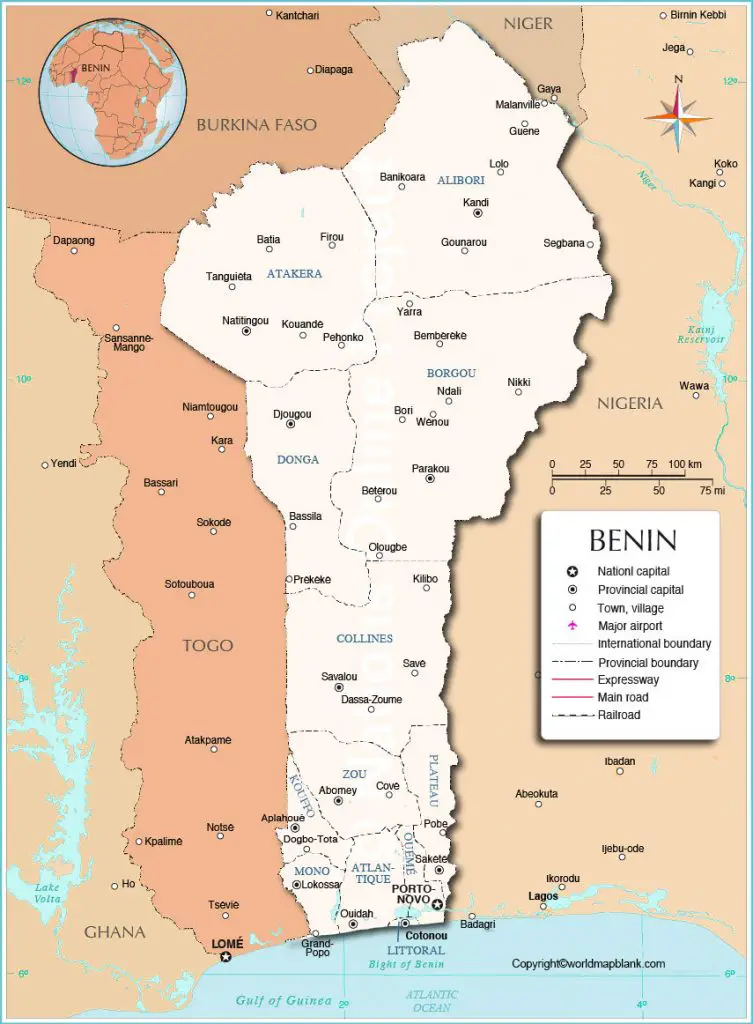
From the labeled map of Benin with cities, it can be observed that Benin consists of ten major cities. They include Cotonou with a population of 818,100, Porto-Novo with a population of 234,300, Parakou with 227,900, Djougou with a population of 206,500, Bohicon with 164,700, Kandi with a population of 149,900, Abomey with a population of 126,800, Natitingou with a population of 119,900, Lokossa with a population of 111,000, and Ouidah with a population of 97,000.
Labeled Benin Map with Capital
The labeled Benin map with Capital, shows that the capital city of Benin is known as Porto-Novo. This city is in the region of Gulf of Guinea in western Africa. In this city the administrative capital of the government of Benin is located. The national archives and the library are established in government buildings. The city is well connected by road and rail to main industrial hub of the country in Cotonou.
It is also well connected through road to Lagos in Nigeria. It is possible to find numerous African artisans and guilds working in the city. A cement factory is located in Porto-Novo and it houses a major bank branch of Benin, called the Banque Internationale du Benin.


