Labeled Map of North Dakota with Capital & Cities
Labeled Map of North Dakota, provides all information about this state, in the US. It is a landlocked state situated in the region of the Great Plains of the north-central US and southern Canada. In the south, the state has borders with South Dakota. In the west, it has borders with Montana, the Canadian provinces, like Saskatchewan, and with Manitoba, in the north.
Labeled Map of North Dakota
The Red River provides a winding shape of the border to North Dakota, and with Minnesota in the east. While referring to the map of North Dakota, one can find out the well-defined boundaries of the state. Besides, the user of this map can locate the position of the state capital, Bismarck, populated places and major cities, principal highways and interstate highways and railroads. The total land area of this state is 70,698 square miles or 183,107 square meters.
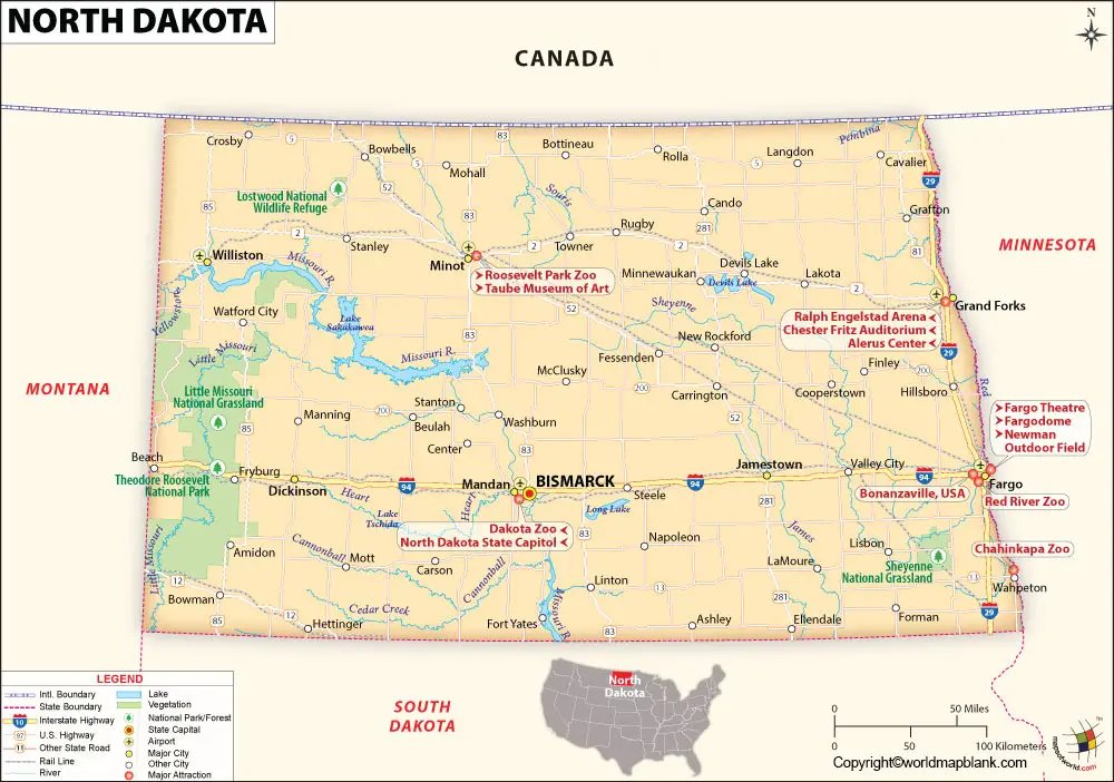
This area is considered to be smaller than half the size of Germany. While comparing the area of North Dakota with that of other US states, it is eight times as big as that of New Jersey. Major rivers that flow in the state, includes the Red River, Sheyenne River, Missouri River, and James River or Dakota River. The estimated population of North Dakota in 2019 is 762,000 people. The largest airport in the state is Fargo’s Hector International Airport. Other airports are Bismarck Municipal Airport as well as Minot International Airport.
Labeled Map of North Dakota Printable
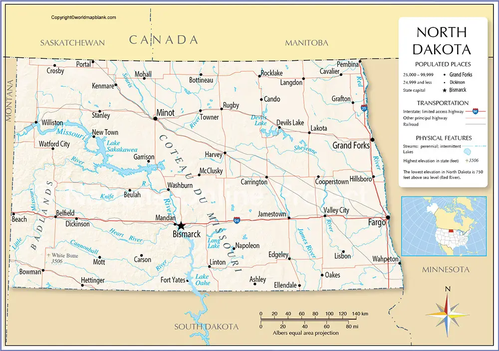
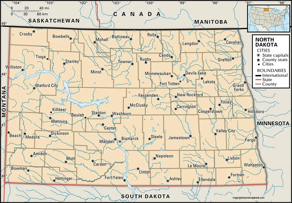
The labeled map of North Dakota with states, shows that it is divided into fifty-three counties. Slope County is a county with a least population count of only 727 people, according to statistics in 2010. This makes the county the smallest populous county in North Dakota. Religion observed, include Christianity, Catholics, Islam and others.
Labeled Map of North Dakota with Cities
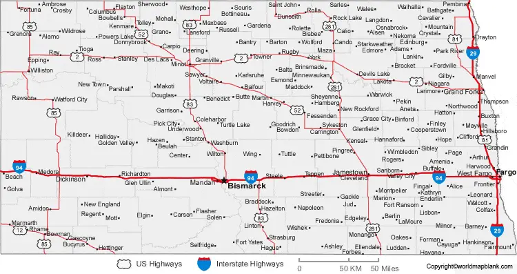
As a part of the labeled map of North Dakota with cities, the names of large cities that have a population of more than 20,000, include Dickinson with a population of 22,700, Williston with a population of 27,000, West Fargo, which is a portion of Fargo–Moorhead Metropolitan Area, has a population of 36,500, Minot with a population of 47,300, Grand Forks with a population of 57,000, Bismarck with a population of 73,000, and Fargo with a population of 124,000. All population figures correspond to the census data of 2018.
Labeled North Dakota Map with Capital
As a part of the labeled North Dakota with capital, the capital city of North Dakota is Bismarck City. It is considered as the seat of Burleigh county from the year 1873. This city is situated in the central region of North Dakota state and located along the eastern bank of the River Missouri. The city’s growth is attributed to factors like business, trade, transportation, and the center for health care. The economic growth of this important city is basically dependent on the production and distribution of oil, gas, and coal, to other places. There is a big oil refinery located at a place called Mandan.
Related Posts


