
🌎 Labeled Political Map of North America
🌎 Labeled Political Map of North America
✅ Free download – PDF and JPEG, ready to print.
Download a printable labeled political map of North America for geography teaching, practice worksheets, classroom exercises, homeschooling, presentations, travel planning, and more.
Couldn't load pickup availability
Add multiple maps to the cart to download them all at once.
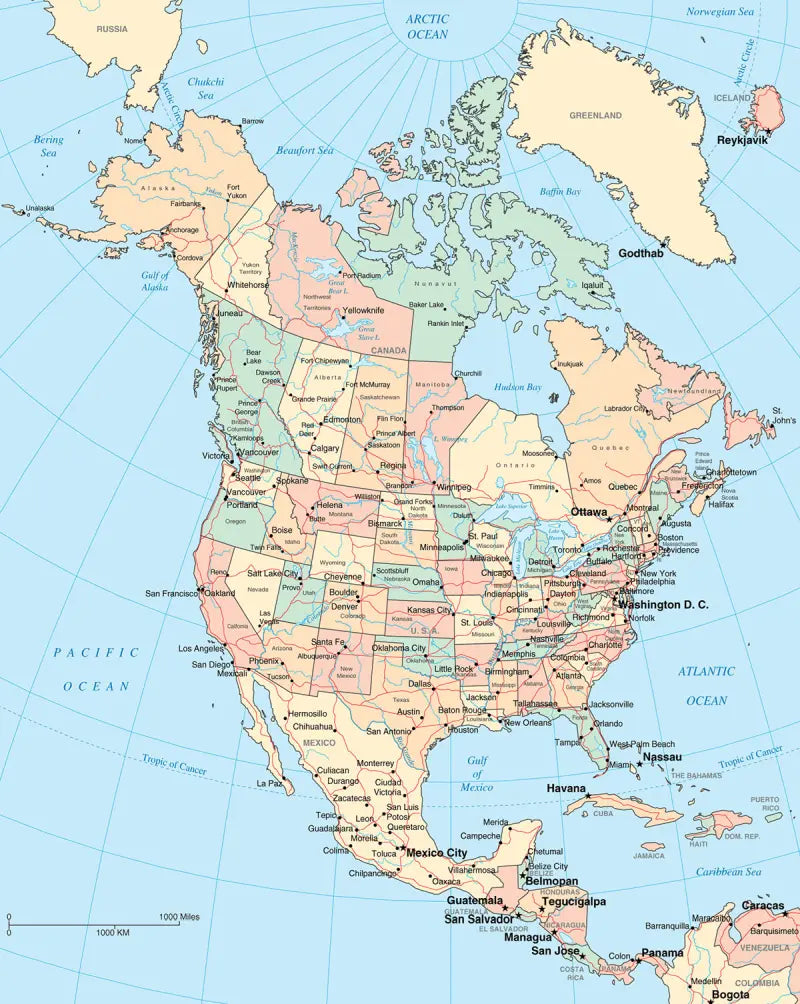
Download your free labeled map of North America, or a printable political map of North America with countries, as a JPG and a PDF!
Choose between the following free maps or download them all:
🗺 Political map of North America with countries
🗺 Labeled map of North America
🗺 North America political map with capitals and cities
The downloads include PDF and JPG versions of the maps.
Our political North America maps include the following countries and capitals:
Antigua and Barbuda (St. John’s), Bahamas (Nassau), Barbados (Bridgetown), Belize (Belmopan), Canada (Ottawa), Costa Rica (San José), Cuba (Havana), Dominica (Roseau), Dominican Republic (Santo Domingo), El Salvador (San Salvador), Guatemala (Guatemala City), Honduras (Tegucigalpa), Jamaica (Kingston), Mexico (Mexico City), Nicaragua (Managua), Panama (Panama City), and the United States (Washington, D.C.).
Complete your maps collection with a blank map of North America or other labeled continent maps.


Download your free map
Enter your email and tell us how you'll use the map. Your download starts immediately.