
🇦🇺 Labeled Political Map of Australia
🇦🇺 Labeled Political Map of Australia
✅ Free download – PDF and JPEG, ready to print.
Download a printable labeled political map of Australia for geography teaching, practice worksheets, classroom exercises, homeschooling, presentations, travel planning, and more.
Couldn't load pickup availability
Add multiple maps to the cart to download them all at once.
Download your free labeled map of Australia with cities or a political map of Australia with states and capitals as a JPEG image and a PDF file!
You can choose from 5 different free maps:
🗺 Labeled map of Australia with states
🗺 Labeled map of Australia with cities
🗺 Australia map labeled
🗺 Political Australia map with states
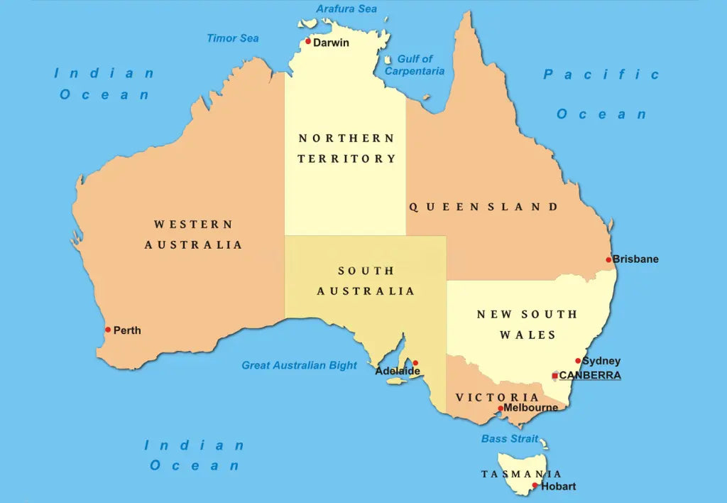
🗺 Political map of Australia with states and territories
All downloads include PDF and JPEG versions of all maps.
The maps with states and territories include borders for:
Australian Capital Territory, New South Wales, Northern Territory, Queensland, South Australia, Tasmania, Victoria, and Western Australia.
The maps with cities include markers for:
Adelaide, Albany, Alice Springs, Augusta, Bairnsdale, Balladonia, Bamaga, Barrow, Barrow Creek, Bathurst, Bendigo, Birdsville, Blackall, Borroloola, Brisbane, Broken Hill, Broome, Bundaberg, Bunbury, Burketown, Cairns, Canberra, Canterbury, Carnarvon, Charleville, Cobar, Collier Bay, Collinsville, Cooktown, Coober Pedy, Cooma, Cunnamulla, Darwin, Denham, Derby, Devonport, Dongara, Dubbo, Emerald, Eneabba, Erldunda, Esperance, Eucla, Exmouth, Fitzroy Crossing, Geelong, Geraldton, Gladstone, Gold Coast, Grafton, Greenvale, Hobart, Innisfail, Israelite Bay, Kalgoorlie, Kalbarri, Karratha, Katherine, Lagrange, Laverton, Lombardina, Longreach, Mackay, Meekatharra, Melbourne, Mildura, Mindil Beach, Mount Gambier, Mount Isa, Mount Magnet, Newcastle, Newman, Normanton, Norseman, Northam, Oodnadatta, Penong, Perth, Port Augusta, Port Hedland, Port Lincoln, Port Macquarie, Port Warrender, Portland, Queenstown, Rawlinna, Rockhampton, Rockingham, St. George, Sydney, Tennant Creek, Townsville, Uluru, Wagga Wagga, Warburton, Weipa, Whyalla, Wiluna, Windorah, Winton, Wittenoom, Wollongong, Wyndham, and Yuendumu.


Download your free map
Enter your email and tell us how you'll use the map. Your download starts immediately.