ODT Maps: Innovative Mapmaking that Challenged Perspectives
This article delves into the unique approach of ODT, Inc. from Amherst, Massachusetts, an enterprise that strived to challenge conventional wisdom and stimulate fresh perspectives on global geography. We invite you to explore the exceptional story of this cartography and geographic education company dedicated to mapping the world and fostering a deeper understanding of our interconnected global community. You can just read on to discover the distinctive aspects that set ODT apart while learning about their maps and products still available today.
The Birth of ODT, Inc.
In the panorama of geography, mapmaking, and education, ODT, Inc. occupied a unique position for nearly half a century. In the bustling 1970s, the seeds for this revolutionary entity were sown by visionary Bob Abramms. His ambition? To challenge norms, stimulate fresh perspectives on global geography, and deepen our understanding of our interconnected world.
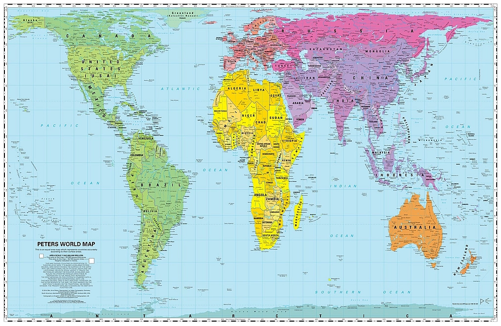
Abramms, initially running a consulting firm focusing on employee empowerment, performance appraisal, and self-directed work teams, brought about a paradigm shift in 1989. ODT, Inc. included the Peters Projection map materials in their corporate culture change, leadership, and diversity diagnostic projects, a transition that signaled their evolution from traditional consultants to trailblazing map publishers. Eventually, ODT primarily operated as a publisher and distributor of products that provided different ways to see the world.
Pioneering Geographic Products
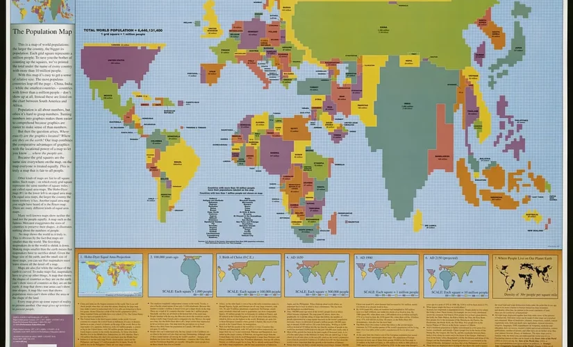
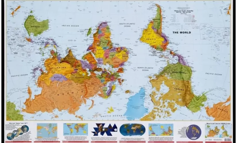
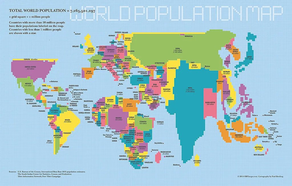
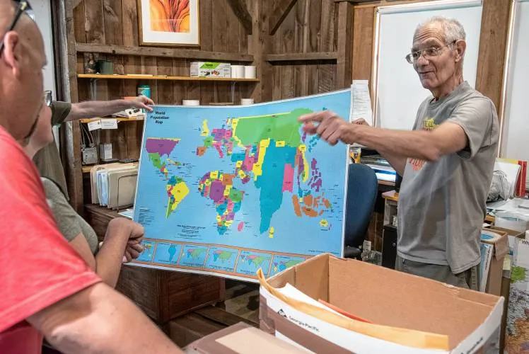
ODT, Inc.’s fame spread far and wide with its distinctive geographical products. From the Peters Projection World Map to the Hobo-Dyer Projection equal area world map, they transformed traditional cartography. Their unconventional “What’s Up? South!” map, presenting an ‘upside-down’ view of the world, boldly challenged classic north-oriented maps, underscoring their commitment to novel perspectives. Their world population map introduced another way of viewing the world by depicting country sizes according to population.
Impactful Publications and Multimedia
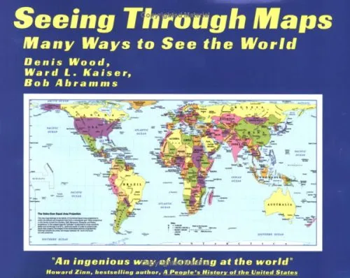 But ODT, Inc.’s innovations didn’t stop at maps. The books they distributed, including their noteworthy “Seeing Through Maps: Many Ways to See the World” and the Arno Peters World Atlas (by Ullmann), opened eyes and minds to new viewpoints. They beautifully encapsulated the company’s mission to broaden geographical understanding and the concept of global interconnectedness.
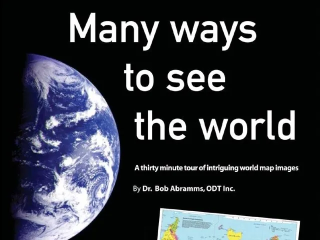
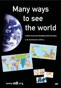 True to their innovative spirit, ODT, Inc. embraced multimedia formats to disseminate their messages. Their educational DVD “Many Ways to See the World” was an inventive endeavor to provide enlightening lessons about map-making and promote different perspectives on global interconnection.
In only 30 minutes, the film explores the minds of extraordinary mapmakers, relates how the South-up map was created, and introduces Arno Peters‘ mission to create a fair map representation for all peoples.
Recognition and Influence
The company’s exceptional work gained national recognition in February 2001 when its Peters Projection map was featured on the renowned TV show West Wing. This marked a significant milestone, solidifying ODT’s reputation as an innovative map publisher. Its groundbreaking contributions, such as the World Population Map, continued to enrich the world of mapping and geography.
A Team Effort
But ODT, Inc. was not just the brainchild of its founder, Bob Abramms. It resulted from a collective effort from a dedicated team including Denis Wood, Ward Kaiser, Ann Hopkins, and Howard Bronstein. United by the shared vision of dismantling geographic stereotypes and teaching the world to view the globe from multiple angles, they helped shape the company’s legacy.
Bob Abramms
After establishing ODT and transitioning his company towards publishing and distributing alternative maps, a significant contribution of Abramms was his role as project director for the Population Map, which he commenced in 2001. Having encountered several cartogram representations, Abramms felt they needed to exploit the potential of maps fully. He collaborated with Fred Pearce in the UK and Bill Yoder in Arizona to accumulate historical population figures and GIS cartograms, which were then incorporated into the Population Map. The map’s design was created in cooperation with Denis Wood, who also worked with Abramms and Ward Kaiser in co-authoring the book “Seeing Through Maps“.
Denis Wood
Denis Wood, an expert in map significance and interpretation, has had his work featured in Ira Glass’ “This American Life”. Wood, a social scientist, and author, holds a profound fascination for maps and has published over 60 articles on various subjects and authored multiple books. With a Ph.D. and Master’s in geography, Wood dedicated his career to educating and consulting on a broad spectrum of topics related to maps and geography.

Ann Hopkins
Ann Hopkins, a former university instructor, brought her decades of experience in academia and business to ODT. Having lived abroad in countries like India, Australia, and Hong Kong, Hopkins developed and taught English as a Second Language programs, emphasizing the need for communication amongst diverse groups. By 2005, she joined ODT, Inc. as the Director of Sales, drawing from her varied background to aid the company in various editorial and developmental roles.
Howard Bronstein
Howard Bronstein professionally occupied dual roles as a map publisher and raft guide while teaching business development courses. As the only president of ODT, Inc. since 1988, Bronstein worked diligently alongside Bob Abramms to give ODT an international presence in the world of cartography.
Ward Kaiser
With his diverse background as a publisher, business executive, pastor, teacher, and community organizer, Ward Kaiser introduced the Peters Projection World Map to North America. His wealth of experience and understanding of maps significantly contributed to ODT’s mission. Kaiser has made numerous media appearances and continues to offer his expertise through lectures, workshops, and professional development seminars.
Overall, the diverse experiences and skills of the ODT team, combined with their shared vision of challenging geographic stereotypes and promoting a multi-faceted understanding of the globe, created a unique and powerful platform for the company’s work.
Mission and Legacy
Despite the diversity of their products, ODT, Inc.’s mission remained unwavering – to celebrate differences and foster a broader, more inclusive viewpoint of the world. This mission permeated its innovative maps, insightful books, and thought-provoking videos.
ODT, Inc. ceased its operations in 2021 due to retirement, but its enduring impact is indisputable. Its dedication to challenging conventional views and cultivating a broader comprehension of our global community continues to reverberate, etching a permanent mark on the world of geography and education.
Related Posts