Seeing Through Maps: Many Ways To See The World [ODT Maps]
The book Seeing Through Maps: Many Ways To See The World by Denis Wood, Ward L. Kaiser, and Bob Abramms of ODT, Inc. presents a nuanced exploration of maps and their messages. Recognizing that maps can often portray a skewed reality influenced by the perspective of their creators, the authors aim to reassess the truthfulness of maps by inspecting various map images and their significance.
This unconventional approach has garnered interest in the geographical community, leading to engaging discussions about the interpretation of maps.
Critical Acclaim
Seeing Through Maps: Many Ways To See The World has earned high praise from notable figures in geography and received positive reviews from scholarly publications. Professor John H. Andrews from the Department of Geography at Trinity College, Dublin, praises it as “compulsively readable”. Professor Tom Koch from UBC, Canada, commended it as a thorough and enlightening introduction to the history and importance of map projections. The Geographical Review also appreciated the book’s insightful content, describing it as “substance-packed” and “thought-provoking.”
Beyond Traditional Cartography
Seeing Through Maps is not confined to the theory and practice of cartography. The authors discuss how map projections convey information about various countries, cultures, and historical periods. They delve into the principles and implications of diverse maps and images, including Peters’ Equal Area Projection, Van Sant’s GeoSphere Map, and Fuller’s Dymaxion Map.
Great Introduction to Academia
The book’s potential for stimulating meaningful discussions makes it a valuable resource for introductory academic courses. It encourages a comprehensive understanding of perceptions and world views. According to Ivor Miller, a scholar from DePaul University, it is suitable for use in social studies, global studies, and psychology courses in universities.
Seeing Through Maps adopts a conversational writing style, with the authors posing rhetorical questions to the readers. They underscore that maps often represent a specific point of view and encourage readers to examine the maps they use in daily life critically.
Updated 2nd Edition
The revised edition of the book includes a cartogram of the 2004 USA Election Results, Hobo-Dyer Projection maps, a selected Chronology of Map Development, and an additional chapter titled “Are Maps TALK instead of Pictures?”. In this chapter, the authors suggest that maps can be tools of persuasion or exploitation, presenting arguments rather than mere representations of reality.
Various Learning Objectives
Seeing Through Maps covers a wide array of learning objectives from the introduction to its final chapter:
Introduction The introduction sets the stage for exploring maps from various perspectives throughout the book, challenging readers to question their assumptions about the world.
Chapter 1: The Multiple Truths of the Mappable World The first chapter emphasizes that maps offer only a single point of view and are inherently biased. It explores the purposes of map creation and the distortions in the Mercator projection. It introduces cartographic concepts like “great circles”, “generalization”, and “conformality.”
Chapter 2: The Many Ways of Making Maps This chapter explains map projection and discusses how distortions occur when translating a round globe to a flat map. It introduces several different cartographic concepts, such as the equal-area map, and highlights that one projection cannot contain both actual shape and true area.
Chapter 3: Unpacking the Map Chapter 3 delves deeper into the concept of map projection and its criticisms. It discusses how maps exaggerate familiar areas’ importance and explains the biases inherent in any projection.
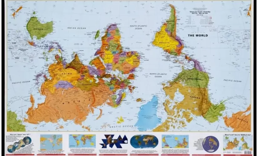
Chapter 4: Three Popular Compromise Projections This chapter identifies the three most well-known compromise projections and discusses why an upside-down projection is a perfectly valid option. It speculates on why the National Geographic Society changed its official projections over time.
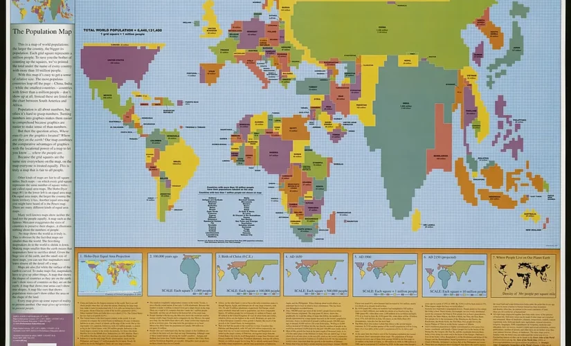
Chapter 5: Pushing the Boundary of the Map Chapter 5 explores various maps, highlighting their unique features and data representation. It encourages readers to question what data is included and excluded from maps and why.
Chapter 6: The Power of Images This chapter discusses various concepts related to maps, including the reason clocks run “clockwise” and the different implications of “East” as a direction versus a location. It also considers alternative views of Columbus’s journey.
Chapter 7: Seeing Through Maps The final chapter compels readers to recall and identify the purposes of maps and appreciate that the world we know depends on how we see it. It encourages readers to ask, “How would this look from a different point of view?” and appreciate that bias underlies any map representation.
Companion DVD
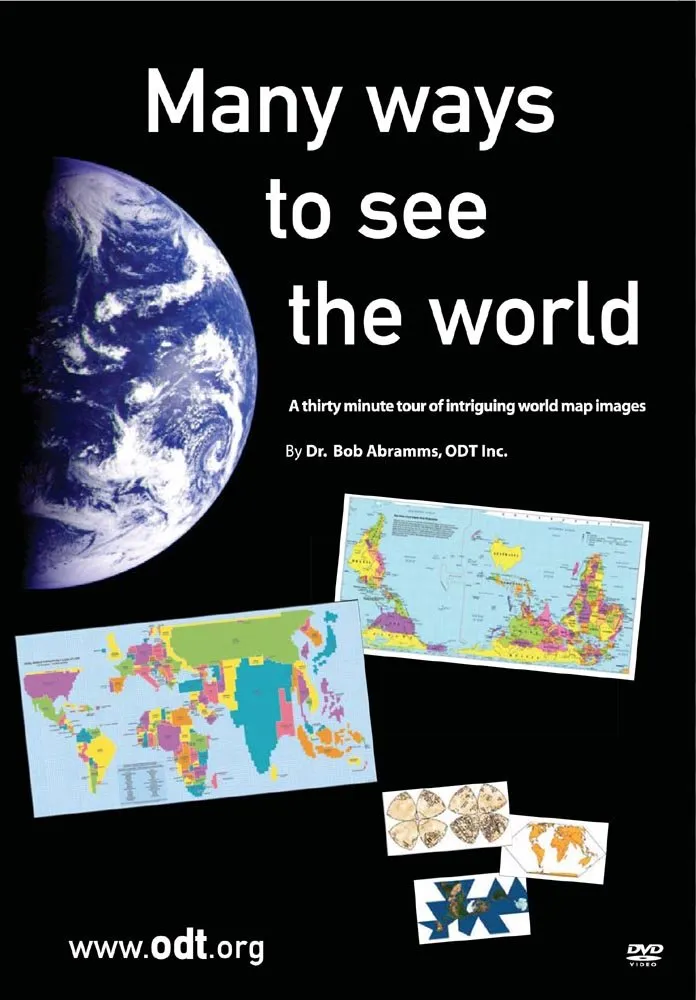
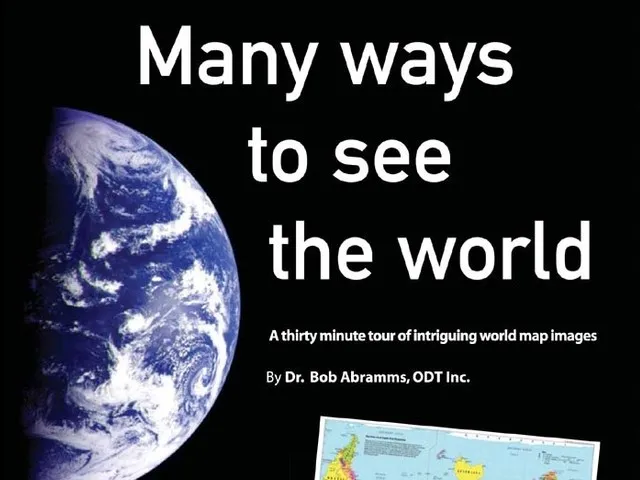
Alongside the book, ODT, Inc. produced a companion DVD called “Many Ways to See the World“. This DVD contains a classroom film, PowerPoint presentations, sample book chapters, and MP3 audio files, providing additional resources for learners and educators alike.
Seeing Through Maps: Many Ways To See The World offers an enlightening perspective on maps, questioning their truthfulness and encouraging readers to critically analyze the information they provide. It is a valuable resource for everyone who wants to learn about cartography and how it shapes our understanding of the world.
Related Posts