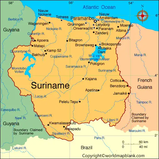
Labeled Map of Suriname with States, Cities & Capital
Get to learn the geography of Suriname with our labeled map of Suriname in the article ahead. We are providing a fully printable labeled map of Suriname to help our users in learning in detailed geography of the country. Suriname or the Republic of Suriname is a South American country that is primarily located on Atlantic Coast. Suriname is basically the smallest country in the Southern American region with the least population base.
- Flat world map
- World coronavirus map
- World geographical map
- World map for kids
- World population map
- Accurate map of World
- Ancient World map
- World Map with Country name
- World Map Wallpaper
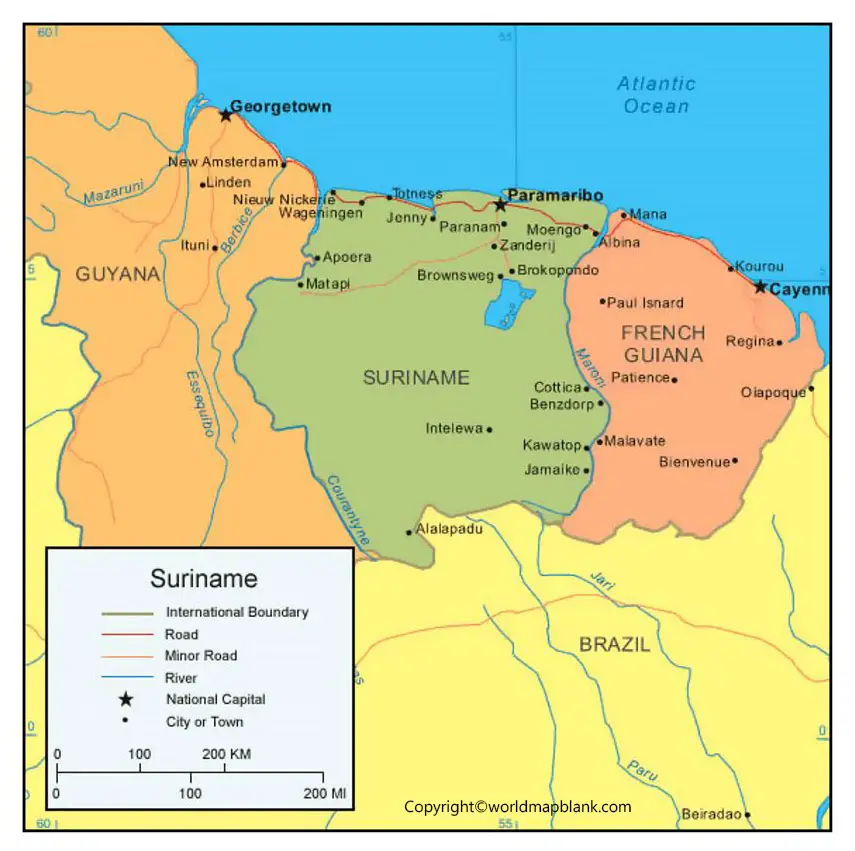
The country shares its borders with French Guiana, Brazil, and Guyana, etc. Suriname is best known for its biodiversity and the huge nature reserves which give its a significant natural resource base.
Labeled Map of Suriname
A labeled map of Suriname is very useful for all those individuals who want to learn country’s geography. Our interactive labeled map of Suriname makes it fun to learn the overall geography of Suriname.
In the map you can read the labeled structure of Suriname which defines the country’s structure as a whole. For instance, the labeled text on the map may define the total numbers of rivers, mountains or other properties within the country. In the similar manner users can figure out the other components of the country as per your requirements and interest.
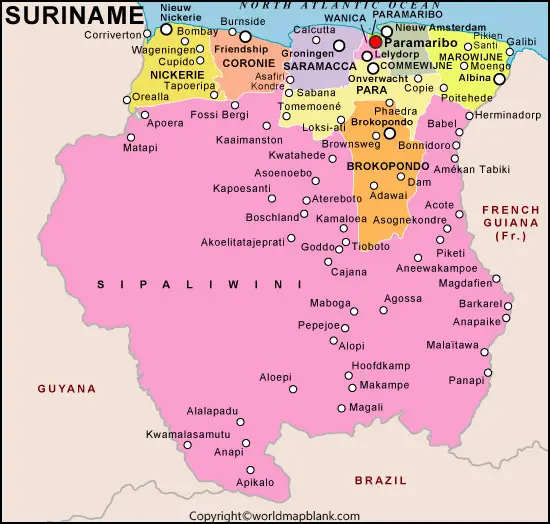
Labeled Map of Suriname with States
Users can explore all the states of Suriname in our specific labeled map of Suriname with states. This map basically contains all the respective states of the country so as to provide the structure of all the states in country. With this labeled state map you can study the geography of any specific state of Suriname.
For instance, you may learn about the various properties of the state in the context of all the historical places such as monuments, rivers and such other landmarks. This labeled state map of Suriname will help the users in the effective learning of the state.
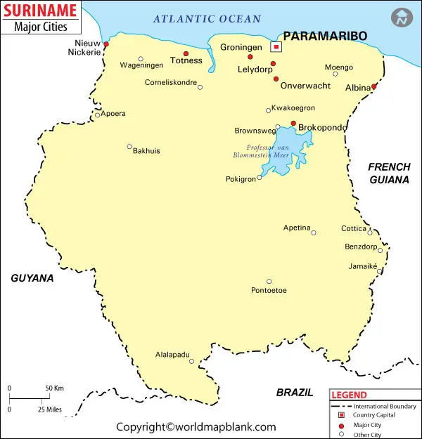
Suriname Map with Cities Labeled
Well, Suriname is although the smallest country of Southern America yet it has the numbers of cities. If you see the overall map of Suriname then you won’t get the ample information on the structure of all cities in the country. We have therefore developed this specific city map of Suriname which contains only the total cities of the country.
This labeled city map will guide the users in understanding the each city of country from very closer view. For instance, you may understand the overall structure of each city, its political boundaries, and other important information on the city.
Labeled Suriname Map with Capitals
Do you want to see the clear structure of all the Suriname capital cities? If yes then you can here check out the specific map of its capitals. The map provides a clear-cut view of all Suriname’s capital cities so that readers can get to understand each capital city. The labeling on the map makes it further easier to understand the various features of each and every capital city.
Related Posts


