Labeled Map of Albania with States, Capital & Cities
The Albania Labeled Map, reveals the republic of Albania and its surrounding countries. This is located on the Balkan Peninsula in the southeastern part of Europe. In the west, Albania is surrounded by the Ionian Sea and the Adriatic Sea. Besides, the country is also bordering with Montenegro in the north, Serbia or Kosovo in the northeast, and the Republic of Macedonia in the east. In the southeast, Albania borders Greece. With Italy and Croatia, Albania shares maritime borders.
- World map with continents
- Physical world map
- Political world map
- Labeled map of Asia
- Labeled map of Africa
- Labeled map of Europe
- Labeled map of Antarctica
- Labeled map of South America
- World time zone map
- Labeled map of World
- World map with Latitude
- Blank map of world
- Labeled map of North America
- Blank map of Asia
- World map with oceans
- World map poster
Labeled Map of Albania
The total measured area of this country is 28,748 km². This country is found slightly smaller in size when compared to that of Maryland. The area of Albania is considered to be smaller and equivalent to only one half the Croatia. The current updated figures of population in Albania, which is recorded as on July 10, Friday, 2020, is 2,877,710. This is equivalent to 0.04% of the total population of the world.
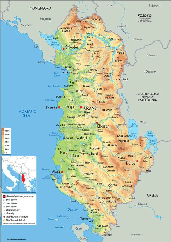
The most important rivers that flow in the country, include the longest Don river in the north, Shkumbin and Seman rivers in the south. In Albania, Islam is commonly practiced. It is either Sunni or Bektashi. Christianity is the second most commonly practiced religion, consisting of Catholic, Protestant, and Orthodox type of people.
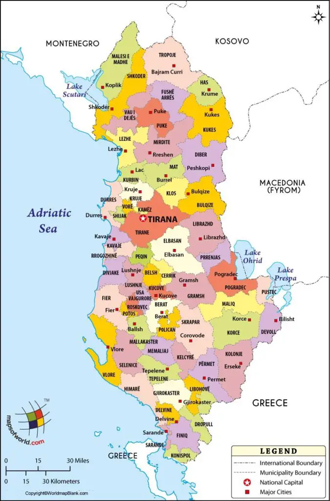
Labeled Map of Albania with States
From the Labeled Map of Albania with States, the capital city and state are known as Tirana. The other states of Albania, include Vlore, Shkoder, Lazhe, Kukes, Korce, Gjirokaster, Fier, Elbasan, Durries, Diber and Berat.
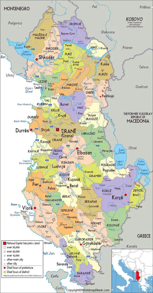
Labeled Map of Albania with Cities
The labeled map of Albania with cities indicate thirty-six in all. They include Vlore or Velona, Vermont, Tropoje, Tirane or Tirana, Tepelene, Shkoder or Scutari, Shegan, Sarande, Pulaj, Peshkopi, Obot, Mamuras, Lushnje, Lezhe, Krumme, Korce, Koplik, Konispol, Kavaje, Karavasta, Jergocat, Iballe, Gjirokaster or Argyrus, Fier-Shegan, Fier, Elbasan, Durres, Dukat, Divjake, Covorode, Cerave, Celeb, Bushtrice, Borsh, Berat, and Bajze.
Labeled Albania with Capital
While looking into labeled Albania with Capital, Tirana or Tirona is the largest city of Albania by population and area. It is situated in the central region of the Republic of Albania. This beautiful city is surrounded by hills and mountains with Mount Dajit elevating on the eastern side of the city. Overlooking the Adriatic Sea, there is a slight valley on the northwest.
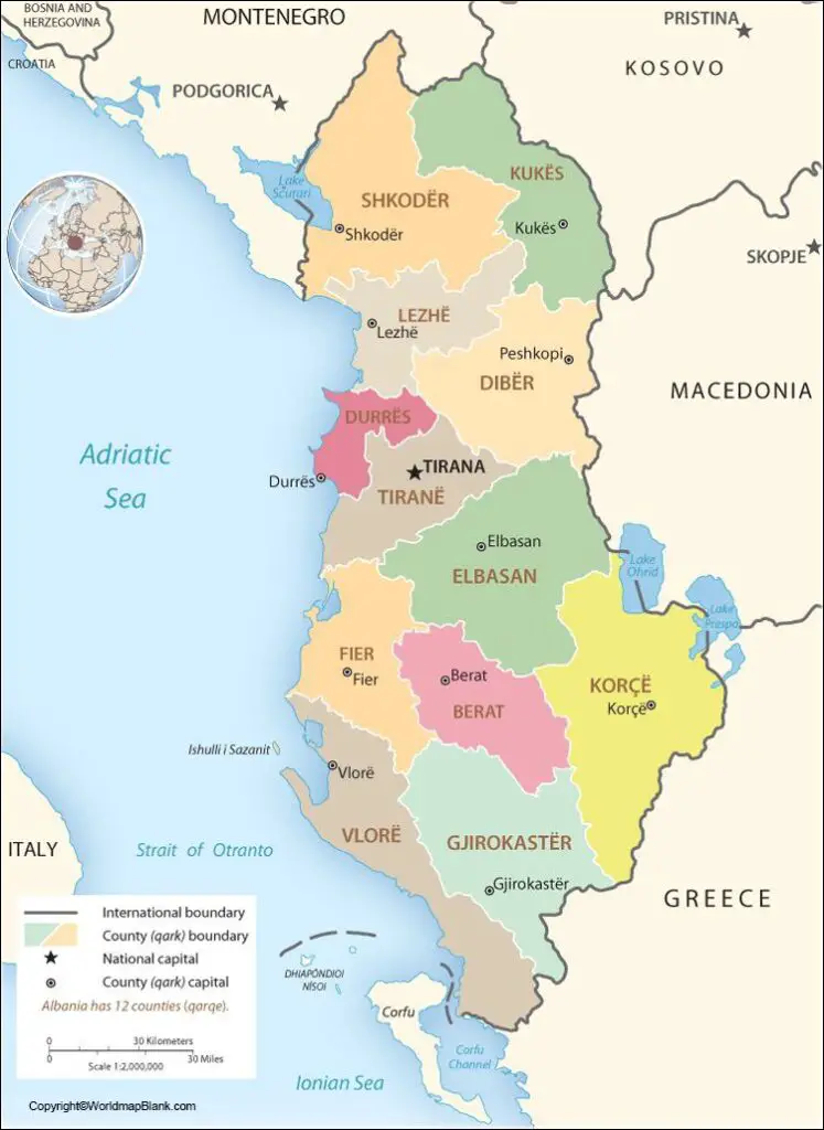
The city is especially influenced by the seasonal climate of the Mediterranean Sea as it is close to it. It is considered as one of the sunniest and wettest cities in Europe. The total sun hours per year is 2,544 hours. Tirana is the center of the country’s economy, including the activities of the government.
The city houses more than 800,000 people, and its occupants belong to different ethnicities similar to any other cities in the developed nations. The percentage distribution of this ethnicity consists of Albanians in the range of eighty-four percent, a small percentage of Greeks and a negligible percentage of Macedonians. Here, the population of females is greater when compared to that of the male population.
Related Posts


