Labeled Map of Iran with States, Capital & Cities
The Labeled Map of Iran shows that it is an Islamic republic located between the Caspian Sea in the north, the Persian Gulf and the Gulf of Oman in the south. Iran is said to be the easternmost recognized country in the Middle East. Countries like Turkmenistan, Turkey, Pakistan, Iraq, Azerbaijan, Armenia, and Afghanistan are located as borders of Iran.
- World map with continents
- Physical world map
- Political world map
- Labeled map of Asia
- Labeled map of Africa
- Labeled map of Europe
- Labeled map of Antarctica
- Labeled map of South America
- World time zone map
- Labeled map of world
- World map with longitude and latitude
- Blank map of world
- Labeled map of North America
- Blank map of Asia
- World map with oceans
- World map poster
It also shares maritime borders with Russia, Kazakhstan, United Arab Emirates, Saudi Arabia, Qatar, Oman, Kuwait, and Bahrain. Most of the regions of Iran are located on the Iranian Plateau, which are recognized as the geological formation in Central and Western Asia.
Labeled Map of Iran
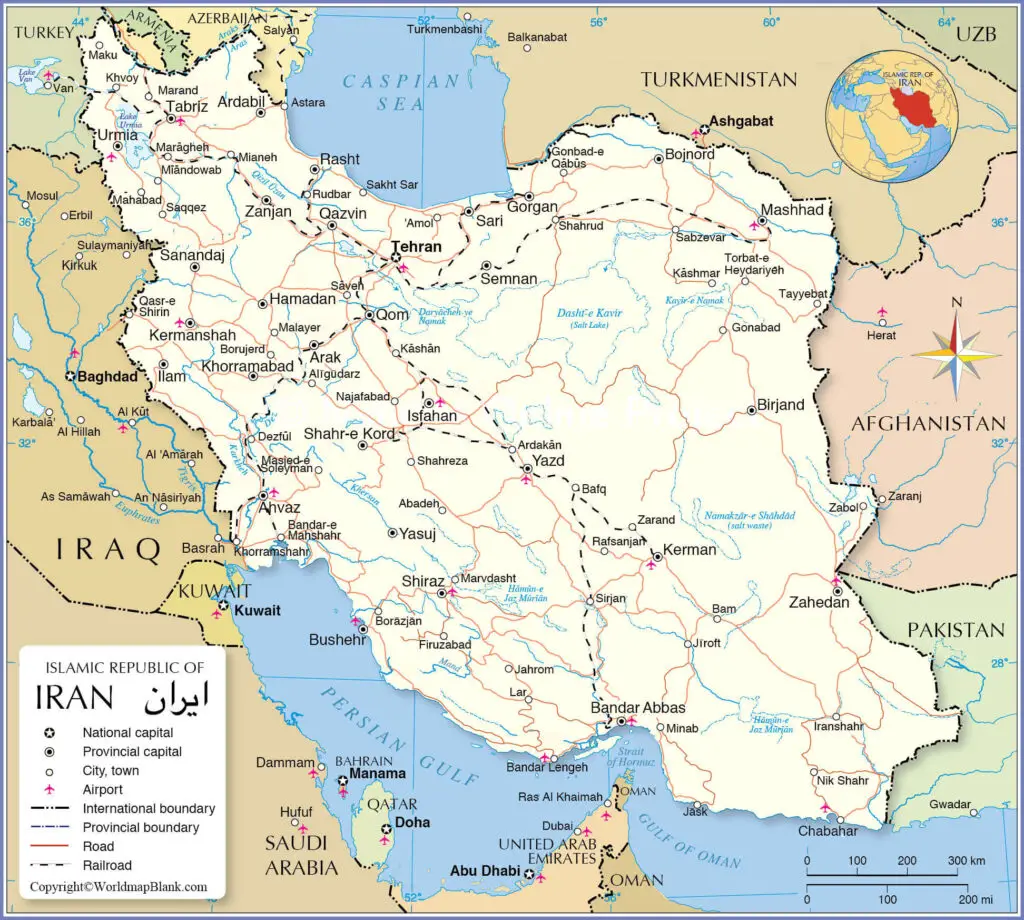
Iran occupies an area of 1,648,195 square kilometers. This country is almost three times the size of France or slightly smaller than Alaska. The 2020 population of Iran is estimated to be equivalent to 83,992,949 people, based on the UN data. It is equivalent to 1.08% of the total global population. Official religions recognized as per the constitution of the Islamic Republic of Iran, include Islam, Christianity, Judaism and Zoroastrianism.
Most of the rivers that flow in Iran are with seasonal flow characteristics, but relatively with a shorter length and shallow depth. The names of ten rivers, include Atrek, Sefid Rud, Aras, Diyala, Karun, Karkheh, and Dez. Out of all the major rivers, five of them flow into the Persian Gulf and three into the Caspian Sea.
Labeled Map of Iran with States
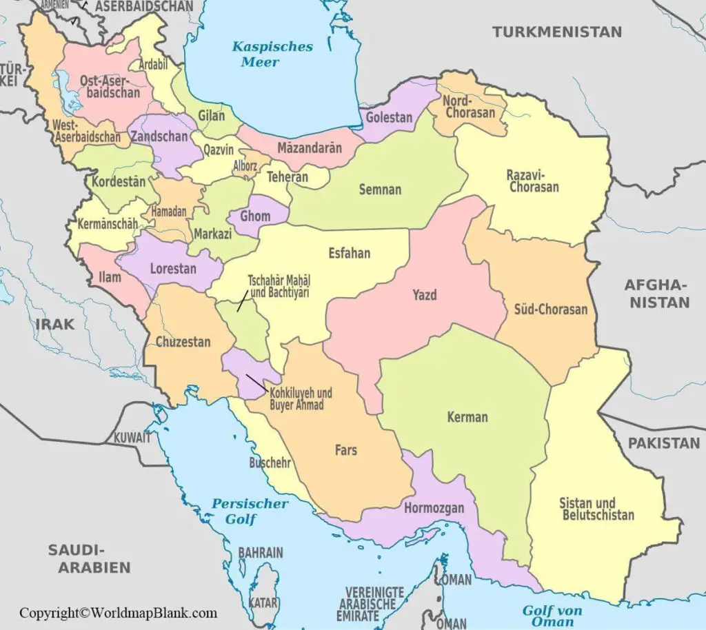
As a part of labeled map of Iran with states or provinces, it may be seen that Iran has been categorized into regions. Accordingly, it consists of five administrative regions. They include Mashhad, Kermanshah, Tabriz, Isfahan, and Tehran. Besides, these regions have been further divided into thirty-one provinces.
Labeled Iran Map with Cities
As a part of the labeled map of Iran with cities, they are listed based on the categorization of provinces. The important names of these cities, include Zanjan, Zahedan, Yazd, Yasuj, Urmia, Tehran, Tabriz, Shiraz, Shahr-e Kord, Semnan, Sari, Sanandaj, Rasht, Qom, Qazvin, Mashhad, Khorramabad, Kermanshah, Kerman, Karaj, Isfahan, Ilam, Hamadan, Gorgan, Bushehr, Bojnord, Birjand, Bandar Abbas, Ardabil, Arak and Ahvaz.
Labeled Iran Map with Capital
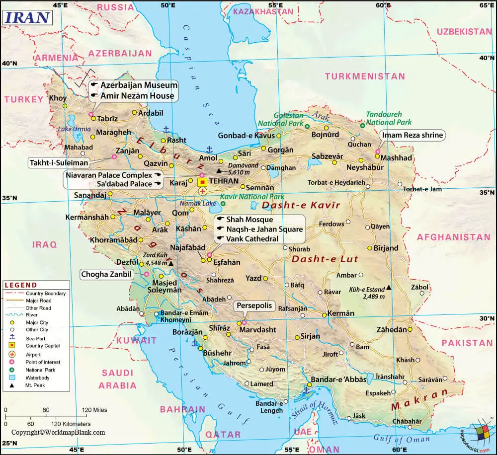
Labeled Iran with capital indicates that Tehran is the largest capital city of Iran. Besides, it is also recognized as the economic as well as the political center of the Republic of Iran. One of the interesting facts about this city is a sixteenth-century masterpiece of Qajar era, known as Golestan Palace.
This palace is identified as the historic core of the Tehran city and marked as a World Heritage Site, declared by UNESCO. The iconic landmark of the city, known as, Azadi Tower, represents the western entrance to this city. Other places of interest include a complex that houses the International Trade and Convention Center, Iran’s National Museum, which is a combination of two museums; Museum of Ancient Iran, and the Museum of the Islamic Era. The city has a Carpet Museum, which is famous for Persian carpets that are available.
Related Posts


