Labeled Map of Libya with States, Capital & Cities
The Labeled Map of Libya shows that it is a country located in the Maghreb region in North Africa. The country is officially recognized as the State of Libya. It is bordered by Sudan and Egypt in the east, Niger, and Chad in the south, and the Mediterranean Sea, Tunisia, and Algeria in the west. Libya has coastline on the Mediterranean Sea. The major portion of the country is covered by the Libyan Desert and has Sahara on the northern and eastern part. Libya also shares a border with other countries, like Greece, Italy, and Malta.
- World map with continents
- Physical world map
- Political world map
- Labeled map of Asia
- Labeled map of Africa
- Labeled map of Europe
- Labeled map of Antarctica
- Labeled map of South America
- World time zone map
- Labeled map of World
- World map with Latitude
- Blank map of world
- Labeled map of North America
- Blank map of Asia
- World map with oceans
- World map poster
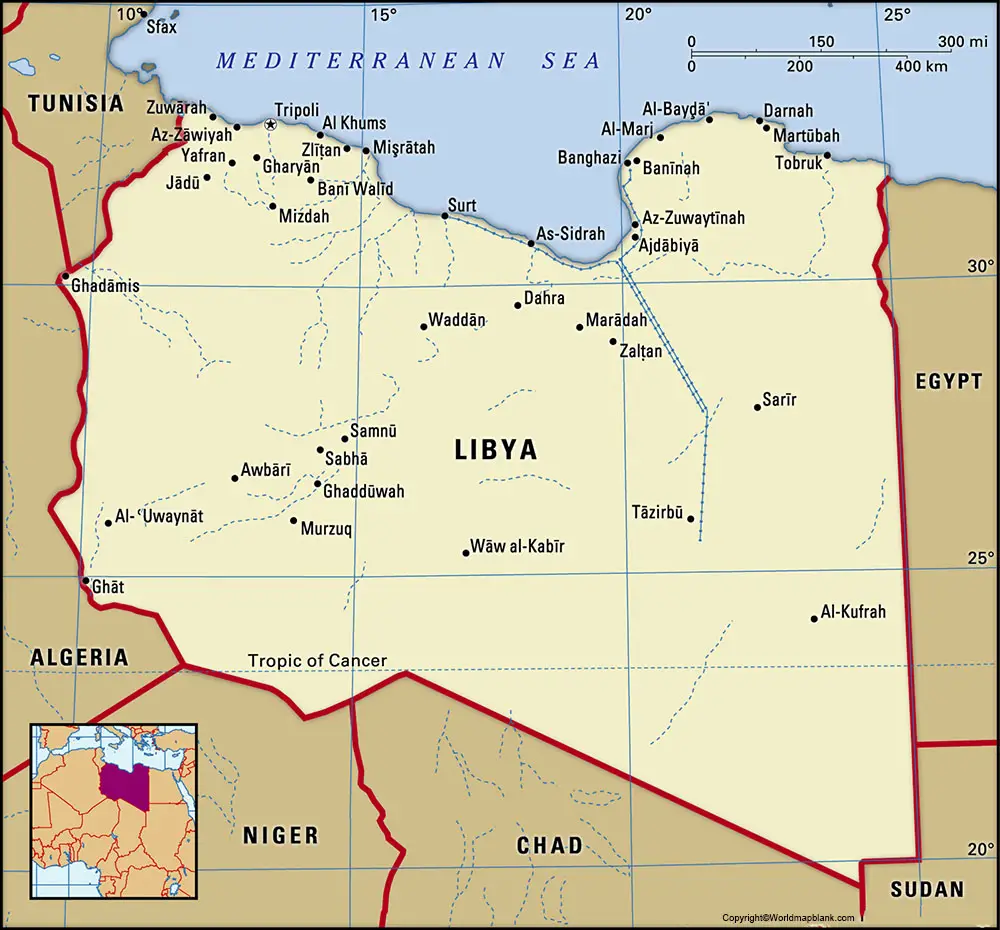
Labeled Map of Libya
As of Tuesday, 18, 2020, the current population of Libya stands at 6,883,162 people. The population of Libya is equivalent to 0.09% of the total global population. The land area of the country is equivalent to 1.76 million square kilometers. The terrain of Libya is barren mostly, featuring flat to undulating plains, depressions, and plateaus. The Desert of the Sahara and the Mediterranean coast are recognized as the country’s most natural features. There are no permanent rivers flowing in Libya. The dominant religion followed is Islam, the other religion is Christianity.
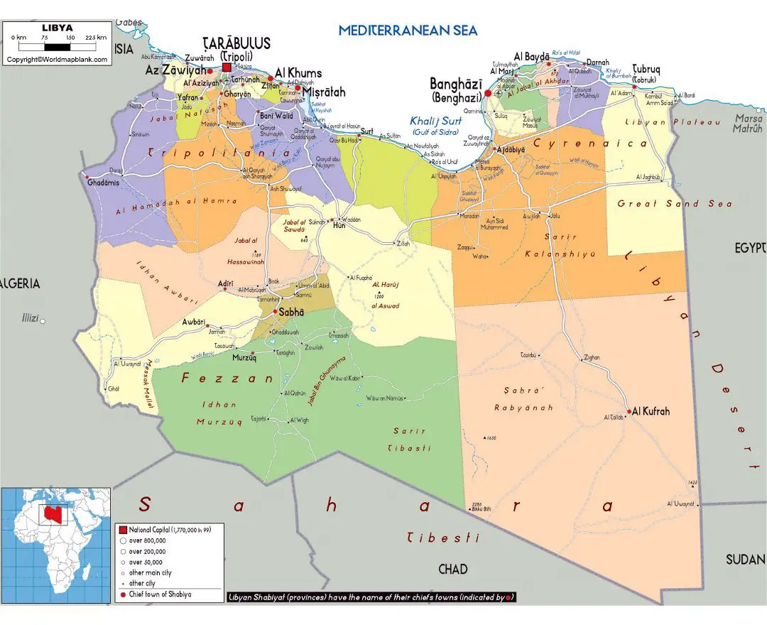
Labeled Map of Libya with States
As a part of the labeled map of Libya with states, historically the entire area of Libya was considered as three provinces. They included Fezzan in the southwest, Cyrenaica in the east, and Tripolitania in the northwest. Later, the state of Libya has been administratively divided into twenty-two units or provinces.
They are also called as districts. Accordingly, the labeled map of Libya with states, shows that it is surrounded by other countries, state borders, boundaries of provinces, the national capital Tripoli, provincial capitals, cities, main roads and major airports. The names of the districts, include Wadi Al Shatii, Wadi Al Hayaa, Tarabulus or Tripoli, Surt, Sabha, Nalut, Murzuq, Misratah, Ghat, Darnah, Benghazi, Az Zawiyah, Al Wahat, An Nuqat al Khams, Al Murgub, Al Marj, Al Kufrah, Al Jufrah, Al Jfara, Al Jabal al Gharbi, Al Jabal al Akhdar and Al Butnan.
Labeled Map of Libya with Cities
Through the labeled map of Libya with cities, it can be observed that the country has one city with population more than a million people. Libya has fourteen cities with a population that ranges between 100,000 and one million people. There are twenty-eight cities that has population between 10,000 and 100,000 people. Some of the names of large cities, include Tripoli, Benghazi, Sabratha, Misurata, Derna, Tobruk, Sirte and Ghadames.
Labeled Libya Map with Capital
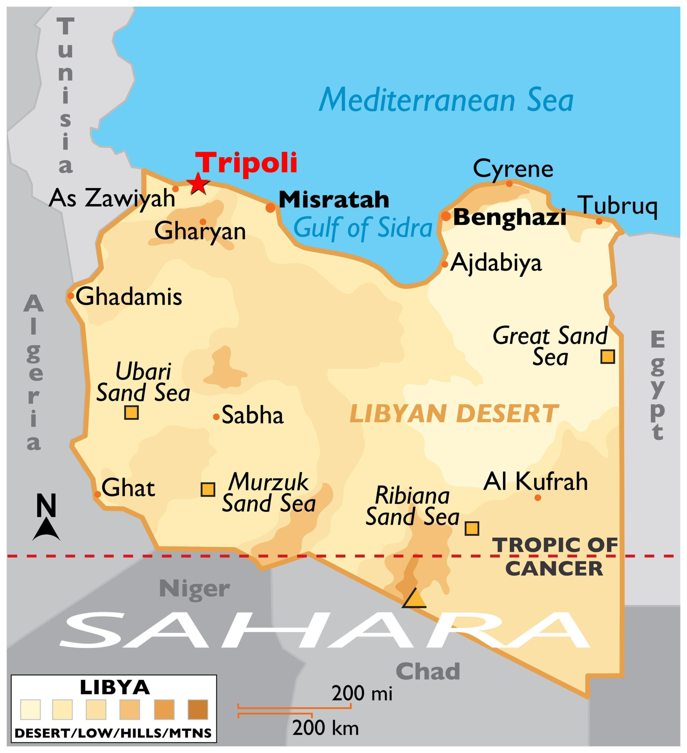
As a part of the labeled Map of Libya with capital, Tripoli is the largest capital city of Libya. It is situated in the western region of the country, and has a population of one million people. This city is also located on the Mediterranean coast and has a major seaport. It is categorized into two portions, like the old city and the newly built one. This city, being located on the prominent coastal region of the Mediterranean, grows olives, vegetables, citrus fruit, tobacco and grains.
Related Posts


